- Home
- :
- All Communities
- :
- Products
- :
- Data Management
- :
- Geodatabase Questions
- :
- how can i get Arcsde St_geometry into Lat long fro...
- Subscribe to RSS Feed
- Mark Topic as New
- Mark Topic as Read
- Float this Topic for Current User
- Bookmark
- Subscribe
- Mute
- Printer Friendly Page
how can i get Arcsde St_geometry into Lat long from oracle 12c
- Mark as New
- Bookmark
- Subscribe
- Mute
- Subscribe to RSS Feed
- Permalink
i am working on arcsde with oracle 12c can any one tell me where i can get st_geometry into lat long in Oracle 12c?? because in oracle, its shows only st_Geometry from geometry table. How do I generate a list of X,Y (projection WGS 1984) values from a geometry in Oracle / SDE?
arcgis 10.2 enterprise-geodatabase arcsde oracle 12c# st_geometry #latitude and longitude
- Mark as New
- Bookmark
- Subscribe
- Mute
- Subscribe to RSS Feed
- Permalink
Have you configured the ST_Geometry function yet?
Configure the extproc to access ST_Geometry in Oracle—Help | ArcGIS Desktop
Once you have that confirmed you can look at this: SQL functions used with ST_Geometry—Help | ArcGIS Desktop

- Mark as New
- Bookmark
- Subscribe
- Mute
- Subscribe to RSS Feed
- Permalink
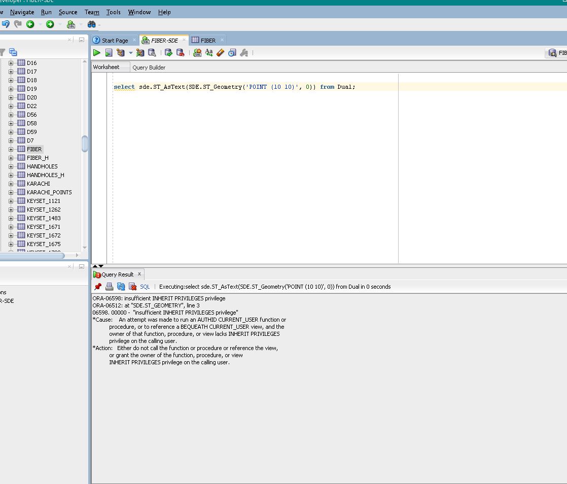
When you run this SQL, what are the results?
select sde.ST_AsText(SDE.ST_Geometry('POINT (10 10)', 0)) from dual;
- Mark as New
- Bookmark
- Subscribe
- Mute
- Subscribe to RSS Feed
- Permalink
Try logging in as the SDE user and running that query. If it does not return something like this:
SDE.ST_ASTEXT(SDE.ST_GEOMETRY('POINT(1010)',0))
--------------------------------------------------------------------------------
POINT  ( 10.00000000 10.00000000)
Then you need to get it configured correctly first, then you can use the SQL functions to extract the X/Y as needed.
How To: Check if the Oracle extproc is set up correctly for direct ST_GEOMETRY SQL queries