- Home
- :
- All Communities
- :
- Products
- :
- Data Management
- :
- Geodatabase Questions
- :
- Getting PostGis geometries into ArcMap
- Subscribe to RSS Feed
- Mark Topic as New
- Mark Topic as Read
- Float this Topic for Current User
- Bookmark
- Subscribe
- Mute
- Printer Friendly Page
- Mark as New
- Bookmark
- Subscribe
- Mute
- Subscribe to RSS Feed
- Permalink
Hello,
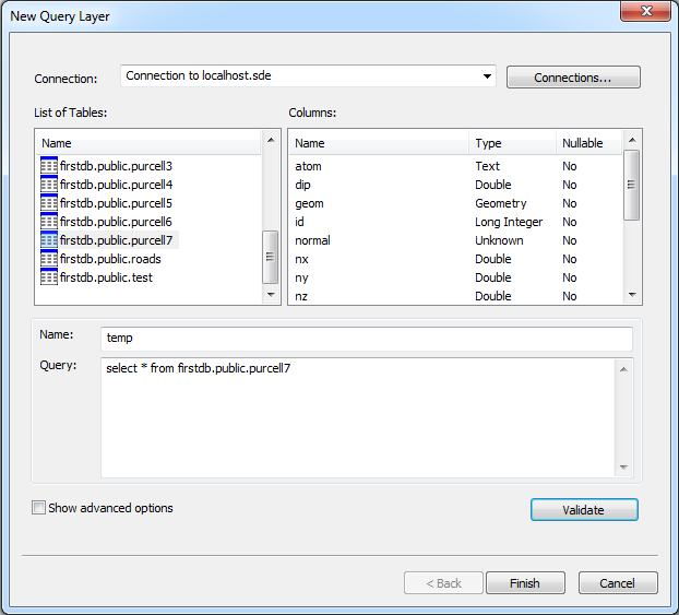
I am trying to bring in data into arcmap from my PostgreSql + Postgis database. The data are points (using ST_Geometry POINTZ types) containing various properties/attibutes. So I successfully connected to my database by creating a new query layer, but many common sql query I put in the 'query' section gives me errors. Below is a screenshot of the query layer dialog.

Here are some errors I get when performing the sql queries
select * from firstdb.public.purcell7 -> attribute conversion error
select geom from firstdb.public.purcell7 -> at least one fixed-point or string data type column must be present to generate unique identifer
But if I do
select id from firstdb.public.purcell7 the validate button does not produce any errors
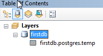
and in arcmap in the table of contents I get
 (this only contains data from the id column of my table- obviously)
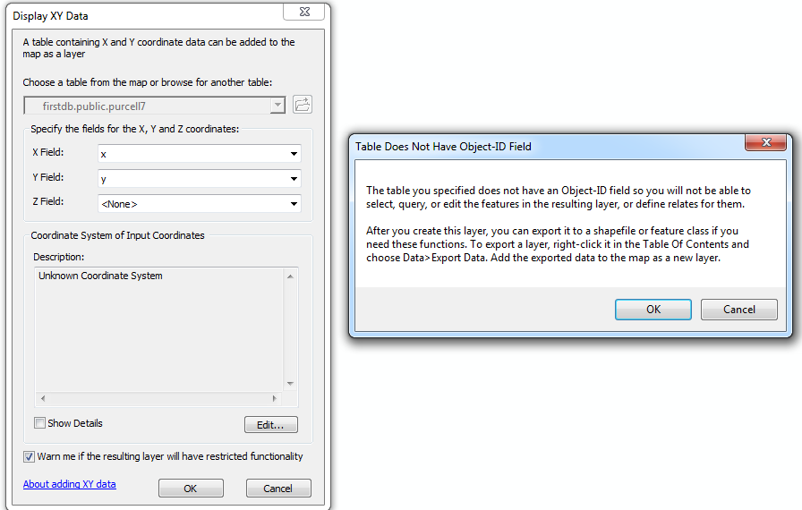
Then if I right-click the firstdb I can 'Add Table' and select the entire table I want (which is what the sql command : select * from firstdb.public.purcell7 should have done but didn't successfully do). Then I select the 'Display XY Data' option for that table where the x and y fields are automatically filled in my x, y columns of the data and hit 'ok' and I get the following warning:

Now the table I am trying to import has OIDs setup, there is a spatial index associated with the table, and there is a proper ST_Geometry associated with the data (POINTZ type).
How do I properly bring in my spatial data from my postgresql + postgis database so that I can view, query, select the data in arcmap?
Solved! Go to Solution.
Accepted Solutions
- Mark as New
- Bookmark
- Subscribe
- Mute
- Subscribe to RSS Feed
- Permalink
The graphic lists the datatype of "Normal" as "Unknown". I'd think you'd need to tackle that issue first.
- V
- Mark as New
- Bookmark
- Subscribe
- Mute
- Subscribe to RSS Feed
- Permalink
The graphic lists the datatype of "Normal" as "Unknown". I'd think you'd need to tackle that issue first.
- V
- Mark as New
- Bookmark
- Subscribe
- Mute
- Subscribe to RSS Feed
- Permalink
Thanks Vince!
Removing the 'normal' column resolved the issue. The column 'normal' was set as an array of doubles (a three component vector). I guess ERSI does not recognized this data type. The data contained in the normal column was also in the table in 3 separate columns (nx, ny, nz) so deleting the normal column was not an issue.
