Turn on suggestions
Auto-suggest helps you quickly narrow down your search results by suggesting possible matches as you type.
Cancel
- Home
- :
- All Communities
- :
- Products
- :
- Data Management
- :
- Geodatabase Questions
- :
- Change Labels when Scale Changes
Options
- Subscribe to RSS Feed
- Mark Topic as New
- Mark Topic as Read
- Float this Topic for Current User
- Bookmark
- Subscribe
- Mute
- Printer Friendly Page
11-24-2015
01:10 PM
- Mark as New
- Bookmark
- Subscribe
- Mute
- Subscribe to RSS Feed
- Permalink
Is there a way to change the label expression based on the scale (for the same layer)?
For example, when the scale is between 1:1 and 1:10,000 the features are labeled with [field_1], and when the scale is between 1:10,000 and 1:50,000 the features are labeled with [field_2].
Any help is highly appreciated,
Hani
Solved! Go to Solution.
1 Solution
Accepted Solutions
11-24-2015
01:29 PM
- Mark as New
- Bookmark
- Subscribe
- Mute
- Subscribe to RSS Feed
- Permalink
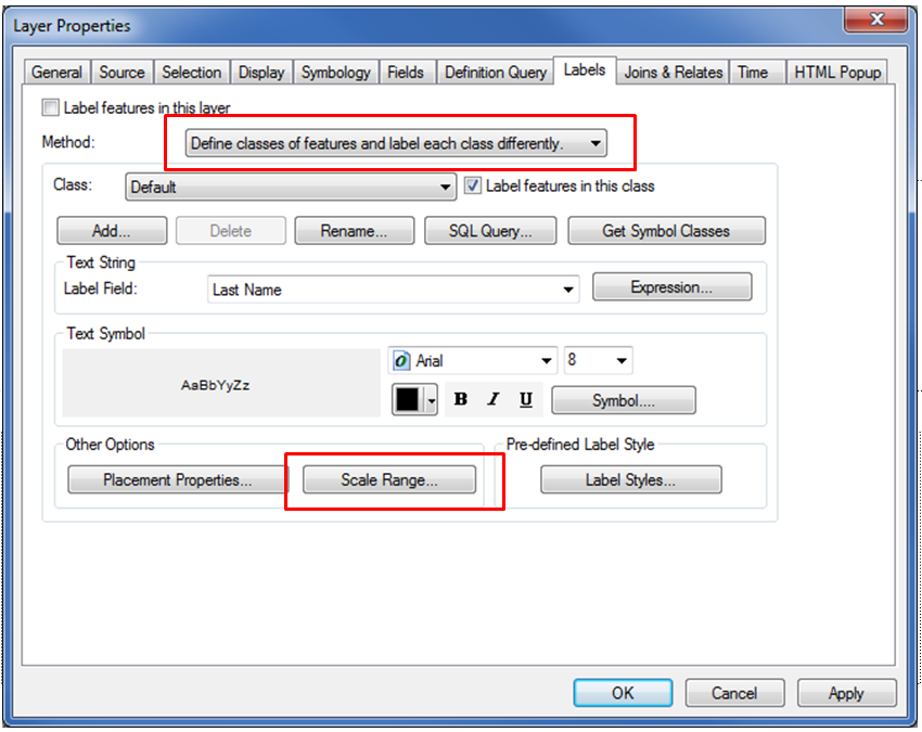
In your layer properties dialog you can "Define classes of features and label each class differently" and set "Scale Range..." for each label class.

3 Replies
11-30-2015
09:55 AM
- Mark as New
- Bookmark
- Subscribe
- Mute
- Subscribe to RSS Feed
- Permalink
Many Thanks Wes,
I tried this and it worked well!
11-26-2015
12:34 PM
- Mark as New
- Bookmark
- Subscribe
- Mute
- Subscribe to RSS Feed
- Permalink
One workaround is to create two different feature-linked geodatabase annotation classes, and defining the scale range in each one of them.
Think Location