- Home
- :
- All Communities
- :
- Products
- :
- Data Management
- :
- Geodatabase Questions
- :
- Best practice to export a feature class (stored in...
- Subscribe to RSS Feed
- Mark Topic as New
- Mark Topic as Read
- Float this Topic for Current User
- Bookmark
- Subscribe
- Mute
- Printer Friendly Page
Best practice to export a feature class (stored in file geodatabase ) to feature dataset (of different coordinate system),
- Mark as New
- Bookmark
- Subscribe
- Mute
- Subscribe to RSS Feed
- Permalink
Best practice to export a feature class (stored in file geodatabase ) to feature dataset (of different coordinate system),
According to ArcGIS, if a feature class is exported to feature dataset, then the coordinate system of the feature class will be automatically converted to be the same as the coordinate system of the feature dataset.
Does projecting the feature class before exporting to the feature dataset produce more accurate results?
Thank you
Best
Jamal
Jamal Numan
Geomolg Geoportal for Spatial Information
Ramallah, West Bank, Palestine
- Mark as New
- Bookmark
- Subscribe
- Mute
- Subscribe to RSS Feed
- Permalink
test by using the same file (with different names), preferably a point layer but any would do. Calculate fields for X and Y in projected coordinates for both. Project and export and dont project and export. recalculate into new fields for both. Add a difference field and subtract the results. In theory, if the same system of projection or coordinate definition is being used, uou should get the same results.
- Mark as New
- Bookmark
- Subscribe
- Mute
- Subscribe to RSS Feed
- Permalink
Based on experience, projecting it before exporting will allow you to choose the Geographic Transformation that will be applied. In the case of NZMG to NZTM. choosing the NTv2 transformation yields the most accurate projection. The default transformation that is used (can't remember which one) was not so good. Then of course if there was only one transformation method for your particular projection then I would like to think that there should be no difference but you never will know until.... so maybe Dan Patterson's suggestion is the only way to be sure.
- Mark as New
- Bookmark
- Subscribe
- Mute
- Subscribe to RSS Feed
- Permalink
When exporting from the data frame, if a geographic transformation has been selected, then the output will correctly reflect that.
I am very sure that the underlying projection / transformation algorithms are the same, whether using the project tool, data frame export or export into a feature dataset.
- Mark as New
- Bookmark
- Subscribe
- Mute
- Subscribe to RSS Feed
- Permalink
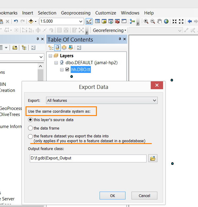
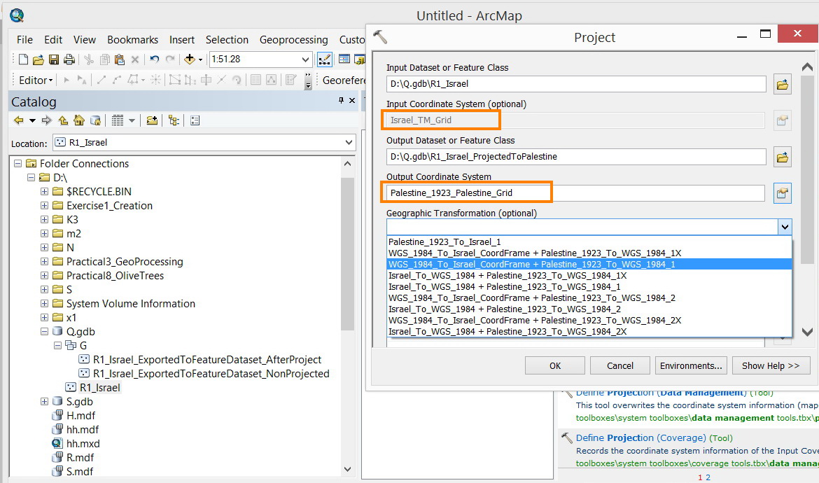
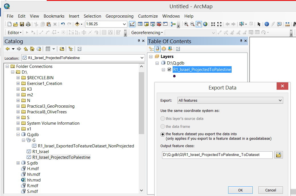
I have applied the scenario below
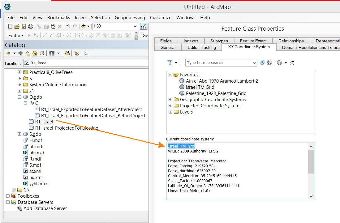
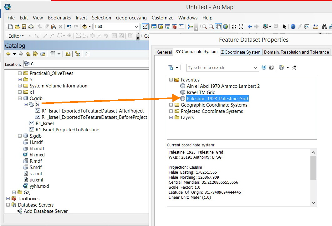
- I got a feature class in Israel_TM_Grid and Feature Dataset with “Palestine_1923_Palestine_Grid”
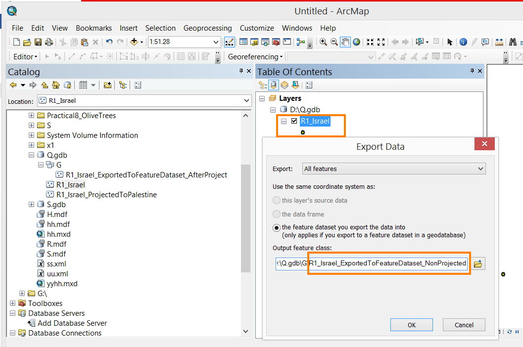
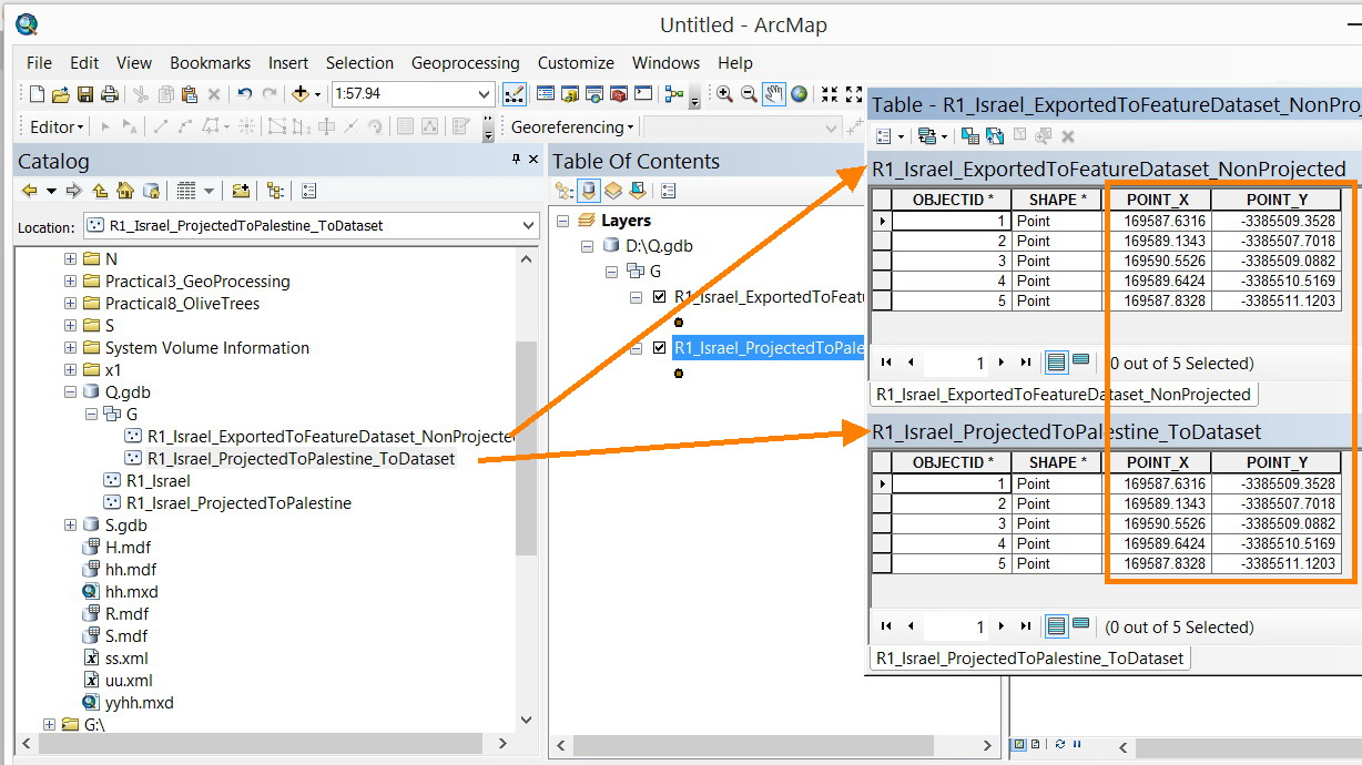
- This feature class is exported to Feature dataset without projection.
- The feature class is converted to Palestine_1923_Palestine_Grid and then exported to the feature dataset
- The XY coordinates are calculated and appear to be equal.
The only ambiguous point here, is which transformation is used as the feature class is directly exported to the feature dataset?
Jamal Numan
Geomolg Geoportal for Spatial Information
Ramallah, West Bank, Palestine
- Mark as New
- Bookmark
- Subscribe
- Mute
- Subscribe to RSS Feed
- Permalink
When exporting geoprocessing results directly into a feature dataset one isn't provided the option to set the transformation within the tool, but this can be set in the Geoprocessing Environment parameters. Thanks for posting your topic as I have used Feature Datasets to manage issues of spatial reference and haven't fully explored the subtleties.