- Home
- :
- All Communities
- :
- Industries
- :
- Gas and Pipeline
- :
- Gas and Pipeline Questions
- :
- Re: Geometric Network Flow Problems
- Subscribe to RSS Feed
- Mark Topic as New
- Mark Topic as Read
- Float this Topic for Current User
- Bookmark
- Subscribe
- Mute
- Printer Friendly Page
Geometric Network Flow Problems
- Mark as New
- Bookmark
- Subscribe
- Mute
- Subscribe to RSS Feed
- Permalink
Hey everyone,
I am tasked with figuring out if a geometric network would work with our company's oil and gas infrastructure data. I am trying to make the entire nation into a network, but I am starting with a few product pipelines. I am pretty much learning this from scratch using the online resources I can Google...
My question is regarding flow direction. I need to make two refineries (sources) flow into one mainline. However, they keep showing as indeterminate. This is just the basic issue. I am also having trouble establishing flow direction later down the pipeline as more refineries (still sources) connect to the mainline and then are diverted at different points to distribution terminals.
Does anyone have any tips for solving this issue?
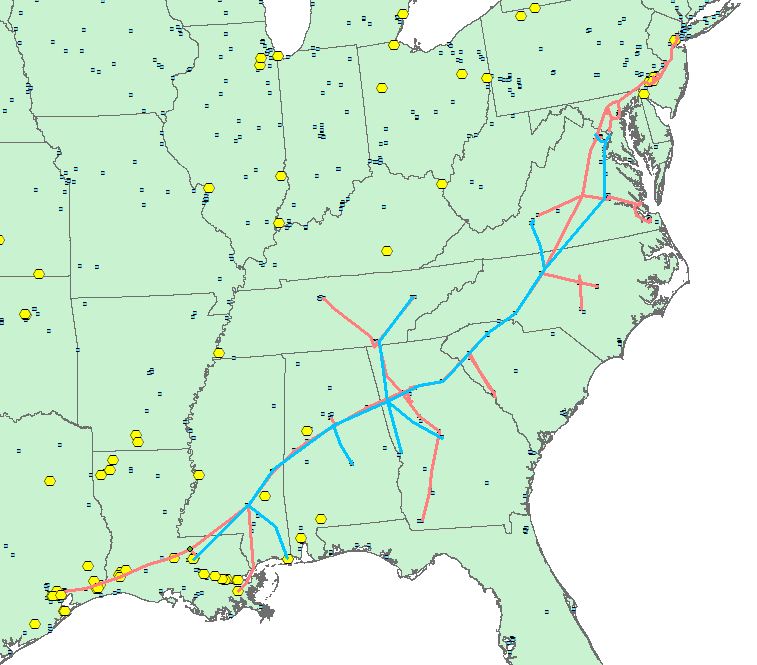
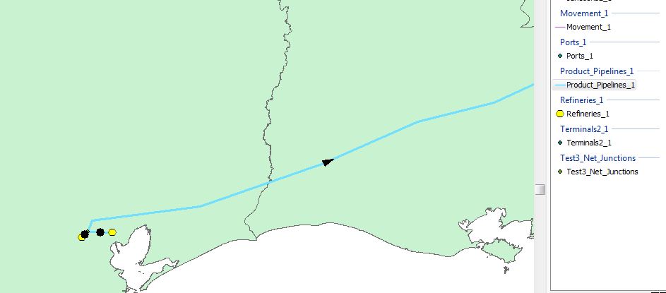
Thanks in advance for the help! I attached two pictures. The first is the flow direction issue that I am trying to resolve. The second is the two pipeline system (Colonial in Red and Plantation in Blue) that I am trying to turn into a network. I will eventually need to (at the very least) connect the refineries (yellow) to their respective pipelines and, if possible, connect the terminals too (blue squares).
- Mark as New
- Bookmark
- Subscribe
- Mute
- Subscribe to RSS Feed
- Permalink
Hello Emma;
I am a relatively new GIS practicioner; however, I would like to bounce back to you some considerations/comments/ideas which may work.
First, lets try to find data entry errors, using map topology to check the relationship between parts of features that are coincident (are you sure that lines representing pipelines snap at the right point (i.e. no under or overshoots, no node mismatch or dead end nodes, etc).
To do so you will need to create a map topology, with that and some detailed visual inspection you should be able to identify errors and correct it. Additionally, you could control spatial data integrity by imposing some rules (geodatabase topology)
Once you will do so, then the next step will be to correct the errors, for which there are several methods, depending on the error type.
I hope that this helps, at least to get started on a methodology that could help you to identify errors.
Good luck
Miguel
- Mark as New
- Bookmark
- Subscribe
- Mute
- Subscribe to RSS Feed
- Permalink
Miguel,
I ended up using the water utilities reporting and editing toolbars to set flow direction based on digitizing direction.
Thank you for your suggestions!
- Mark as New
- Bookmark
- Subscribe
- Mute
- Subscribe to RSS Feed
- Permalink
Are you using source or sinks? You might want to try sinks and flag the end points as sinks. You can also manually set flow direction using digitized direction using the water/gas utility editing toolbar. You can get the toolbar as part of gas as built editing or water network editing and analysis solution.
As-Built Editing and Analysis | ArcGIS for Gas
Water Utility Network Editing and Analysis | ArcGIS for Water
- Mark as New
- Bookmark
- Subscribe
- Mute
- Subscribe to RSS Feed
- Permalink
Thanks Michael,
That is what I ended up doing. It has worked well so far!