- Home
- :
- All Communities
- :
- User Groups
- :
- Elevation Data
- :
- Questions
- :
- Create terrain effect over shapefile polygon in Ar...
- Subscribe to RSS Feed
- Mark Topic as New
- Mark Topic as Read
- Float this Topic for Current User
- Bookmark
- Subscribe
- Mute
- Printer Friendly Page
Create terrain effect over shapefile polygon in ArcMap 10.4
- Mark as New
- Bookmark
- Subscribe
- Mute
- Subscribe to RSS Feed
- Permalink
I have a Digital Elevation Model and polygon shapefile and I want to make an effect that polygons follow terrain structure according to DEM. If I just overlay it over DEM the polygon will be flat. I know how to do that in ArcScene, but I want to do that in ArcMap and not sure how. I have tried with Window\Image Analysis but without success.
I have attached one example from Google Maps where forest polygon follows terrain structure.
- Mark as New
- Bookmark
- Subscribe
- Mute
- Subscribe to RSS Feed
- Permalink
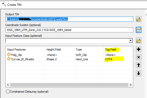
I suggest the following for the polygons:
You can create a Tin again, add the polygon layer and add the shape containing the contours, in this shape, specify the column containing the elevations. After that configure the views of the polygons.
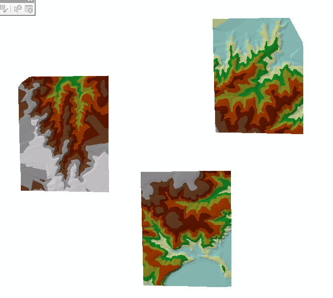
I leave you the captures as an example:
- Mark as New
- Bookmark
- Subscribe
- Mute
- Subscribe to RSS Feed
- Permalink
This is amazing! Absolutely what I need...