- Home
- :
- All Communities
- :
- Products
- :
- Data Management
- :
- Data Management Questions
- :
- What projection should I use to measure in meters?
- Subscribe to RSS Feed
- Mark Topic as New
- Mark Topic as Read
- Float this Topic for Current User
- Bookmark
- Subscribe
- Mute
- Printer Friendly Page
What projection should I use to measure in meters?
- Mark as New
- Bookmark
- Subscribe
- Mute
- Subscribe to RSS Feed
- Permalink
Dear all,
I want to do some distance calculations in ArcGIS, but it is always calculating in degrees. I think the only way to make it measure my distances in meters is to change the data and the data frame to an appropriate projection? (I have set the map properties to meters already.) However, I do not know which projection to choose. I am looking at an area that is roughly at 31.0309° N, 103.1831° E. I have read somewhere else that UTM is good, but Arc offers so many different UTM projections that I was lost again. I think the UTM grid should be 48.
Is anybody able to suggest a specific coordinate reference system that I can try? Thanks ever so much in advance.
Carina
Solved! Go to Solution.
- Mark as New
- Bookmark
- Subscribe
- Mute
- Subscribe to RSS Feed
- Permalink
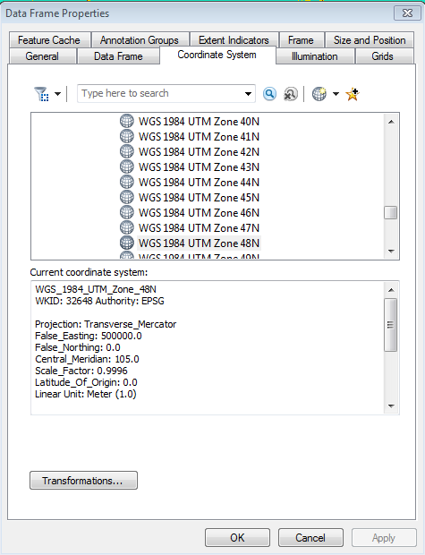
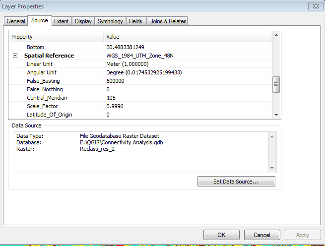
Could you attach snapshot of the current spatial reference and extent of the layer from the layer properties?
Think Location
- Mark as New
- Bookmark
- Subscribe
- Mute
- Subscribe to RSS Feed
- Permalink
Here are two screen shots:
- Mark as New
- Bookmark
- Subscribe
- Mute
- Subscribe to RSS Feed
- Permalink
Thank you for the screenshots....
It seems that the coordinate values correspond to the values in Decimal Degrees (GCS). You need to do two steps.
1. Using Define Projection, define a Geographic coordinate system (GCS_WGS_1984).
This will ensure that the coordinate values corresponds to its correct spatial reference.
2. Next, using Project Raster, you can reproject the above raster from Geographic CS to Projected CS (WGS_1984_UTM_Zone_48N)
Think Location
- Mark as New
- Bookmark
- Subscribe
- Mute
- Subscribe to RSS Feed
- Permalink
Okay! And do I need to start a new map for this or should I try it in the old one?
- Mark as New
- Bookmark
- Subscribe
- Mute
- Subscribe to RSS Feed
- Permalink
Open it in a new map so that the spatial reference of the data frame gets reset.
Think Location
- Mark as New
- Bookmark
- Subscribe
- Mute
- Subscribe to RSS Feed
- Permalink
So, just to make sure I do everything right this time: I define projection and reproject raster in my old map. And then I open the data in a new map, but without defining a reference system for the data frame. And then it should (in theory) work?
- Mark as New
- Bookmark
- Subscribe
- Mute
- Subscribe to RSS Feed
- Permalink
Yes. When we open a layer in a new map, the data frame takes up the coordinate system of the added layer.
Think Location
- Mark as New
- Bookmark
- Subscribe
- Mute
- Subscribe to RSS Feed
- Permalink
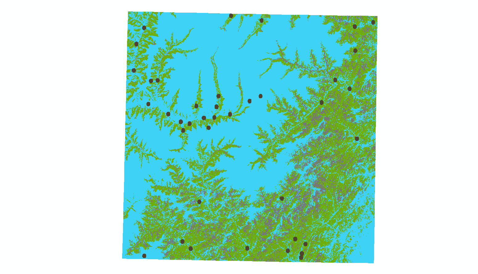
Hmm, after doing this and open them in a new map they are displayed slighlty askew (see below). But I will try the tool that involves the distance calculation anyway and see if it works ...
- Mark as New
- Bookmark
- Subscribe
- Mute
- Subscribe to RSS Feed
- Permalink
Carina,
What version of ArcGIS are you using?
Based on your comment about the Define Projection tool, I am wondering whether some data layers now have incorrect coordinate systems (projections). For instance, for the rasters that have cell sizes in degrees, what coordinate system do they have? They should have a geographic one like WGS84.
Even if the layers are all using a geographic coordinate system, and the data frame is too, the measure tool should default to measuring geodesic distances and some linear unit.
Because of that, I am wondering whether data frame/layers have projected coordinate systems, but the data (coordinates) themselves are still in degrees.
Melita
- Mark as New
- Bookmark
- Subscribe
- Mute
- Subscribe to RSS Feed
- Permalink
I am using ArcMap 10. All the rasters are now in UTM North 48. I can provide screen shots on Sunday or Monday of the properties of the layers.
@Melita: I didn't know that was possible - that the data frame and layers could have projected coordinate systems, but the coordinates could still be in degrees. What would I do then to solve this? 