- Home
- :
- All Communities
- :
- Products
- :
- Data Management
- :
- Data Management Questions
- :
- Re: Strangeness - gaps unintentionally created whi...
- Subscribe to RSS Feed
- Mark Topic as New
- Mark Topic as Read
- Float this Topic for Current User
- Bookmark
- Subscribe
- Mute
- Printer Friendly Page
Strangeness - gaps unintentionally created while editing
- Mark as New
- Bookmark
- Subscribe
- Mute
- Subscribe to RSS Feed
- Permalink
I've been asked to update our City's parcel layer based on changes the County sent us and am noticing gaps being created when editing. This happens both when editing in a Version of the Parcels in SDE and when editing the same data in a File Geodatabase. We are using ArcGIS 10.2.1. with an Advanced License.
For example, one of the updates was a parcel split. Using the County's line layer, I set out to split the parcel. Red lines are the County data and the Green polygons with black borders are the City parcels data. So in this case, the first task is to split into two the left-side polygon to create "Polygon A" and "Polygon B" (currently A and B are one parcel).
NOTE - our data varies from the County's slightly (long story) and that is currently OK, so the task is to modify our data as close as possible based on the County's changes. So we are going to split the parcels (yellow highlighter) but not worry about the fact the county data for the boundary of "A/B" to "Polygon C" is off by 0.0000796 feet.
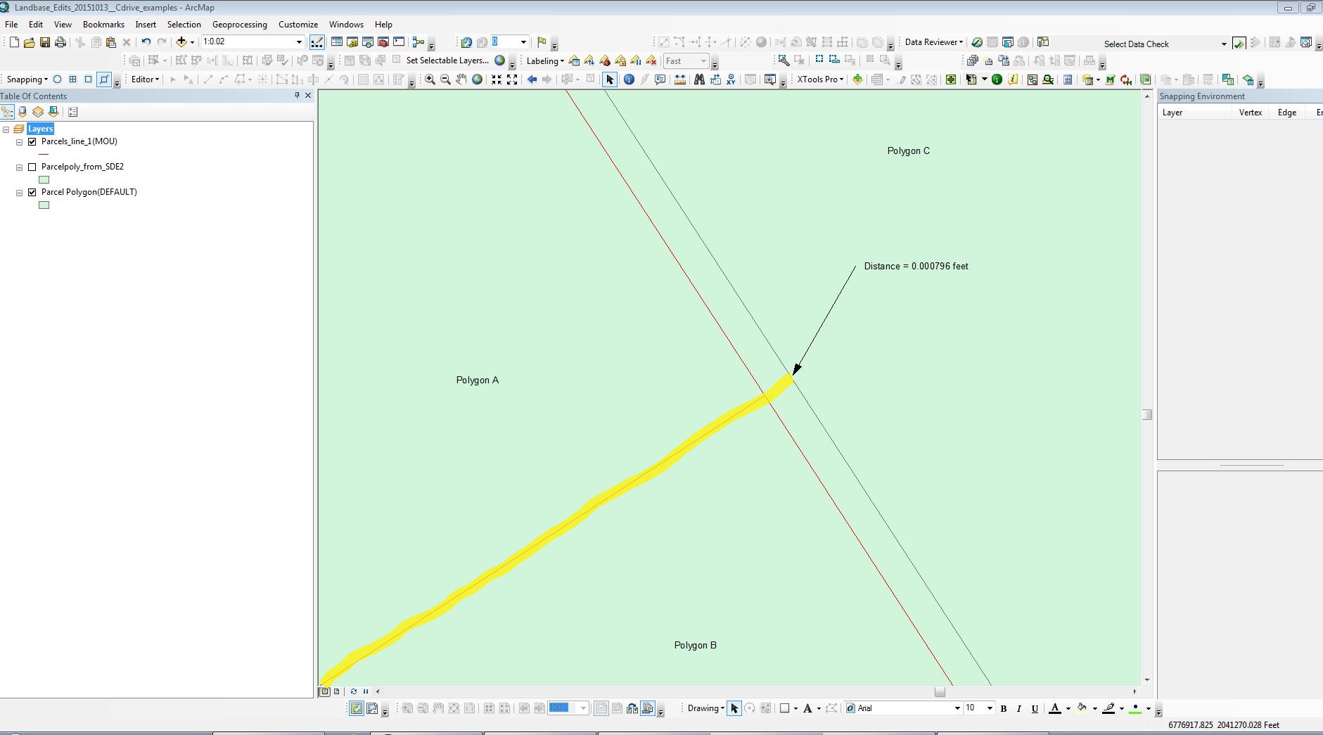
When I do the split, weirdness results. The original polygon has now been split to "Polygon A" and "Polygon B", but now there is a gap between those two and "Polygon C" (the white space). That was an unexpected outcome.
To do the split, I used the "Cut Polygons Tool" on the Editing Toolbar along with the "Trace", and then spanned the gap well into "Polygon C" with the "Cut". So how come there is a gap there now (the white space)?
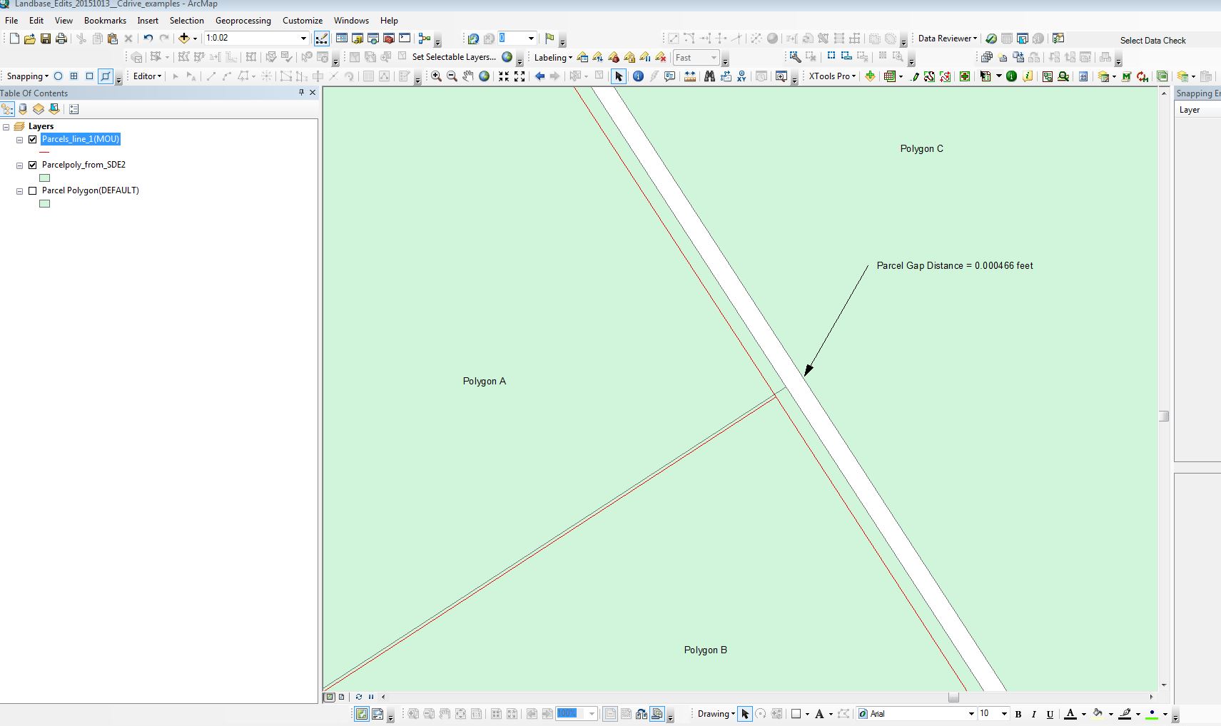
The gap is definitely a problem. As part of testing to see what is going on, I tried going one step further and Merging the polygons that I had originally split. The result is they do merge but the gap remains. So it seems unlikely to be a visual thing.
So I'm a bit puzzled. I've done a considerable amount of editing over the past several years but not run into issues like this.
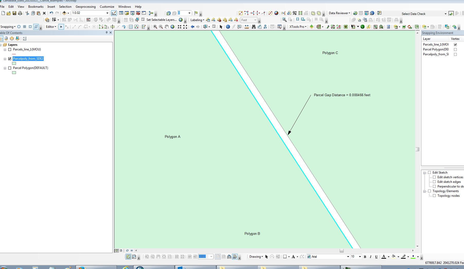
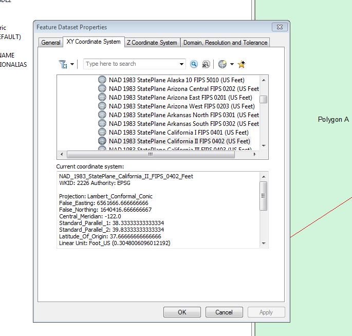
Note that the scale depicted here is very zoomed in (1:0.02). Given that this is happening at this micro level, I almost wonder if the XY Tolerance and Resolution settings are off. Here is what we are using (set same for both the File Geodatabase and SDE Version).
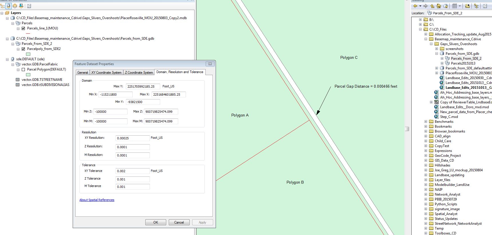
So I guess my question is what is causing this and how do I fix it. I know this can be corrected "after-the-fact" with Topology, but we'd prefer not to create problems on the front end while editing. It almost seems like a setting is off. Any ideas?
Chris Donohue, GISP
Solved! Go to Solution.
- Mark as New
- Bookmark
- Subscribe
- Mute
- Subscribe to RSS Feed
- Permalink
Update:
Did another round with ESRI Customer Support and were able to replicate the issue this time. We also looked at a line edit I did where the result appeared to be a line overshoot when viewed at a scale more zoomed in than 1:1.
The resulting answer is that due to the micro scale what appears to be errors are essentially visual artifacts due to the extreme scale and not a realistic view.
More explanation from the followup email from Customer Support:
As per our phone interaction, a map scale past 1:1 is a known limitation of our software because at a scale of 1:1, the screen display is equal to the actual distance of objects on the earth's surface (i.e. an inch on your screen is equal to an inch on the ground). When you go past that scale, it may appear that features are overlapping (when in reality) what you are seeing is the actual software resolution tolerance pushed past it's maximum threshold. In essence, the entire screen is only one point (at a map scale of 1:0), which is why your work flow is producing inaccurate results.
So in a nutshell, what you see when zoomed in closer than 1:1 is not an accurate depiction.
Chris Donohue, GISP
- « Previous
-
- 1
- 2
- Next »
- « Previous
-
- 1
- 2
- Next »