- Home
- :
- All Communities
- :
- Products
- :
- Data Management
- :
- Data Management Questions
- :
- Spatial Reference issue
- Subscribe to RSS Feed
- Mark Topic as New
- Mark Topic as Read
- Float this Topic for Current User
- Bookmark
- Subscribe
- Mute
- Printer Friendly Page
Spatial Reference issue
- Mark as New
- Bookmark
- Subscribe
- Mute
- Subscribe to RSS Feed
- Permalink
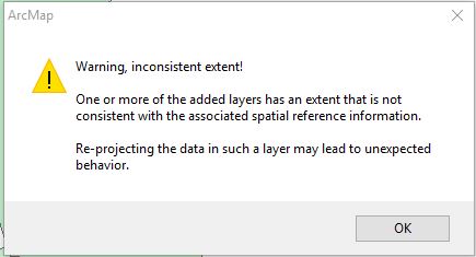
I received a project with a shapefile from another department. When I try and load it into ArcMap 10.2.1, I receive the following:
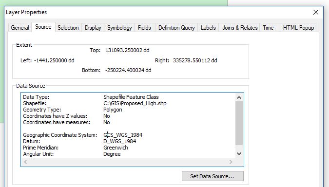
Properties:
Just looking for some direction on how to resolve. I understand the distinction between Geographic Cood. Sys. vs Projections but I'm struggling to identify, if this is my issue.
- Mark as New
- Bookmark
- Subscribe
- Mute
- Subscribe to RSS Feed
- Permalink
Looks like someone used the define projection tool, and defined it as a geographic coordinate system (GCS wgs84)
And given the extents that is totally absurd. Since it was a shapefile, locate the *.prj file and rename it to *.xxx and reload the shapefile. It will probably load but it will tell you it doesn't have a defined projection.
Perhaps someone meant to give it a Web Mercator projection instead if you are using webby data sources