Turn on suggestions
Auto-suggest helps you quickly narrow down your search results by suggesting possible matches as you type.
Cancel
- Home
- :
- All Communities
- :
- Products
- :
- Data Management
- :
- Data Management Questions
- :
- Re: Remove Black Borders around Raster Tiles
Options
- Subscribe to RSS Feed
- Mark Topic as New
- Mark Topic as Read
- Float this Topic for Current User
- Bookmark
- Subscribe
- Mute
- Printer Friendly Page
Remove Black Borders around Raster Tiles
Subscribe
9461
2
01-04-2011 04:03 AM
01-04-2011
04:03 AM
- Mark as New
- Bookmark
- Subscribe
- Mute
- Subscribe to RSS Feed
- Permalink
Hi All,
I have around 2000 JPG200 Raster tiles of aerial photography for a region. This is loaded into a Raster Catalogue and displayed in ArcMap.
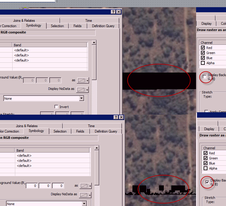
The data displays correctly but most of the tiles overlap at the border and a black border is displayed. I have set the properties to display the Background Value (0,0,0) as nothing, and this helps, but not all of the semi-black borders gets removed.
I have limited experience with raster imagery display, and I would appreciate some help to rectify this. Any help in the right direction would be appreciated.
Cheers.
I have around 2000 JPG200 Raster tiles of aerial photography for a region. This is loaded into a Raster Catalogue and displayed in ArcMap.
The data displays correctly but most of the tiles overlap at the border and a black border is displayed. I have set the properties to display the Background Value (0,0,0) as nothing, and this helps, but not all of the semi-black borders gets removed.
I have limited experience with raster imagery display, and I would appreciate some help to rectify this. Any help in the right direction would be appreciated.
Cheers.
2 Replies
01-04-2011
06:55 AM
- Mark as New
- Bookmark
- Subscribe
- Mute
- Subscribe to RSS Feed
- Permalink
Greetings,
So the problem with the black border is that most often these values are zero's (0). However, once you compress the data with compressions such as jpeg or jpeg 2000, in order for the compression to work as nice as it does, it changes some of these values. Hence, when you say background 0,0,0 is nodata, you start seeing the black speckles.
Resolving this is more tricky. You can clip the black border and write out a new dataset (possibly undesirable because of time and space constraints). If you have 10.0 you could use a clip function based on a graphics or feature to accomplish the same in-memory. If you have 10.0 and are using the mosaic dataset, then you can recompute the footprint to accomplish the clipping automatically.
Hope this helps.
Robert
01-04-2011
08:55 AM
- Mark as New
- Bookmark
- Subscribe
- Mute
- Subscribe to RSS Feed
- Permalink
Hi Robert,
Thanks so much for your post. It does make sense. I did the transformation from the original Tiff's to JPG2000 to save space as my production server is a bit limited in HDD space than my pre-production server.
We do have ArcGIS 10 and and will try the mosaic dataset as you mentioned.
Cheers
Thanks so much for your post. It does make sense. I did the transformation from the original Tiff's to JPG2000 to save space as my production server is a bit limited in HDD space than my pre-production server.
We do have ArcGIS 10 and and will try the mosaic dataset as you mentioned.
Cheers