- Home
- :
- All Communities
- :
- Products
- :
- Data Management
- :
- Data Management Questions
- :
- Python Script to Project Shapefiles in a folder
- Subscribe to RSS Feed
- Mark Topic as New
- Mark Topic as Read
- Float this Topic for Current User
- Bookmark
- Subscribe
- Mute
- Printer Friendly Page
Python Script to Project Shapefiles in a folder
- Mark as New
- Bookmark
- Subscribe
- Mute
- Subscribe to RSS Feed
- Permalink
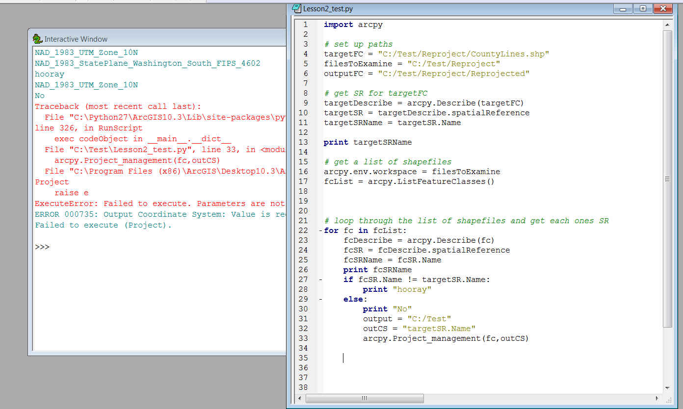
I am very, very new to Python and I am trying to write a script that will allow me to Project shapefiles into a coordinate system that is assigned to one particular shapefile in a folder. So I have 4 files and one has that which I want to re-Project the others into. What I am struggling with is the output CS parameter required by the Project_management tool when called in the script. I get an error message saying that the output Coordinate System value and the outputFC parameter is not valid. I'm wondering where I'm going wrong.
Any help at all would be so greatly appreciated.
Sincerely,
Natasha
Solved! Go to Solution.
- Mark as New
- Bookmark
- Subscribe
- Mute
- Subscribe to RSS Feed
- Permalink
Happy I could help. By the way, unless this is for a class (in which case you do need to work on figuring things out yourself), don't have an hesitation about using code that is posted. I good programmer (in my opinion) is always trying to put themselves out of work....but there is no reason to reinvent the wheel.....unless you are trying to clean code up and/or make it faster, etc. 
There are many threads on geonet re: learning python. Here are a few that you may want to check out.
Seeking advice on how to go about learning Python
Think Python: How to Think Like a Computer Scientist
Introduction to Writing Geoprocessing Scripts with Python 10.2/10.3 Class Resources
And Dan has quite a few blog posts on many advanced topics....he has a list of the blogs
NumPy and Python... lists, link, samples and esoterica...
Python can be great fun. Good luck!
- « Previous
-
- 1
- 2
- Next »
- « Previous
-
- 1
- 2
- Next »