Turn on suggestions
Auto-suggest helps you quickly narrow down your search results by suggesting possible matches as you type.
Cancel
- Home
- :
- All Communities
- :
- Products
- :
- Data Management
- :
- Data Management Questions
- :
- Problems with transforming a CAD data
Options
- Subscribe to RSS Feed
- Mark Topic as New
- Mark Topic as Read
- Float this Topic for Current User
- Bookmark
- Subscribe
- Mute
- Printer Friendly Page
Problems with transforming a CAD data
Subscribe
1888
1
02-18-2011 06:39 AM
02-18-2011
06:39 AM
- Mark as New
- Bookmark
- Subscribe
- Mute
- Subscribe to RSS Feed
- Permalink
Hi there,
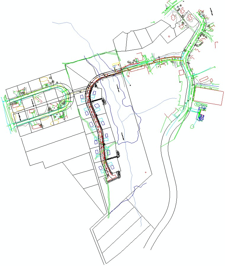
I try to georeference a CAD (2011, dxf) data on my ArcGIS9.2/ArcMap. The georeference goes ok, the CAD looks fine also, but only at the ArcMap session. If close the ArcMap, and use the newly georeferenced CAD again otherwhere, it can not keep the new coordinates even the wld/prj file is there (can display, but go off a little bit, can not line up completely). It seems ArcGIS 9.2 only can do a temporary georeference, and can not maintain the permanent transform result. I don't know if this is right? Otherwise what is the problem here? or how can we keep the transformed coordinates for a CAD?
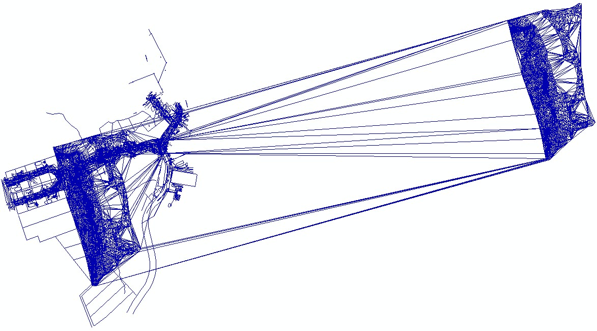
Since I can not have permanently transformed CAD file, I try to convert the CAD to a shapefile right after Update Georeference at that ArcMap session. The shapefile's coordinate can be maintined fine this way, but the graphic features all screw up completely (see attachments). I don't know if there are any conflicts between AutoCAD2011 and ArcGIS9.2, or I can not convert a CAD at ArcMap/georeference session?
Thanks a lot for help
Binke
I try to georeference a CAD (2011, dxf) data on my ArcGIS9.2/ArcMap. The georeference goes ok, the CAD looks fine also, but only at the ArcMap session. If close the ArcMap, and use the newly georeferenced CAD again otherwhere, it can not keep the new coordinates even the wld/prj file is there (can display, but go off a little bit, can not line up completely). It seems ArcGIS 9.2 only can do a temporary georeference, and can not maintain the permanent transform result. I don't know if this is right? Otherwise what is the problem here? or how can we keep the transformed coordinates for a CAD?
Since I can not have permanently transformed CAD file, I try to convert the CAD to a shapefile right after Update Georeference at that ArcMap session. The shapefile's coordinate can be maintined fine this way, but the graphic features all screw up completely (see attachments). I don't know if there are any conflicts between AutoCAD2011 and ArcGIS9.2, or I can not convert a CAD at ArcMap/georeference session?
Thanks a lot for help
Binke
1 Reply
02-18-2011
10:49 AM
- Mark as New
- Bookmark
- Subscribe
- Mute
- Subscribe to RSS Feed
- Permalink
Hi there,
I try to georeference a CAD (2011, dxf) data on my ArcGIS9.2/ArcMap. The georeference goes ok, the CAD looks fine also, but only at the ArcMap session. If close the ArcMap, and use the newly georeferenced CAD again otherwhere, it can not keep the new coordinates even the wld/prj file is there (can display, but go off a little bit, can not line up completely). It seems ArcGIS 9.2 only can do a temporary georeference, and can not maintain the permanent transform result. I don't know if this is right? Otherwise what is the problem here? or how can we keep the transformed coordinates for a CAD?
Since I can not have permanently transformed CAD file, I try to convert the CAD to a shapefile right after Update Georeference at that ArcMap session. The shapefile's coordinate can be maintined fine this way, but the graphic features all screw up completely (see attachments). I don't know if there are any conflicts between AutoCAD2011 and ArcGIS9.2, or I can not convert a CAD at ArcMap/georeference session?
Thanks a lot for help
Binke
Hi Binke,
AutoCAD 2011 format is not supported on ArcGIS 9.2. Have you tried saving it in 2007 format and performing the same operations to see if it works?