- Home
- :
- All Communities
- :
- Products
- :
- Data Management
- :
- Data Management Questions
- :
- Re: Problem displaying US Forest Service GeoTiffs ...
- Subscribe to RSS Feed
- Mark Topic as New
- Mark Topic as Read
- Float this Topic for Current User
- Bookmark
- Subscribe
- Mute
- Printer Friendly Page
Problem displaying US Forest Service GeoTiffs in ArcGIS 10.2
- Mark as New
- Bookmark
- Subscribe
- Mute
- Subscribe to RSS Feed
- Permalink
US Forest Service GeoTiff Topo Maps downloaded from their site aren't displaying correctly in ArcMap. An example of one of their maps is here: http://data.fs.usda.gov/geodata/rastergateway/data/47121/fstopo/470012130_Sun_Top_FSTopo.zip. Other GeoTiffs I download from other sites all seem to work fine (e.g. from USGS site). I can even re-save the USFS GeoTiff as a regular .tif file and then manually georeference it and it and then that works fine as well.
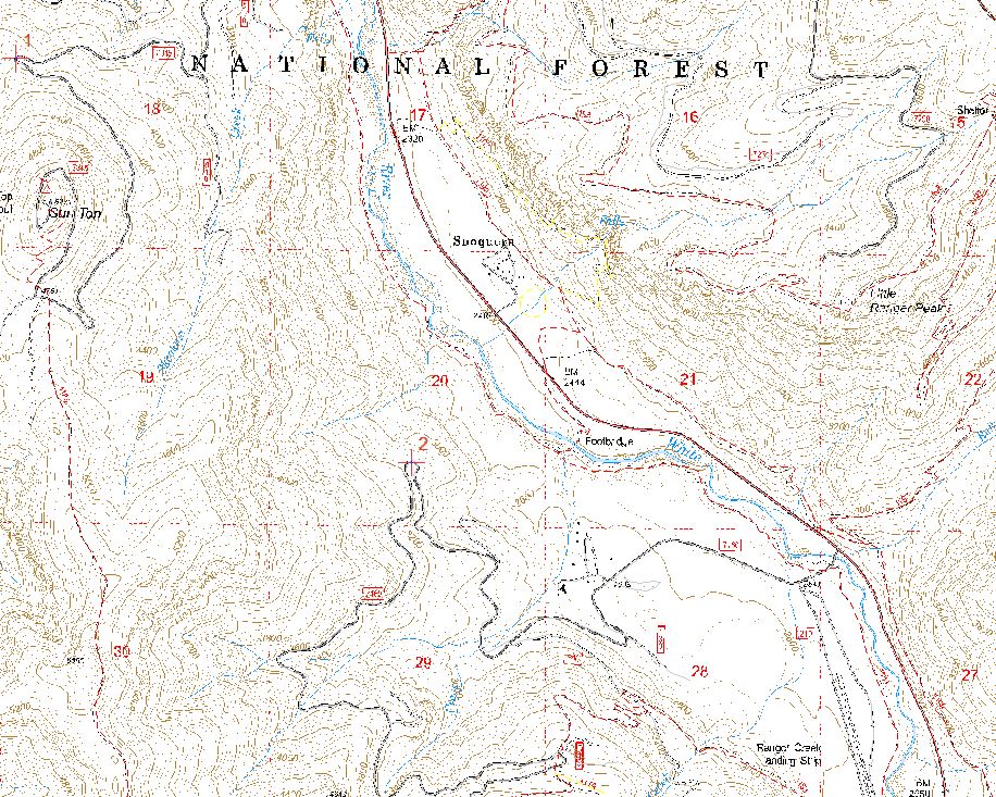
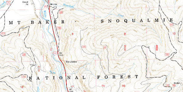
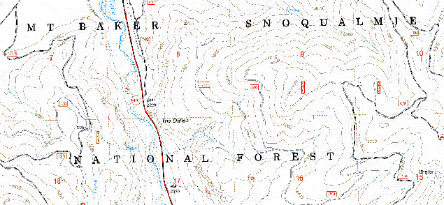
Here's what it looks like in ArcMap : [ATTACH=CONFIG]34966[/ATTACH]
Here's what it's supposed to look like: [ATTACH=CONFIG]34967[/ATTACH]
I've tried different projections and re-sampling. Can anyone help here? My knowledge of raster technology is very limited.
Thanks!
- Mark as New
- Bookmark
- Subscribe
- Mute
- Subscribe to RSS Feed
- Permalink
The ZIP file you reference has 2 TIFs. Both are georeferenced, although only one of them has the term "geo" in it. Looking at the TIFF image metadata shows the following, and ArcMap shows the same information.
- 470012130_geo.tif: Geographic, NAD83
- 470012130.tif: Projected, NAD83 UTM zone 10N
Which image are you having problems with? And what is the projection of the data frame?
Your "good" capture didn't come through as an attachment so I am not clear on what you are expecting to see.
- Mark as New
- Bookmark
- Subscribe
- Mute
- Subscribe to RSS Feed
- Permalink
When it comes to discrete raster data, especially color maps, I have always thought ArcMap's rendering engine falls short. Looking at how a section of 470012130.tif renders on my screen between Windows Photo Viewer and ArcMap.
Windows Photo Viewer:
ArcMap:
Granted, Windows Photo Viewer is treating the image as RGB while ArcMap is dealing with the color map, but it just seems the quality difference shouldn't be this pronounced.
- « Previous
-
- 1
- 2
- Next »
- « Previous
-
- 1
- 2
- Next »