- Home
- :
- All Communities
- :
- Products
- :
- Data Management
- :
- Data Management Questions
- :
- Re: Population Density shapefile for US
- Subscribe to RSS Feed
- Mark Topic as New
- Mark Topic as Read
- Float this Topic for Current User
- Bookmark
- Subscribe
- Mute
- Printer Friendly Page
Population Density shapefile for US
- Mark as New
- Bookmark
- Subscribe
- Mute
- Subscribe to RSS Feed
- Permalink
Hi, I love this shapefile for population density for US from esri documents below but it has restrictions not allowing to use it as data but merely a view. Has anyone got this file without such restrictions? Or any alternative shapefile for population density like this? Anybody knows the ways to reproduce similar shapefile, otherwise? I actually need it for New York State only. Thanks.
https://www.arcgis.com/home/item.html?id=302d4e6025ef41fa8d3525b7fc31963a
- Mark as New
- Bookmark
- Subscribe
- Mute
- Subscribe to RSS Feed
- Permalink
Short of finding an appropriate boundary file and obtaining the census data from government sources, you will just have to search the web. I found some for new York city but they are in final form and not in raw data.
PS you can get density, by projecting the boundary file to a statewide appropriate projection and taking the population for each unit and dividing by the shape_area field and scaling up so that you get an appropriate representation like population/sq km or similar units.
- Mark as New
- Bookmark
- Subscribe
- Mute
- Subscribe to RSS Feed
- Permalink
Have you tried looking at the US Census Bureau's TIGER line data? I know there are a lot of population tract polygons but I am not sure on the density. It might take a little bit of digging:
- Mark as New
- Bookmark
- Subscribe
- Mute
- Subscribe to RSS Feed
- Permalink
(1) You can get the geography data from the census bureau's pages, visit https://www.census.gov/geo/maps-data/data/tiger.html/ and look for block groups, and counties for New York. You can retrieve shapefiles or geodatabase layers from that resource.
[Edited to add this correction: visit Geography - U.S. Census Bureau for shapefiles and geodatabase content]
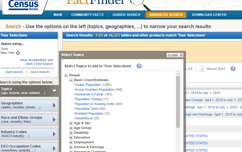
(2) I would recommend the American Communities Survey (ACS) data if you want recent data you can cite (at this date probably the July 1st estimates for 2014, I have not checked to see if the 2015 estimates are available as yet)--unless there is a requirement that you use PL data from the 2010 census. Both are available from the census bureau's web site, http://factfinder2.census.gov. A guided search will have you find county-level population estimates in a first step and in a second step, allocation to "All counties ["within New York" in this case].
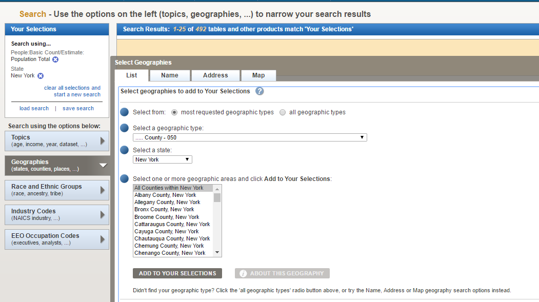
Retrieve the result table and working in ArcMap or ArcGIS Pro, join it to your shapefile (I would recommend file-based geodatabase as a more robust option for storing the counties or block groups). In rendering the map you can normalize total population by area to produce an up-to-date map. This approach involves a little work, but avoids the vagaries of looking for a prepared dataset or map, which may be out-of-date or based on data other than census 2010 or the 2014 July 1st estimates.
best regards
-caminante (Austin, Texas)