Turn on suggestions
Auto-suggest helps you quickly narrow down your search results by suggesting possible matches as you type.
Cancel
- Home
- :
- All Communities
- :
- Products
- :
- Data Management
- :
- Data Management Questions
- :
- Polygon 'footprints'
Options
- Subscribe to RSS Feed
- Mark Topic as New
- Mark Topic as Read
- Float this Topic for Current User
- Bookmark
- Subscribe
- Mute
- Printer Friendly Page
05-21-2018
02:04 PM
- Mark as New
- Bookmark
- Subscribe
- Mute
- Subscribe to RSS Feed
- Permalink
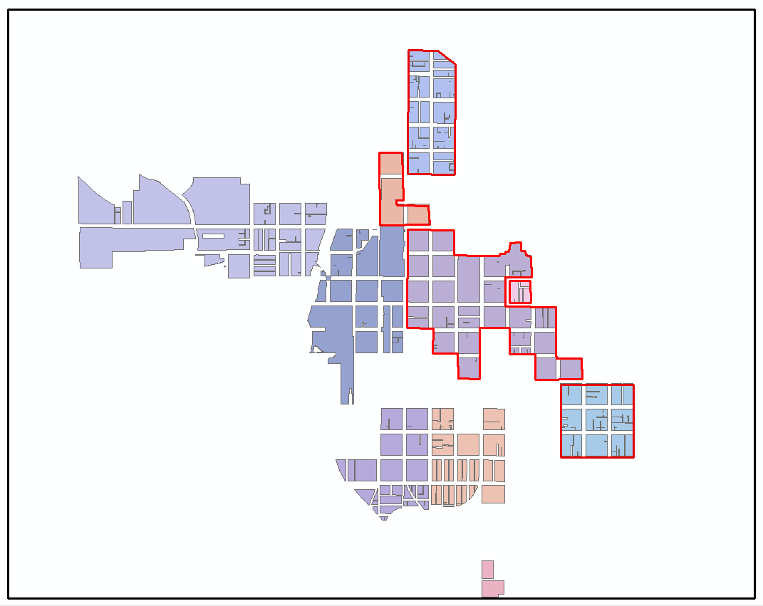
I have a polygon feature set that represents urban renewal projects (see sample image of data below). The original polygons were derived by dissolving parcels; hence the regular linear gaps which are where street centerlines are. I'd like to do something akin to aggregate polygons however, given that quite a number of the projects abut others, aggregate is out. Basically, what I'd like is something that looks like the red outline footprint I've sketched around a couple of the project areas; is there a tool to do such a task rather than drawing by hand?
That should just about do it....
Solved! Go to Solution.
10 Replies
05-22-2018
08:39 AM
- Mark as New
- Bookmark
- Subscribe
- Mute
- Subscribe to RSS Feed
- Permalink
Points... if it were a polygon, then you wouldn't need a concave hull
- « Previous
-
- 1
- 2
- Next »
- « Previous
-
- 1
- 2
- Next »