- Home
- :
- All Communities
- :
- Products
- :
- Data Management
- :
- Data Management Questions
- :
- Re: need help
- Subscribe to RSS Feed
- Mark Topic as New
- Mark Topic as Read
- Float this Topic for Current User
- Bookmark
- Subscribe
- Mute
- Printer Friendly Page
- Mark as New
- Bookmark
- Subscribe
- Mute
- Subscribe to RSS Feed
- Permalink
Hello,
I have two shapefiles having same projection. one file is a part of area of the other file. When added to the screen, they are not superimposing. Please tell me where i did the problem. the shapefiles are here with attached. Thank u....
Title was edited by: Timothy Hales
Solved! Go to Solution.
Accepted Solutions
- Mark as New
- Bookmark
- Subscribe
- Mute
- Subscribe to RSS Feed
- Permalink
I think that you should define WGS_1984_UTM_Zone_44N to these shapefiles. If I do so, the geometry is projected east of the city of Warangal.
- Mark as New
- Bookmark
- Subscribe
- Mute
- Subscribe to RSS Feed
- Permalink
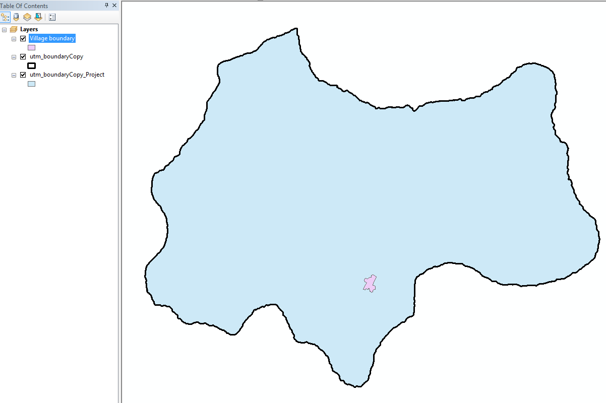
I am not sure what your issue is. this is how the layers show up if I open them up at my end:
- Mark as New
- Bookmark
- Subscribe
- Mute
- Subscribe to RSS Feed
- Permalink
U also have one more text file inplease add that through add x,y. The shapefiles are not coinciding with the points in the text file.
- Mark as New
- Bookmark
- Subscribe
- Mute
- Subscribe to RSS Feed
- Permalink
It appears the incorrect projection is defined for the shapefiles. When I create a xy features for the included .txt file and define a geographic coordinate system WGS1984 the points align fine with india. The Shapefiles also have a defined projection of WGS 1984 but the coordinated don't resemble reasonable Lat and Lon values. It would appear that the projection for these shapefiles has been incorrectly defined.
- Mark as New
- Bookmark
- Subscribe
- Mute
- Subscribe to RSS Feed
- Permalink
Thank u... I have reprojected and i got the files superimposed....
- Mark as New
- Bookmark
- Subscribe
- Mute
- Subscribe to RSS Feed
- Permalink
I think that you should define WGS_1984_UTM_Zone_44N to these shapefiles. If I do so, the geometry is projected east of the city of Warangal.
- Mark as New
- Bookmark
- Subscribe
- Mute
- Subscribe to RSS Feed
- Permalink
Thank u so much.
I have projected the files again and i got the layers super imposed. Thank u very much