- Home
- :
- All Communities
- :
- Products
- :
- Data Management
- :
- Data Management Questions
- :
- Re: Mosaic to new raster
- Subscribe to RSS Feed
- Mark Topic as New
- Mark Topic as Read
- Float this Topic for Current User
- Bookmark
- Subscribe
- Mute
- Printer Friendly Page
- Mark as New
- Bookmark
- Subscribe
- Mute
- Subscribe to RSS Feed
- Permalink
- Report Inappropriate Content
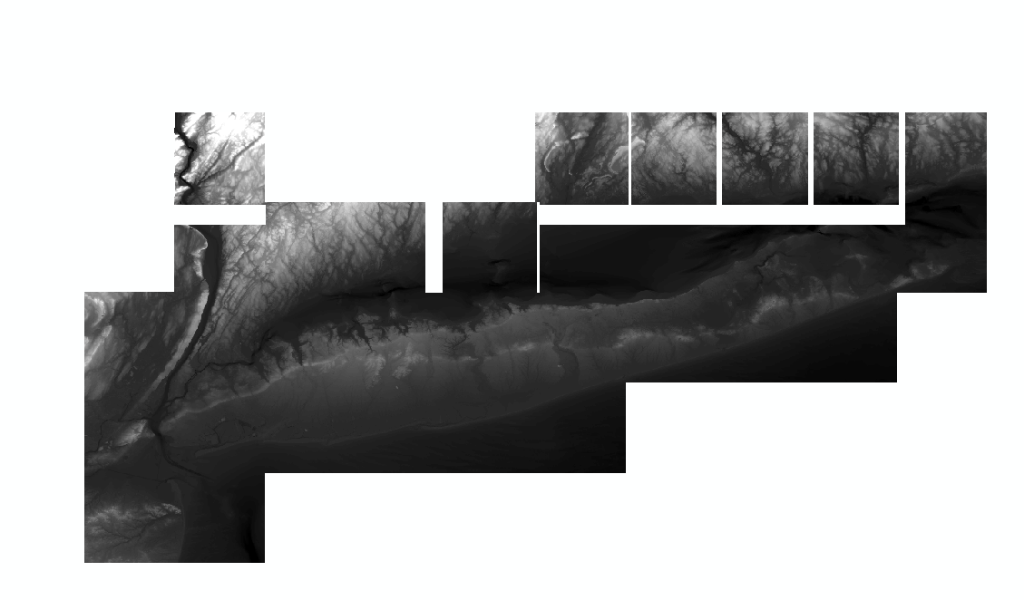
I have 33 DEM tiles that I am trying to mosaic together using this tool in ArcGIS Desktop,
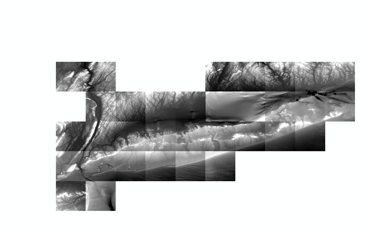
but I keep getting strange results.
All of the DEM pixel depths/sizes are 32 bit float, 1 band and are in NAD83, which I have been specifying in the tool. I'm saving it to a gdb and not specifying a cellsize. I am also leaving the mosaic operator and colormap modes as the defaults. This is the result I am getting:
Wondering if anyone knows why this is happening.
I tried using a mosaic dataset, but I am having issues with performing additional manipulation of it after I added all of the tiles. I would prefer to use the mosaic to new raster as I know the additional analysis and manipulation I need to perform has worked in the past.
Solved! Go to Solution.
- Mark as New
- Bookmark
- Subscribe
- Mute
- Subscribe to RSS Feed
- Permalink
- Report Inappropriate Content
Hmmm, I used to run this same tool.
Try finding out the cell size of the seperate rasters and input that number into the cell size option in the tool, so you know the cell size is the same throughout the process. Export to GRID format too. I find it's the most ESRI friendly.
- « Previous
-
- 1
- 2
- Next »
- « Previous
-
- 1
- 2
- Next »