Turn on suggestions
Auto-suggest helps you quickly narrow down your search results by suggesting possible matches as you type.
Cancel
- Home
- :
- All Communities
- :
- Products
- :
- Data Management
- :
- Data Management Questions
- :
- Input satellite image from google earth to arcmap
Options
- Subscribe to RSS Feed
- Mark Topic as New
- Mark Topic as Read
- Float this Topic for Current User
- Bookmark
- Subscribe
- Mute
- Printer Friendly Page
Input satellite image from google earth to arcmap
Subscribe
15771
8
10-07-2010 12:01 AM
10-07-2010
12:01 AM
- Mark as New
- Bookmark
- Subscribe
- Mute
- Subscribe to RSS Feed
- Permalink
how do i input a satellite image from google earth into arcmap (arceditor) so that arcmap understands the location of this image?
i need this image so that later on i can do some editing to locate some points on the map.
i need this image so that later on i can do some editing to locate some points on the map.
8 Replies
11-17-2010
06:09 AM
- Mark as New
- Bookmark
- Subscribe
- Mute
- Subscribe to RSS Feed
- Permalink
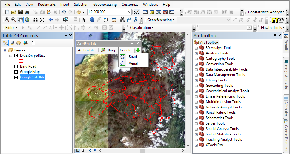
I used to have to do this...you could cut and paste a raster image of the Google Earth data by print screen or whatever you like. But, have you tried using the Bing Maps layer provided by ESRI this would make it much easier as you have imagery just as good as Google Earth within the ArcMap interface...
Otherwise if you have been making KMZ files in Google Earth have you had a look at importing them into ArcGIS (I am not sure if you can).
Hope this helps...
Simon Kettle
www.cambridgecarbonates.com
Otherwise if you have been making KMZ files in Google Earth have you had a look at importing them into ArcGIS (I am not sure if you can).
Hope this helps...
Simon Kettle
www.cambridgecarbonates.com
01-31-2011
09:41 PM
- Mark as New
- Bookmark
- Subscribe
- Mute
- Subscribe to RSS Feed
- Permalink
Where can I find that bing map layer? Does is cover South Africa? i.t.o. the google images: Mapwindow GIS is open source freeware with a nice little plugin to import a screenshot of GE together with the projection.it's called shape2earth. only con is it's restricted to your screen resolution.
plz let me know if you find a tool that can import high quality images
plz let me know if you find a tool that can import high quality images
02-15-2011
05:52 AM
- Mark as New
- Bookmark
- Subscribe
- Mute
- Subscribe to RSS Feed
- Permalink
Hi,
I am interesting in the Bing map layer you mention as a way to get a base map into ARCGIS. How can I access this function?
Thanks,
Lane
I am interesting in the Bing map layer you mention as a way to get a base map into ARCGIS. How can I access this function?
Thanks,
Lane
06-21-2011
01:20 AM
- Mark as New
- Bookmark
- Subscribe
- Mute
- Subscribe to RSS Feed
- Permalink
Hi,
I am interesting in the Bing map layer you mention as a way to get a base map into ARCGIS. How can I access this function?
Thanks,
Lane
I do apologise for the very tardy responce...I didn't recieve the email saying you had replied to this feed. Apologies. If your running Arc9.3 have to register (this only takes a short time) see: http://forums.arcgis.com/newreply.php?do=newreply&p=77613&ESRISessionID=atYEzjfPCWvzX7roO_IC1_L0dK-2...
With ArcGIS10 the Bing maps layers are included in the add base map function which is part of the add data button on the toolbar within ArcMap.
I hope this helps...again apologies for the very late reply.
06-21-2011
01:28 AM
- Mark as New
- Bookmark
- Subscribe
- Mute
- Subscribe to RSS Feed
- Permalink
Additionally you could download GoogleEarth Pro which I think is relatively expensive where you can import and export shapefiles between the two programmes but I am not sure of imagery.
However being able to export your shapefiles into kmz/kml file format means you can overlay this on imagery.
I would also point out that within ArcGIS Toolbox (using ArcGIS10) there is a conversion tool to KML (which opens in Google) look for Conversion Tools>To KML and pick your tool (this has also worked for me in the past).
Hope this all helps.
09-07-2011
07:37 PM
- Mark as New
- Bookmark
- Subscribe
- Mute
- Subscribe to RSS Feed
- Permalink
how to Input satellite image from google earth to arcmap
Thanks,
Lane
Thanks,
Lane
02-07-2012
11:55 PM
- Mark as New
- Bookmark
- Subscribe
- Mute
- Subscribe to RSS Feed
- Permalink
dear friends
i am having a tool,with that its possibly to download the Google earth images with lat long values. i downloaded 350 sqm area images with high quality.
i am having a tool,with that its possibly to download the Google earth images with lat long values. i downloaded 350 sqm area images with high quality.
10-11-2013
09:12 AM
- Mark as New
- Bookmark
- Subscribe
- Mute
- Subscribe to RSS Feed
- Permalink
You can check this link: Synchronize ArcMap with Google Earth.
http://en.acolita.com/synchronize-arcgis-arcmap-10-with-google-earth.html
http://en.acolita.com/synchronize-arcgis-arcmap-10-with-google-earth.html