Turn on suggestions
Auto-suggest helps you quickly narrow down your search results by suggesting possible matches as you type.
Cancel
- Home
- :
- All Communities
- :
- Products
- :
- Data Management
- :
- Data Management Questions
- :
- IDW interpolation of point rain data
Options
- Subscribe to RSS Feed
- Mark Topic as New
- Mark Topic as Read
- Float this Topic for Current User
- Bookmark
- Subscribe
- Mute
- Printer Friendly Page
IDW interpolation of point rain data
Subscribe
1219
1
06-06-2019 08:33 AM
06-06-2019
08:33 AM
- Mark as New
- Bookmark
- Subscribe
- Mute
- Subscribe to RSS Feed
- Permalink
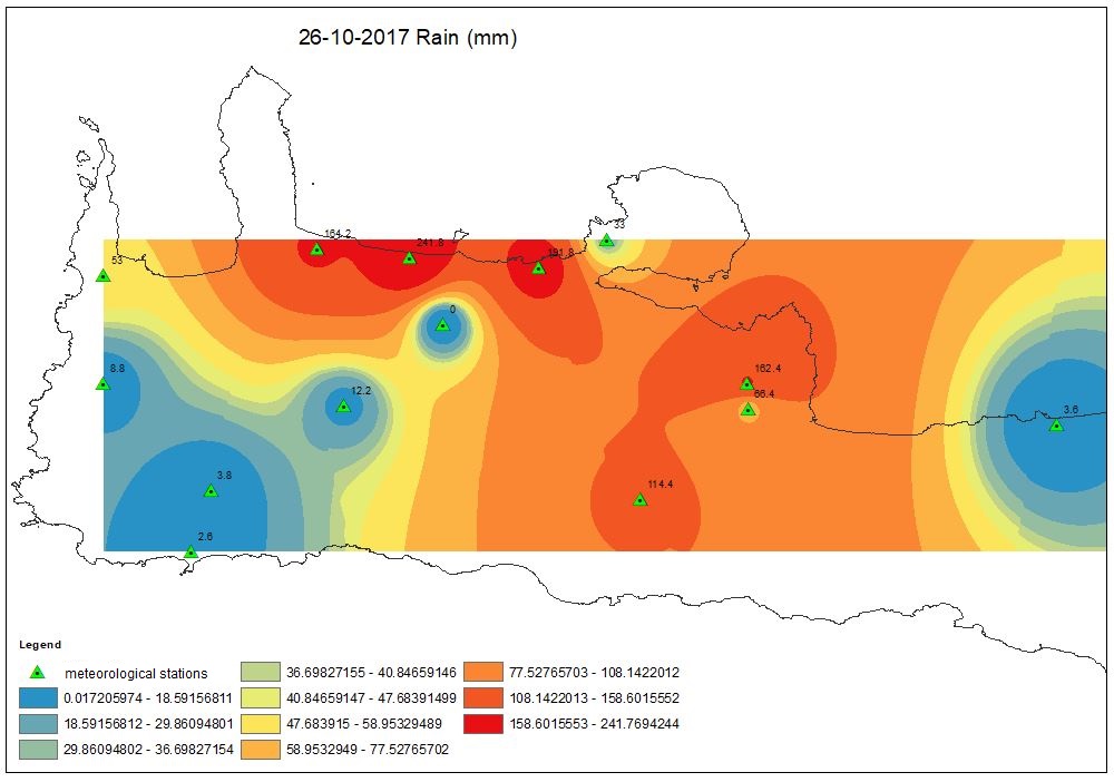
I have point-shapefile with meteorological stations counting daily rain of a specific precipitation event. I tried to interpolate the rain data applying the Inverse Distance Weighting, but I noticed that the output interpolated area resulted having as boundaries the locations of the stations. Is there any way to raise up the applicable interpolated area in order to have as boundaries the whole study area through IDW? I attach you the relevant photo. Thanks in advance.
1 Reply
06-06-2019
08:45 AM
- Mark as New
- Bookmark
- Subscribe
- Mute
- Subscribe to RSS Feed
- Permalink
Set the Analysis Extent in the tool's Environments to the size you want (I presume the underlying vector layer's extent)
By default the Analysis Extent is set to the input dataset since you have specified otherwise.