Turn on suggestions
Auto-suggest helps you quickly narrow down your search results by suggesting possible matches as you type.
Cancel
- Home
- :
- All Communities
- :
- Products
- :
- Data Management
- :
- Data Management Questions
- :
- Hillshade function in Mosaic rasters
Options
- Subscribe to RSS Feed
- Mark Topic as New
- Mark Topic as Read
- Float this Topic for Current User
- Bookmark
- Subscribe
- Mute
- Printer Friendly Page
Hillshade function in Mosaic rasters
Subscribe
1621
1
01-15-2014 12:15 AM
01-15-2014
12:15 AM
- Mark as New
- Bookmark
- Subscribe
- Mute
- Subscribe to RSS Feed
- Permalink
Hi There,
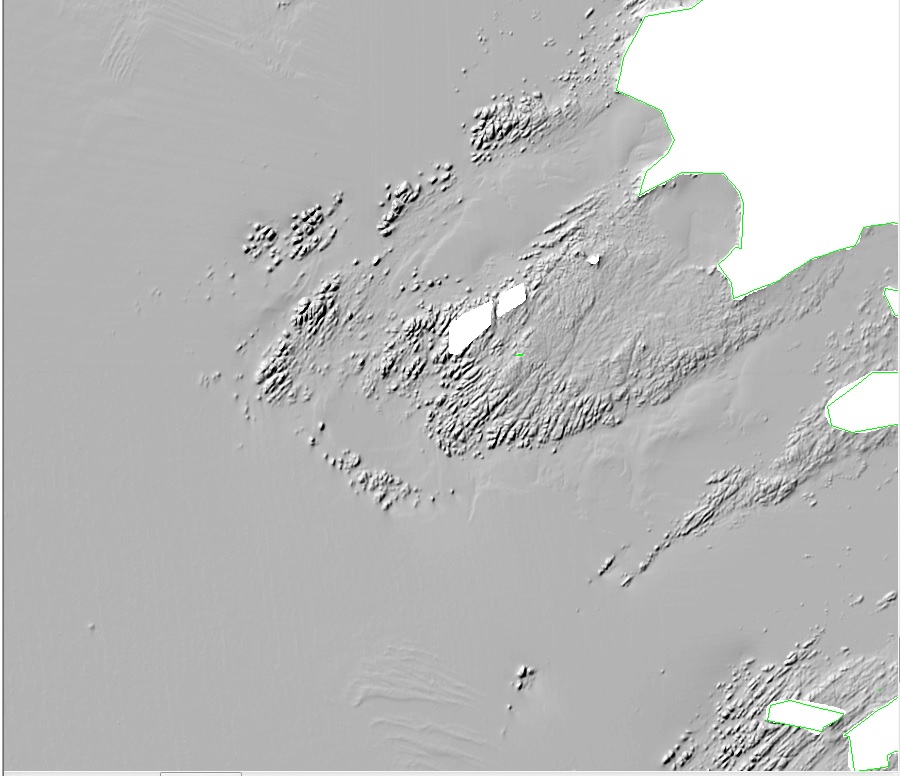
I have multiple grids for bathymetry data of the seafloor. I've mosaiced these rasters to create a continuous image and would now like to apply some greyscale shading to highlight the features on the seafloor. I've tried a lot of options but the images produced are very smoothed and it's difficult to see any definition in the features.
Attached are 2 images 1 that was created by another mapping package (Test_GM.jpg) which is how I would like the data to look - slightly darker and with the features both craggy rocks and smooth sandwaves are well defined. The second produced using the Hillshade function in mosaic rasters (Test_ArcGIS.jpg) firstly is very pale therefore light and shaded areas are not well contrasted as a result the features to me are not as well defined as they could be. I used the following parameters in ArcGIS:
Azimuth:315
Altitude: 45
Scaling Adjusted
Z factor: 10
Pixel Size Power: 0.8
Pixel Size Factor: 0.024
All suggestions welcome as I'd like to continue to use the mosaics rather then having to create new images in a seperate mapping package.
1 Reply
01-31-2014
07:44 AM
- Mark as New
- Bookmark
- Subscribe
- Mute
- Subscribe to RSS Feed
- Permalink
Right click the layer in the TOC in go to properties, under symbology try adjusting the stretch renderer (standard deviations for example). You can also do this with the image analysis window as well. Let me know if that works for you.
Jake
Jake