- Home
- :
- All Communities
- :
- Products
- :
- Data Management
- :
- Data Management Questions
- :
- Re: Geocoding addresses, cant zoom or pan the the ...
- Subscribe to RSS Feed
- Mark Topic as New
- Mark Topic as Read
- Float this Topic for Current User
- Bookmark
- Subscribe
- Mute
- Printer Friendly Page
Geocoding addresses, cant zoom or pan the the individual points unless selected?
- Mark as New
- Bookmark
- Subscribe
- Mute
- Subscribe to RSS Feed
- Permalink
- Report Inappropriate Content
I have a wierd bug, maybe its something I have done wrong I dont know but I wondered if anyone else might have come across it / can help me.
I have geocoded a big list of addresses (2000+) they have all came in correctly in the right location, except when I try to pan or zoom to them by selecting them in the table it wont allow me, however if I manually select a point with a cursor, I can then pan or zoom to it, does anyone know why this might be happening?
Thanks
- Mark as New
- Bookmark
- Subscribe
- Mute
- Subscribe to RSS Feed
- Permalink
- Report Inappropriate Content
First- the usual questions; Version of ArcGIS, etc.
You have 2000+ points that represent the geocoding results of a table of addresses, correct? And all of these satisfy the minimum requirements for a matched address, correct? In other words, you have the same number of points as you do address records? I ask that question because your geocoding results table will have record of unmatched address, but will have no point to zoom to. I can't think of another reason why you can't zoom to a selected feature from the attribute table.
- Mark as New
- Bookmark
- Subscribe
- Mute
- Subscribe to RSS Feed
- Permalink
- Report Inappropriate Content
All yes Joe :-), I have noticed though, that i can zoom to the points fine if they used the street center lines to match the address (I am using a composite address locator) the ones that wont allow me to zoom to (my original problem) seem to be matched using parcel boundaries (part of the composite address locators).
Another point that may or may not be relevant is that the original composite address locator was stored on our SDE, (I dont have admin rights) and I couldn't run it via the sde so I copied the address locator to my local drive.
- Mark as New
- Bookmark
- Subscribe
- Mute
- Subscribe to RSS Feed
- Permalink
- Report Inappropriate Content
Luke, what Joe is alluding to is any unmatched addresses will be in the output features but with null geometry, so even though you can select the row you can't zoom to it. Rematch the data interactively to find Status = 'U' rows.
There is plenty of scope to break locators when storing them in an enterprise GDB - and it isn't supported in the current release. Copy them to file storage.
- Mark as New
- Bookmark
- Subscribe
- Mute
- Subscribe to RSS Feed
- Permalink
- Report Inappropriate Content
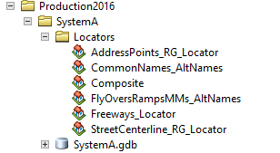
What Bruce said... You can also select by attributes where Status = 'U'. See: Cannot delete locator in a file geodatabase . It's one of many that Bruce and I have tag-teamed recommending that the locators be file based, not gdb based. See below:
- Mark as New
- Bookmark
- Subscribe
- Mute
- Subscribe to RSS Feed
- Permalink
- Report Inappropriate Content
Yeah, thank you guys for offering your help, but my problem is even the matched address which were matched with the parcel data can't be zoomed/panned to, I am trying it on another users mxd now who has admin privileges and can run the address locator from the sde... maybe that is the reason
- Mark as New
- Bookmark
- Subscribe
- Mute
- Subscribe to RSS Feed
- Permalink
- Report Inappropriate Content
If it was me, I'd try a couple things; first I'd create all the locators in a directory and re-geocode your address list and try zooming to the results. You might also create a table of addresses that matched against your parcels and then match them to the parcel locator. That might tell you if something is goofy with your parcel locator or your parcel data.
- Mark as New
- Bookmark
- Subscribe
- Mute
- Subscribe to RSS Feed
- Permalink
- Report Inappropriate Content
Hi Joe, thanks for the help - what solved it was using the composite address locator on another users pc with admin rights, strange but problem solved 