- Home
- :
- All Communities
- :
- Products
- :
- Data Management
- :
- Data Management Questions
- :
- Re: Displaying SRTM/TIN in ArcScene
- Subscribe to RSS Feed
- Mark Topic as New
- Mark Topic as Read
- Float this Topic for Current User
- Bookmark
- Subscribe
- Mute
- Printer Friendly Page
Displaying SRTM/TIN in ArcScene
- Mark as New
- Bookmark
- Subscribe
- Mute
- Subscribe to RSS Feed
- Permalink
Hi guys,
I was just wondering why is it I cannot display in 3D the uploaded SRTM and generated TIN in ArcScene? Is there any lacking data on it?
Please refer on the picture below.
Thank you.

- Mark as New
- Bookmark
- Subscribe
- Mute
- Subscribe to RSS Feed
- Permalink
What happens if you choose "Floating on a custom surface" and choose the DEM for Base Heights?
Think Location
- Mark as New
- Bookmark
- Subscribe
- Mute
- Subscribe to RSS Feed
- Permalink
It just form a straight line like this

- Mark as New
- Bookmark
- Subscribe
- Mute
- Subscribe to RSS Feed
- Permalink
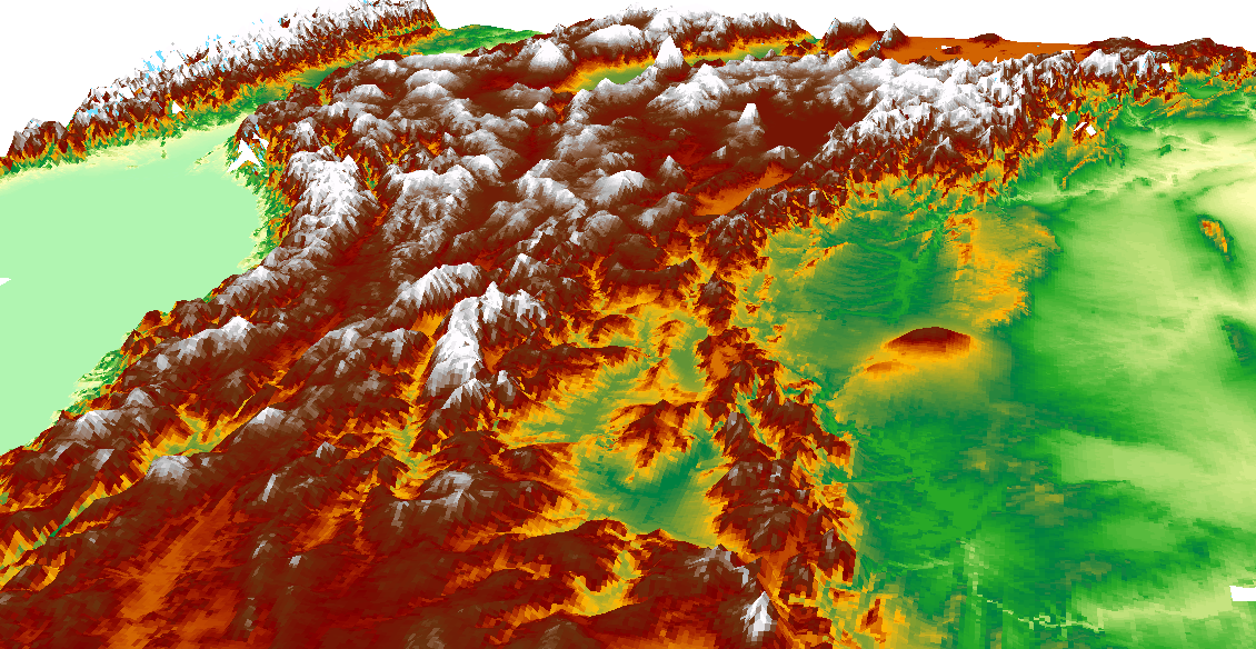
The issue you are experiencing is to do with the fact your XY coordinates are in decimal degrees and your Z values are in metres. So totally different units. You need to set the raster as the floating on custom surface then in the next panel (elevation from features) set the factor to convert layer elevation to scene units. So what do you use? You can get an idea by visiting this blog page.
Below is a screen shot SRTM data for Turkey where I had set the factor to be 0.00005156, you just play around until you get what you like is my experience.
- Mark as New
- Bookmark
- Subscribe
- Mute
- Subscribe to RSS Feed
- Permalink
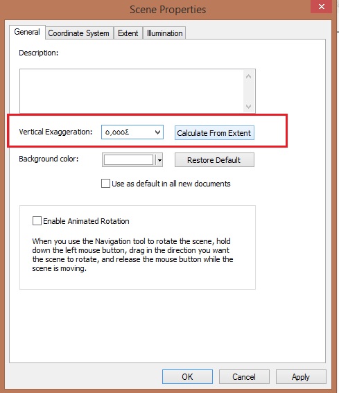
You need to calculate Vertical exaggeration from extent:
see below picture.
- Mark as New
- Bookmark
- Subscribe
- Mute
- Subscribe to RSS Feed
- Permalink
Now i got.
Thank you for the help.
- Mark as New
- Bookmark
- Subscribe
- Mute
- Subscribe to RSS Feed
- Permalink
Is it work now?
- Mark as New
- Bookmark
- Subscribe
- Mute
- Subscribe to RSS Feed
- Permalink
yes by just putting the vertical exaggeration in scene properties, but i still have to check the layer properties of some of my data especially the units of z factors.
Thanks much for the help.