- Home
- :
- All Communities
- :
- Products
- :
- Data Management
- :
- Data Management Questions
- :
- Re: Creating a polygon when there are water bodies...
- Subscribe to RSS Feed
- Mark Topic as New
- Mark Topic as Read
- Float this Topic for Current User
- Bookmark
- Subscribe
- Mute
- Printer Friendly Page
Creating a polygon when there are water bodies in the polyline shapefile
- Mark as New
- Bookmark
- Subscribe
- Mute
- Subscribe to RSS Feed
- Permalink
Hi,
I have NGA shoreline polyline shapefile of Indoneisa. I have modified it by adding two lines to close the polygons, so that I can create a polygon of my area of interest. However, there are numerous waterbodies which are drawn in the shapefile, and when I am trying to create a polygon from the polyline, a closed polygon is not being created. I tried dissolving the polylines but that didn't help either. Any ideas on how to do it? Otherwise, I will have to manually delete the polylines which are interrupting in the creation of the polygon.
I am attaching a portion of shapefile I am working with (the complete one is too big to be attached here). Any help will be greatly appreciated.
Thanks,
Tilottama
Solved! Go to Solution.
Accepted Solutions
- Mark as New
- Bookmark
- Subscribe
- Mute
- Subscribe to RSS Feed
- Permalink
Hello,
Any polyline with dangles would not get converted into polygon. Create a topology to find the number of dangles. Try closing the dangles before converting them to polygons.
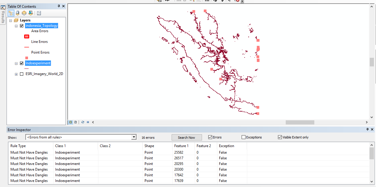
I found 16 dangles in the attached data. You could ignore the errors where the dangles are valid.
Think Location
- Mark as New
- Bookmark
- Subscribe
- Mute
- Subscribe to RSS Feed
- Permalink
Hi Tilottama,
I use the GSHHG coastline shapefiles (GSHHG | ngdc.noaa.gov ), because you can adjust the level of accuracy of the coastlines (high-resolution, lower resolution, crude and more) and you can also use overlays of hydrology, islands in lakes etc. to the amount of accuracy you need. In your case I would just use the outline without waterbodies, clip (Geoprocessing/clip) the global coastline-file to your work area (must be an extra shapefile) and that gives you closed polygons.
Try the one attached,
cheers,
Anna
- Mark as New
- Bookmark
- Subscribe
- Mute
- Subscribe to RSS Feed
- Permalink
Hello,
Any polyline with dangles would not get converted into polygon. Create a topology to find the number of dangles. Try closing the dangles before converting them to polygons.
I found 16 dangles in the attached data. You could ignore the errors where the dangles are valid.
Think Location
- Mark as New
- Bookmark
- Subscribe
- Mute
- Subscribe to RSS Feed
- Permalink
You need to work in a Geodatabase > Feature Dataset, for the creation of topology. Shapefiles do not support topology.
Think Location
- Mark as New
- Bookmark
- Subscribe
- Mute
- Subscribe to RSS Feed
- Permalink
Hi Jayanta,
Thanks so much. I used the method suggested by you and could close all the dangles and complete the polygon.
Thanks very much,
Tilo
- Mark as New
- Bookmark
- Subscribe
- Mute
- Subscribe to RSS Feed
- Permalink
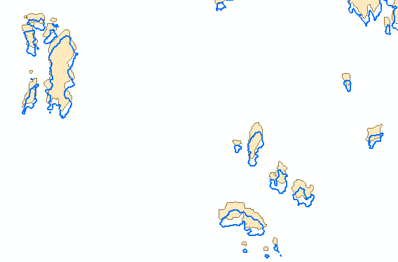
One thing that you can do is revise manually the shore line to see if it is connected, which would take you a lot of time. To narrow down the problem, you can create some additional lines (on a copy of you data) to see where the problem occurs.
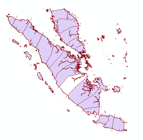
The part left in blank is the part that has issues. Creating some more additional lines narrows it further down:
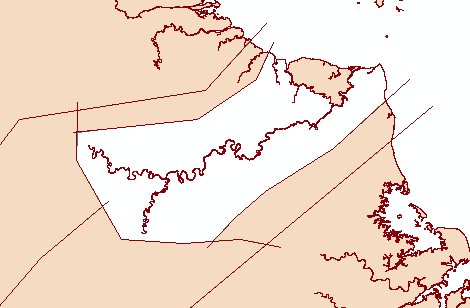
Looking at the river you will notice that there is spot that is left open causing the create polygon operation to fail on that line. See below the location. If you close that part, the polygon will be formed.
The suggestion by Anna sounds good, although you will have to see if the precision and the differences between the datasets can be overcome (define which one is correct), because there huge differences in detail:
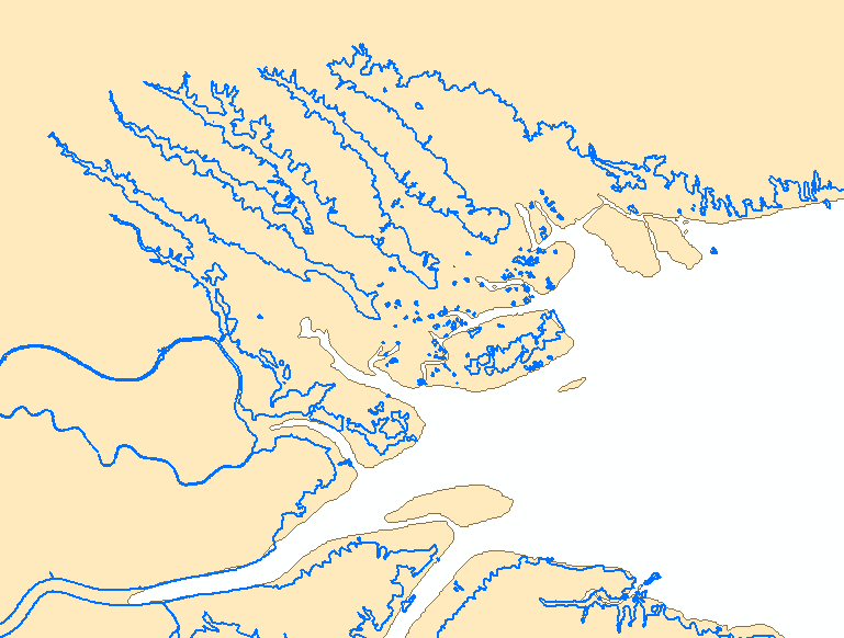
... and location
And they both have the same spatial reference...
- Mark as New
- Bookmark
- Subscribe
- Mute
- Subscribe to RSS Feed
- Permalink
Hi Xander,
Thanks for the great suggestion. I did try this method too. Helped quite a bit. Thanks!
I used the topology correction (Jayanta's suggestion) to close the dangles.
Thanks so much!
Tilottama