Turn on suggestions
Auto-suggest helps you quickly narrow down your search results by suggesting possible matches as you type.
Cancel
- Home
- :
- All Communities
- :
- Products
- :
- Data Management
- :
- Data Management Questions
- :
- Converting CAD polylines and points by CAD Layer
Options
- Subscribe to RSS Feed
- Mark Topic as New
- Mark Topic as Read
- Float this Topic for Current User
- Bookmark
- Subscribe
- Mute
- Printer Friendly Page
Converting CAD polylines and points by CAD Layer
Subscribe
1102
0
03-23-2011 06:28 AM
03-23-2011
06:28 AM
- Mark as New
- Bookmark
- Subscribe
- Mute
- Subscribe to RSS Feed
- Permalink
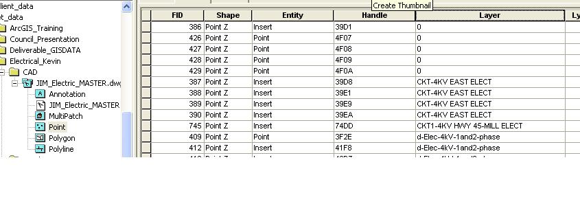
I've converted a CAD file and now I need to break down the points and polylines to shapefiles by the Layer attribute. Is there a way I can import the CAD layer by it's layer attribute?
Am I making sense? I'm not sure how to explain it. See the attachment.
In the attachement you can see my CAD file; each CAD file, as we know, has attributes and I want to import the CAD polyline and point layers by the layer attribute to shapefiles. My result would be a seperate shapefile for 0, CKY-4KV EAST ELECT, CKT1-4KV HWY 45-MILL ELECT, etc, etc.
I'm tired of doing these one at a time using Select By Attribute after I convert the CAD to shapefiles. I want to break them down further using a srcipt or tool. There's got to be a solution out there.
I'm still on 9.3 due to clients, I prefer help to be for 9.3 but I do have access to 10
0 Replies