- Home
- :
- All Communities
- :
- User Groups
- :
- Coronavirus disease 2019 (COVID-19)
- :
- Questions
- :
- Re: Are there any templates for food distribution ...
- Subscribe to RSS Feed
- Mark Topic as New
- Mark Topic as Read
- Float this Topic for Current User
- Bookmark
- Subscribe
- Mute
- Printer Friendly Page
Are there any templates for food distribution (charities, schools, churches, local government)?
- Mark as New
- Bookmark
- Subscribe
- Mute
- Subscribe to RSS Feed
- Permalink
- Report Inappropriate Content
I'm just throwing a net out here to see if anyone has seen templates for a robust food distribution map stack? I will probably just start making one from scratch, but I'm always looking for ways to speed things up.
Thanks for any tips you might have.
Solved! Go to Solution.
Accepted Solutions
- Mark as New
- Bookmark
- Subscribe
- Mute
- Subscribe to RSS Feed
- Permalink
- Report Inappropriate Content
Hi Alex,
FYI, please take a look at some of these new solution offerings,
Updated Coronavirus Response Solution Available Now
Hope this helps,
- Mark as New
- Bookmark
- Subscribe
- Mute
- Subscribe to RSS Feed
- Permalink
- Report Inappropriate Content
This is the data for "Places of Worship"
All Places of Worship
I'm not sure of the status of these locations and food distributions. There are schools layers in ArcGIS Online, I'm sure you can find the feature layers. I know Feeding America has a lot of food distribution locations.
Here's a map Feeding America has for Riverside & San Bernardino Counties in California, it allows the user to search near them to find food banks and route to them.
ArcGIS Web Application
- Mark as New
- Bookmark
- Subscribe
- Mute
- Subscribe to RSS Feed
- Permalink
- Report Inappropriate Content
Thanks for your help Amanda!
- Mark as New
- Bookmark
- Subscribe
- Mute
- Subscribe to RSS Feed
- Permalink
- Report Inappropriate Content
No problem! If you have any other questions, we'll be sure to reply as best as we can.
Thanks!
Amanda
- Mark as New
- Bookmark
- Subscribe
- Mute
- Subscribe to RSS Feed
- Permalink
- Report Inappropriate Content
Hi Alex,
FYI, please take a look at some of these new solution offerings,
Updated Coronavirus Response Solution Available Now
Hope this helps,
- Mark as New
- Bookmark
- Subscribe
- Mute
- Subscribe to RSS Feed
- Permalink
- Report Inappropriate Content
Well there you go! 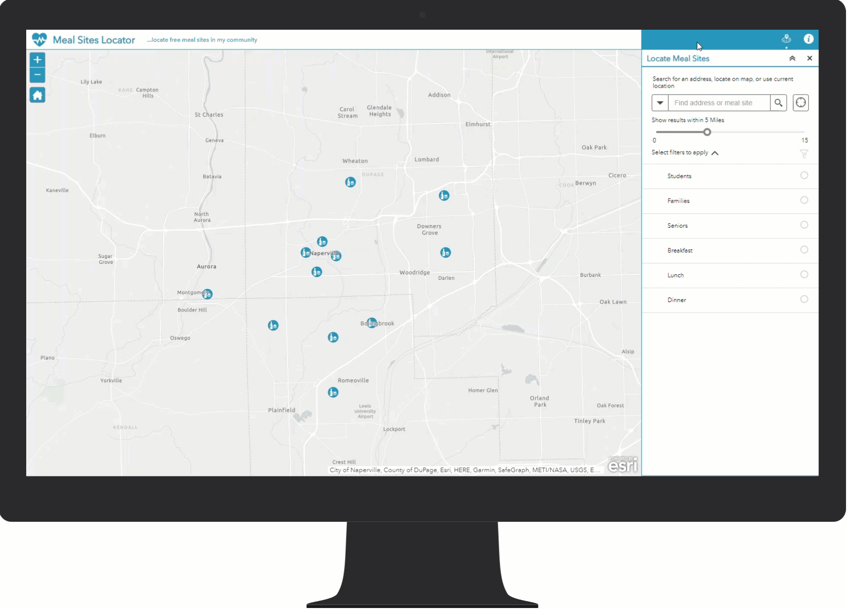
- Mark as New
- Bookmark
- Subscribe
- Mute
- Subscribe to RSS Feed
- Permalink
- Report Inappropriate Content
Looks great!!