- Home
- :
- All Communities
- :
- User Groups
- :
- Coordinate Reference Systems
- :
- Questions
- :
- No Transformation available from NAD 83 CSRS to WG...
- Subscribe to RSS Feed
- Mark Topic as New
- Mark Topic as Read
- Float this Topic for Current User
- Bookmark
- Subscribe
- Mute
- Printer Friendly Page
No Transformation available from NAD 83 CSRS to WGS 84?
- Mark as New
- Bookmark
- Subscribe
- Mute
- Subscribe to RSS Feed
- Permalink
- Report Inappropriate Content
It's been a number of years since I used ArcMap and I must have forgotten something because The ultimate goal is to export a shapefile to a kmz file. However when I ran the "Layer to KML" tool, my data - which is in NAD83 CSRS UTM20N - ended up in the middle of the ocean with very odd coordinates. After some "googling" I found a similar issue that was resolved by first de-projecting the data set to WGS84. However, when I try to do this no transformation file comes up. 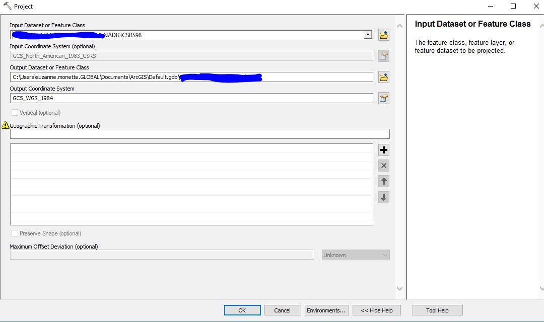
I was expecting to see this one available. What obvious thing have I forgotten over the past 1/2 dozen years? 
![]()
Any help would be very much appreciated!
Thanks,
Sue
- Mark as New
- Bookmark
- Subscribe
- Mute
- Subscribe to RSS Feed
- Permalink
- Report Inappropriate Content
Yes, one of those transformations should have come up. One possibility is that the CSRS definition doesn't match Esri's close enough and we're not recognizing it. If you look at the layer properties, and see a WKID of 0, that's would confirm it.
Another possibility is that there's an issue with the data extent. That it falls outside of the valid area of the transformations. Can you post a sample coordinate pair for the data? Or if you add it to ArcMap / map in Pro does it line up correctly against a base map? I'm leaning towards this second option because just missing/not applying a transformation shouldn't cause the data to display wildly off.
Melita