- Home
- :
- All Communities
- :
- User Groups
- :
- Coordinate Reference Systems
- :
- Questions
- :
- Re: Extents of shapefile not right after using Def...
- Subscribe to RSS Feed
- Mark Topic as New
- Mark Topic as Read
- Float this Topic for Current User
- Bookmark
- Subscribe
- Mute
- Printer Friendly Page
Extents of shapefile not right after using Define Projection tool
- Mark as New
- Bookmark
- Subscribe
- Mute
- Subscribe to RSS Feed
- Permalink
- Report Inappropriate Content
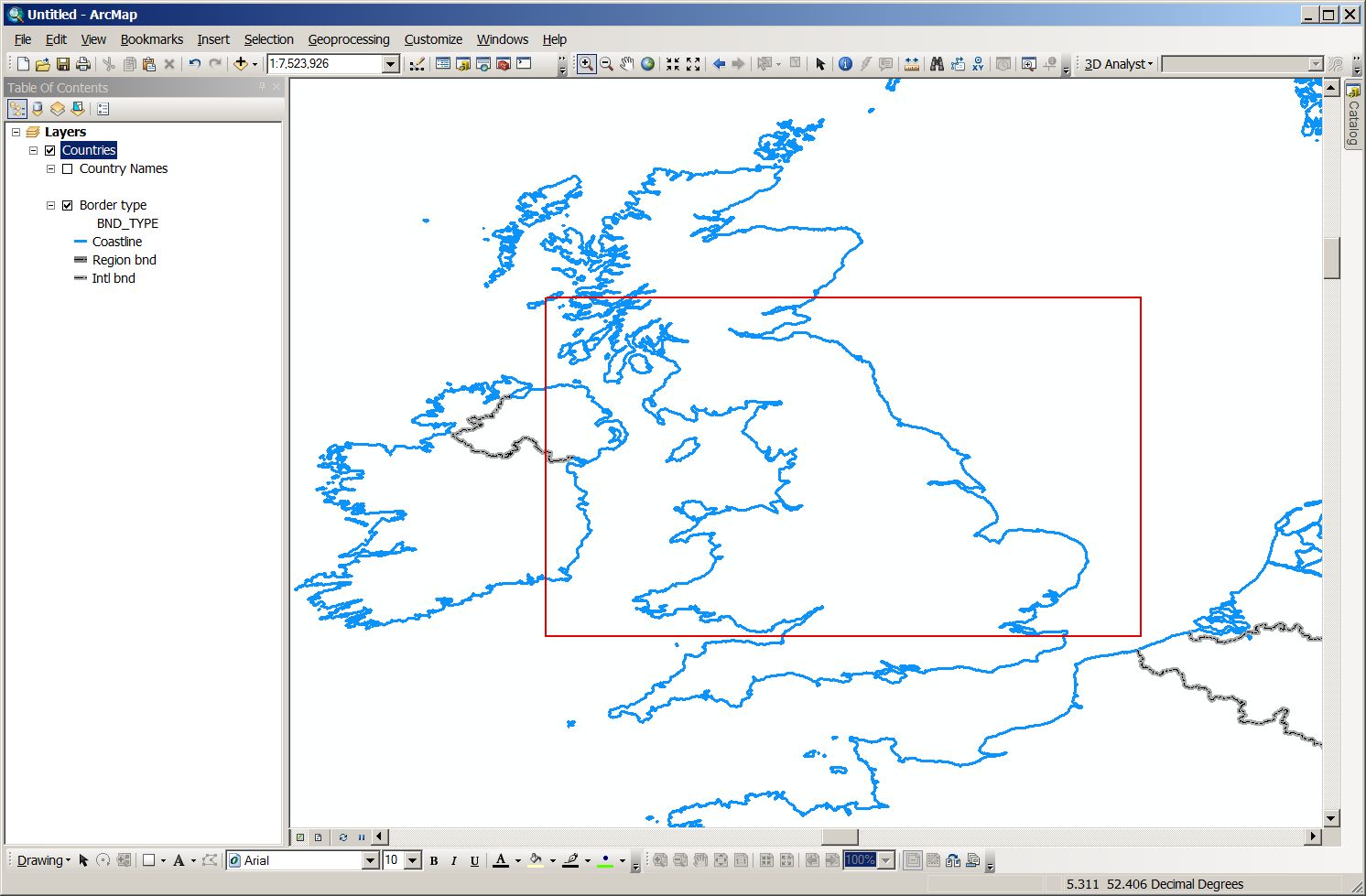
I have a shapefile that did not initially have a projection. I used Define Projection tool to give it projection of Web Mercator.
Then I saw that the extents are as follows:
Top: 56.610778 m
Bottom: 51.286333 m
Left: -6.744222 m
Right: 2.604972 m
This does not look right to me. How would I be able to fix it?
- Mark as New
- Bookmark
- Subscribe
- Mute
- Subscribe to RSS Feed
- Permalink
- Report Inappropriate Content
Do you know where this data is supposed to be?
Assuming those extents are in fact degrees, that gives me a polygon covering most of the UK.
Define it as GCS not WebM.
- Mark as New
- Bookmark
- Subscribe
- Mute
- Subscribe to RSS Feed
- Permalink
- Report Inappropriate Content
Rightly said by Neil Ayres, you need to define the coordinate system as a geographic coordinate system (e.g. GCS_WGS1984.).
Think Location
- Mark as New
- Bookmark
- Subscribe
- Mute
- Subscribe to RSS Feed
- Permalink
- Report Inappropriate Content
The reason why I defined it as Web Mercator is because I will later on upload this map onto ArcGIS Online. Should I still define it as GCS_WGS1984? And then as Web Mercator?
- Mark as New
- Bookmark
- Subscribe
- Mute
- Subscribe to RSS Feed
- Permalink
- Report Inappropriate Content
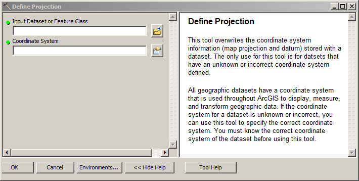
You need to know the difference between defining a projection and actually projecting a feature class.
If you have a feature class in which you have no projection information, you need to go back to the data source to find out what projection the data is in and then DEFINE PROJECTION as such.
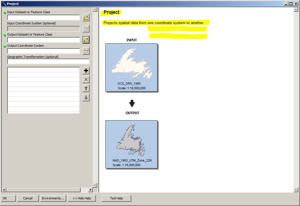
Once you have a feature class with (correct) projection information and you want to present that data in a different projection, you will run the PROJECT tool.
- Mark as New
- Bookmark
- Subscribe
- Mute
- Subscribe to RSS Feed
- Permalink
- Report Inappropriate Content
What do you mean by going back to the data source? Where exactly is that? How can I find the projection if the shapefile does not have a projection or coordinate system?
- Mark as New
- Bookmark
- Subscribe
- Mute
- Subscribe to RSS Feed
- Permalink
- Report Inappropriate Content
By data source, Joe means the person or place where you got the data. There might be metadata that describes what the coordinate reference system is. It's pretty obviously in latitude-longitude (degrees) so probably WGS84 or it could be OSGB 1936 because it's in the UK.
If your goal is to upload it to a server that requires EPSG:3857 also known as Web Mercator, you'll first have to define the data as a geographic coordinate system (degrees), then use the Project Tool to create a copy of the data that's in the projected coordinate system that you want to use.
Melita
- Mark as New
- Bookmark
- Subscribe
- Mute
- Subscribe to RSS Feed
- Permalink
- Report Inappropriate Content
What do you mean by going back to the data source? Where exactly is that? How can I find the projection if the shapefile does not have a projection or coordinate system?
Ummm.... What Melita said; you got the data from somewhere or someone, right? Ask them....