- Home
- :
- All Communities
- :
- User Groups
- :
- Coordinate Reference Systems
- :
- Questions
- :
- Re: error 000151 Geotransformation is not valid
- Subscribe to RSS Feed
- Mark Topic as New
- Mark Topic as Read
- Float this Topic for Current User
- Bookmark
- Subscribe
- Mute
- Printer Friendly Page
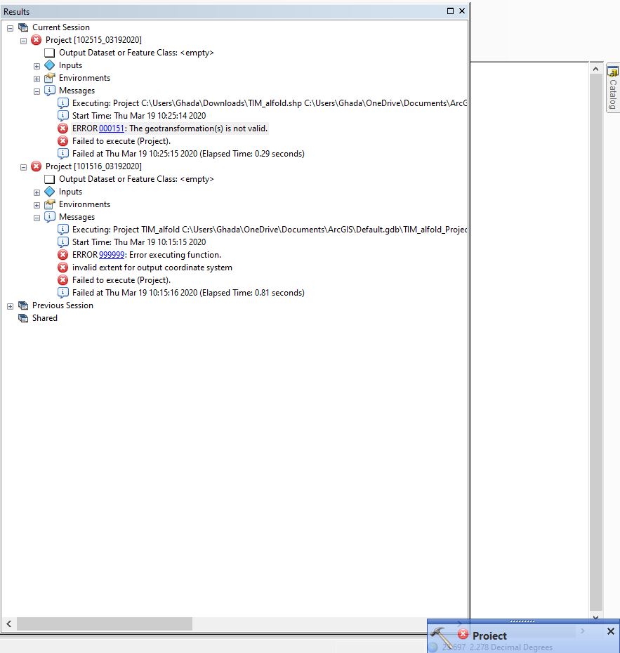
error 000151 Geotransformation is not valid
- Mark as New
- Bookmark
- Subscribe
- Mute
- Subscribe to RSS Feed
- Permalink
- Report Inappropriate Content
Dear ESRICommunity, I need someone's help ASAP please. I am trying to reproject a shapefile that it is initially projected GCS_Hungarian_1972 to WGS84_UTM_zone_34N but arcmap is giving me an error ' error 000151 Geotransformation is not valid' . Many thanks))
- Mark as New
- Bookmark
- Subscribe
- Mute
- Subscribe to RSS Feed
- Permalink
- Report Inappropriate Content
Check the geometry of your input and repair if necessary. Check the transformation is being populated with hungarian1972 to wgs84, also check the environments output coordinate system and processing extent, as ArcMap loves to randomly add a transformation.
- Mark as New
- Bookmark
- Subscribe
- Mute
- Subscribe to RSS Feed
- Permalink
- Report Inappropriate Content
Thanks David)) I will try that, the problem also whenever I try to calculate Longitude and Latitude of some points in the shp file it is giving wrong results!!
- Mark as New
- Bookmark
- Subscribe
- Mute
- Subscribe to RSS Feed
- Permalink
- Report Inappropriate Content
Can you provide and example of 'wrong' and by how much? If all the data are indeed in decimal degrees there is little a transformation can do to make the answers wrong by a significant amount.
- Mark as New
- Bookmark
- Subscribe
- Mute
- Subscribe to RSS Feed
- Permalink
- Report Inappropriate Content
For instance when I opened the attributes table there was no coordinates, so I tried to calculate the Longitude and the Latitude using geometry calculator and this is what it gave, which is abnormal!!!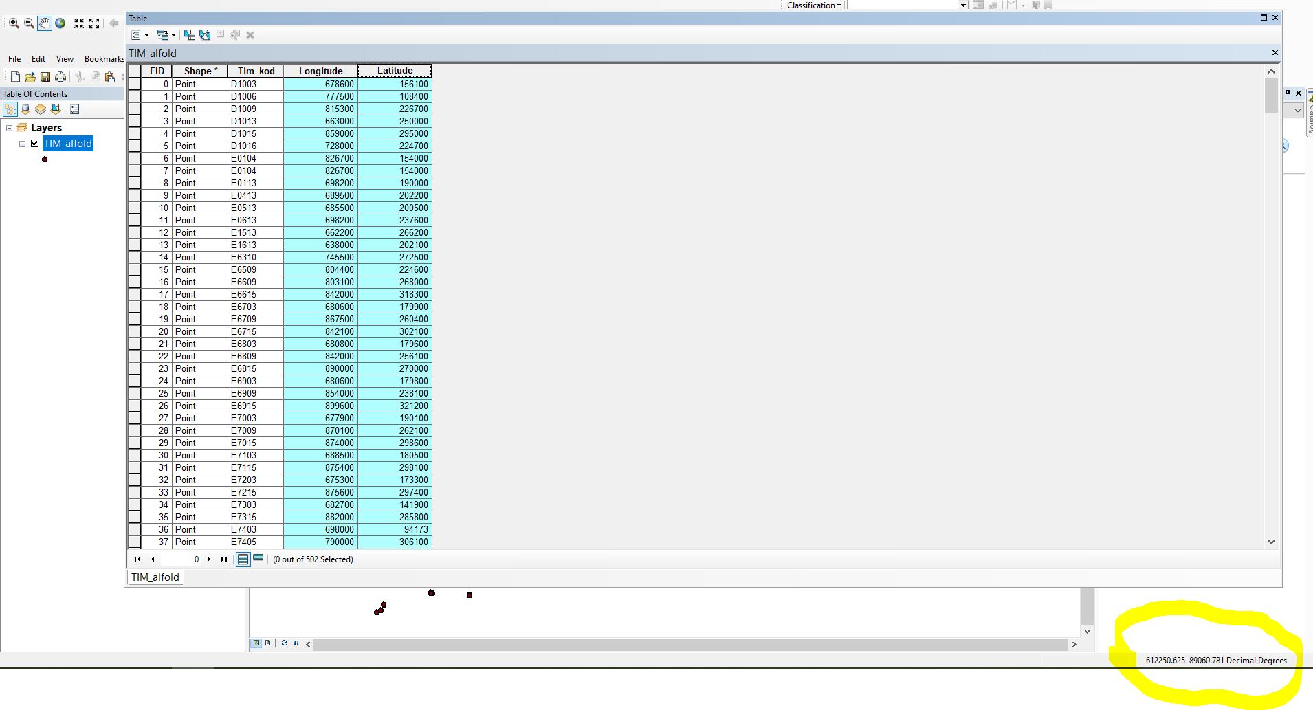
- Mark as New
- Bookmark
- Subscribe
- Mute
- Subscribe to RSS Feed
- Permalink
- Report Inappropriate Content
They may have been 'defined' wrong. and may not actually be in decimal degrees
They look like Web Mercator.
To find out what is going on...
Is your map coordinate system defined as being in decimal degrees? perhaps a GCS WGS84?
Did you calculate the values in the native units or in the coordinate system of the map?
Skip the field calculator and use one of the following
Add Geometry Attributes—Data Management toolbox | Documentation
and don't leave this optional, specify your data's coordinate system to make sure it is indeed in decimal degrees.
Coordinate_System (Optional) | The coordinate system in which the coordinates, length, and area will be calculated. The coordinate system of the input features is used by default. |
and be careful using this
Calculate Geometry Attributes—Data Management toolbox | Documentation
coordinate_system (Optional) | The coordinate system in which the coordinates, length, and area will be calculated. The coordinate system of the input features is used by default. For coordinate-based geometry properties, the coordinate system will only be applied when the coordinate format is the same as input; otherwise, the geographic coordinate system WGS_1984 will be used |
The field calculator can be dangerous unless you know what the output units will be.