- Home
- :
- All Communities
- :
- User Groups
- :
- Coordinate Reference Systems
- :
- Questions
- :
- Properly referenced geotiff loading in wrong
- Subscribe to RSS Feed
- Mark Topic as New
- Mark Topic as Read
- Float this Topic for Current User
- Bookmark
- Subscribe
- Mute
- Printer Friendly Page
Properly referenced geotiff loading in wrong
- Mark as New
- Bookmark
- Subscribe
- Mute
- Subscribe to RSS Feed
- Permalink
The geotiff is exported from Pix4d in State Plane NAD83(2011) South Carolina International Feet (as defined by EPSG 6570). It imports properly into Global Mapper, AutoCAD Civil 3D, Hypack, and Trimble Business Center. We have found the issue but can not explain why it is happening and thats my question, why?
When you bring it into ArcGIS, its loading it in with a custom coordinate system that is defining the latitude of origin as 31.5. The problem is, the real latitude of origin is 31.83333333. So Arc is placing the image to the south by .33333333 degrees. If you go into the toolbox and define the project to the proper definition for 6570, the geotiff is then displayed properly.
Why is this going on with Arc only?
- Mark as New
- Bookmark
- Subscribe
- Mute
- Subscribe to RSS Feed
- Permalink
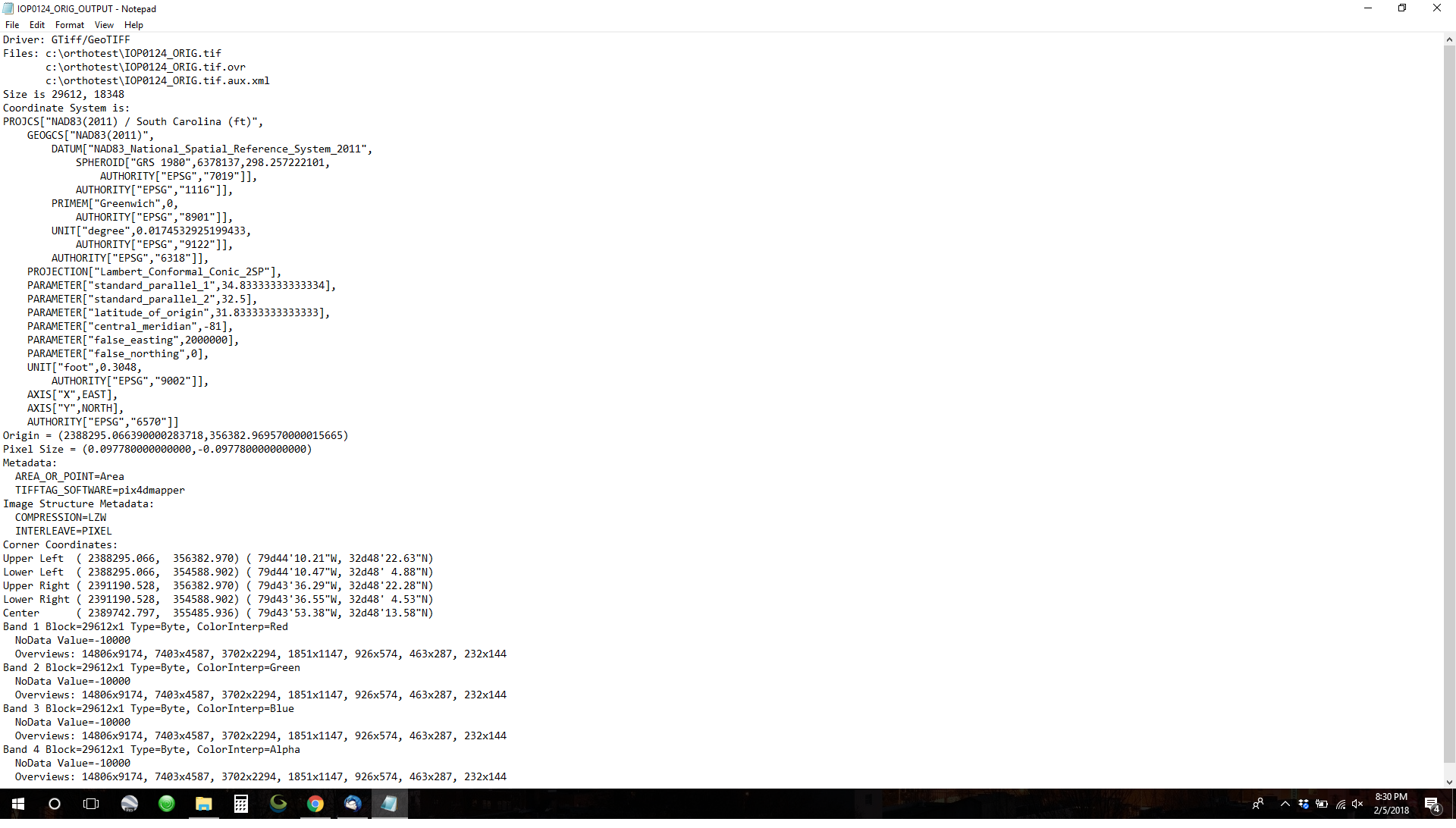
So upon further review....Even a properly defined header directly from Pix4D is importing incorrectly. It is still incorrectly bringing it in with latitude of origin of 31.5 instead of the 31.83333333. This is mind boggling to us as it is properly defined in the header. What is Arc seeing that is not in plain sight?
Here is the header as read with gdalinfo:
Can we unmark this as assumed answered? My fault as I thought it was solved but alas....
Also to clarify, this has been tested on multiple computers with the same file and all do the same thing.
- « Previous
-
- 1
- 2
- Next »
- « Previous
-
- 1
- 2
- Next »