- Home
- :
- All Communities
- :
- User Groups
- :
- Coordinate Reference Systems
- :
- Questions
- :
- Help witht Coordinates
- Subscribe to RSS Feed
- Mark Topic as New
- Mark Topic as Read
- Float this Topic for Current User
- Bookmark
- Subscribe
- Mute
- Printer Friendly Page
Help witht Coordinates
- Mark as New
- Bookmark
- Subscribe
- Mute
- Subscribe to RSS Feed
- Permalink
Hi everyone
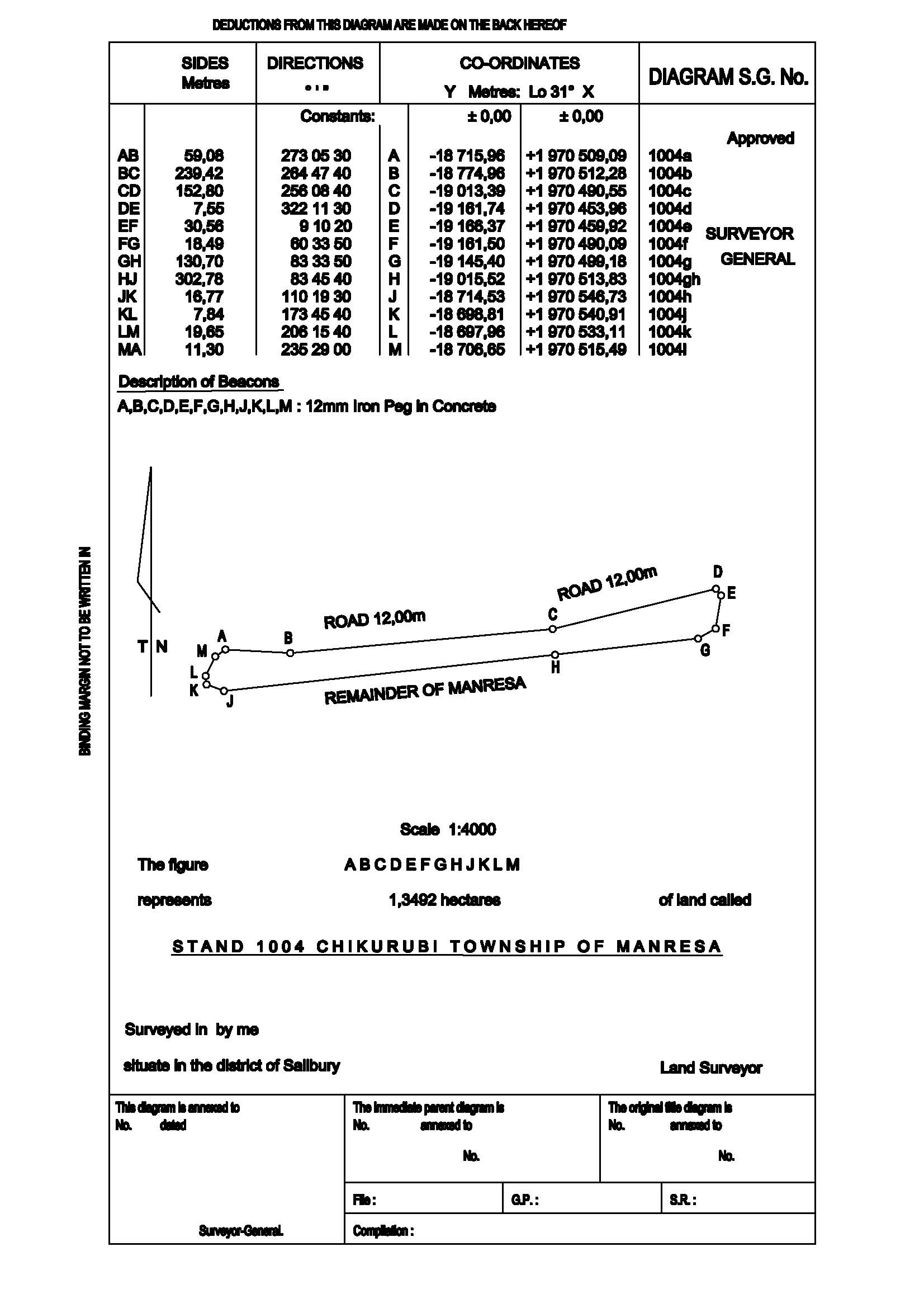
Can anyone make heads or tails with these coordinates? It is from a survey of a lot that I need to map into a BIM program as a site plan and I am deeply confused!
The distance between points is clear but the remainer (mainly how the coordinates are written) is quite unclear to me.
Thank you in advance !!
- Mark as New
- Bookmark
- Subscribe
- Mute
- Subscribe to RSS Feed
- Permalink
No way to tell what the coordinate system for sure, you can only guess. I would try coordinate systems that are used in that particular area of the world. Better yet, ask the person you got this survey sheet from.
- Mark as New
- Bookmark
- Subscribe
- Mute
- Subscribe to RSS Feed
- Permalink
The (partial) definition is there in the Coordinates header: Lo 31. That's a South African coordinate reference system (CRS). It might be based on the Cape datum/geographic CRS or the current Hartebeesthoek94 CRS. We do a weird workaround to support these coordinates because the axes are south-west (or maybe west-south order) rather than our default of east-north.
Try entering them as they are using projected coordinate systems-national grids-south africa-Hartebeesthoek94 Lo31 and see how they work. If they appear to be flipped, try the (E-N) version instead.
Melita