I am currently working with some image data which originates from PDF documents (plots), which have been georeferenced using Google Earth as images within kmz files.
I have noticed that if I import these kmz layers into ArcGIS, the georeferencing goes way off. Is this something to do with the way the two programs store/deal with georeferencing of images? The issue seems to be related to the rotation of the image; images rotated further from 'up=north' have worse issues, with unrotated images more or less unaffected. Both the rotation and dimensions of the image are affected by this.
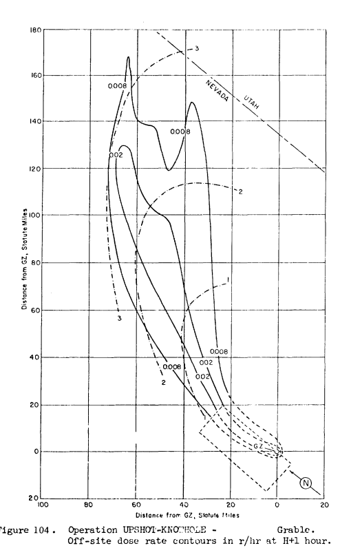
Original image:
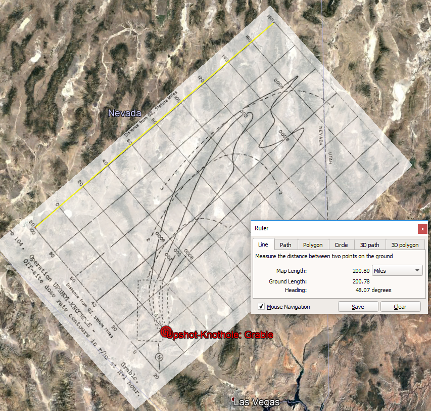
Google Earth:
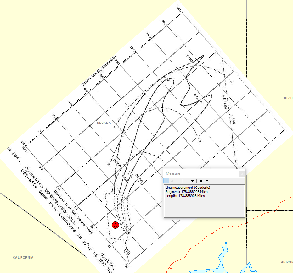
Imported in ArcMap:
Has anyone else encountered this problem? I can't find anything referencing a possible cause; the images are imported with a WGS84 GCS, and forcing this to change doesn't affect it by enough (or in the right manner) to explain it.
It's not too difficult to fix the georeferencing, but I would rather import them correctly in the first place!
Cheers
Murray