- Home
- :
- All Communities
- :
- User Groups
- :
- Coordinate Reference Systems
- :
- Questions
- :
- Coordinate System and converion
- Subscribe to RSS Feed
- Mark Topic as New
- Mark Topic as Read
- Float this Topic for Current User
- Bookmark
- Subscribe
- Mute
- Printer Friendly Page
Coordinate System and converion
- Mark as New
- Bookmark
- Subscribe
- Mute
- Subscribe to RSS Feed
- Permalink
- Report Inappropriate Content
Hi,
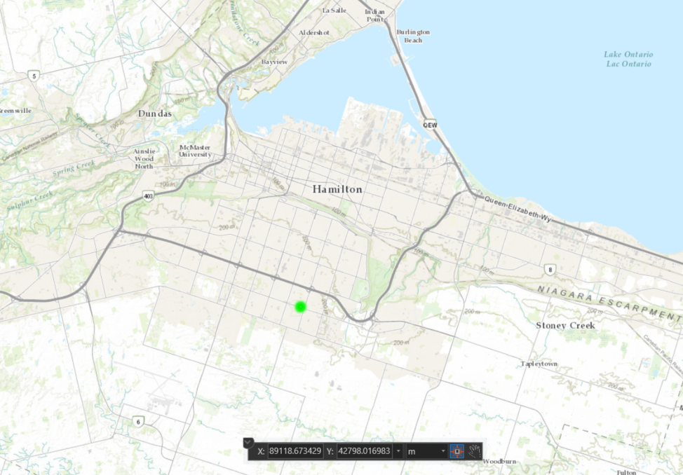
I need guidance, tips to understand, translate coordinate system. I am using an internal asset management system that is keeping coordinate (x, y) as -8889118.673429, 5342798.016983. It is located in Hamilton ON.
Any idea what type
How I can compare with coordinate system WGS 84?
Thanks a bunch
- Mark as New
- Bookmark
- Subscribe
- Mute
- Subscribe to RSS Feed
- Permalink
- Report Inappropriate Content
raju vayu, coordinates of your point are probably in Projected Coordinate System called WGS 1984 Web Mercator (auxiliary sphere), WKID 3857. They are projected with Mercator Auxiliary Sphere projection from latitude and longitude values defined in Geographic Coordinate System WGS 1984, WKID 4326. If you project those values back to geographic coordinates, you would have much smaller numbers, roughly -79.8523124, 43.2021892.
I hope this helps.
- Mark as New
- Bookmark
- Subscribe
- Mute
- Subscribe to RSS Feed
- Permalink
- Report Inappropriate Content
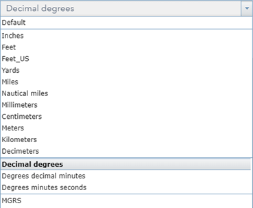
Thanks Bojan for helpful information. I have related question. I am using esri map service to project these values into WGS84(WKID 3857). Can I publish in meter as 'display unit' . Is it possible?
- Mark as New
- Bookmark
- Subscribe
- Mute
- Subscribe to RSS Feed
- Permalink
- Report Inappropriate Content
I am not familiar how exactly map service works or if you can use linear units on WGS84, but those values should always be in angular units. Meters do not make any sense when data is in geographic coordinates: a degree span at the equator is different then 1 degree near a pole.