- Home
- :
- All Communities
- :
- User Groups
- :
- Conservation GIS
- :
- Documents
- :
- Miriam Schmidts, Esri
- Subscribe to RSS Feed
- Mark as New
- Mark as Read
- Bookmark
- Subscribe
- Printer Friendly Page
Miriam Schmidts, Esri
Miriam Schmidts, Esri
Miriam Schmidts, Esri
SCGIS Experience & Contributions
https://scgis.org/user/profile/miriam-schmidts
Jul 2010 - Present Membership Chair The Society for Conservation GIS
As a membership chair, I administer all memberships (new and old), maintain the membership database, and address any membership issues that may arise. The Society for Conservation GIS (SCGIS) works to build community, provide knowledge, and support individuals using Geographic Information Systems (GIS) and science for the conservation of natural resources and cultural heritage. The SCGIS assists conservationists worldwide in using GIS through communication, networking, scholarships, and training. Membership is open to any individual seeking assistance in the achievement of personal or organizational conservation goals. For more information, see http://www.scgis.org/.
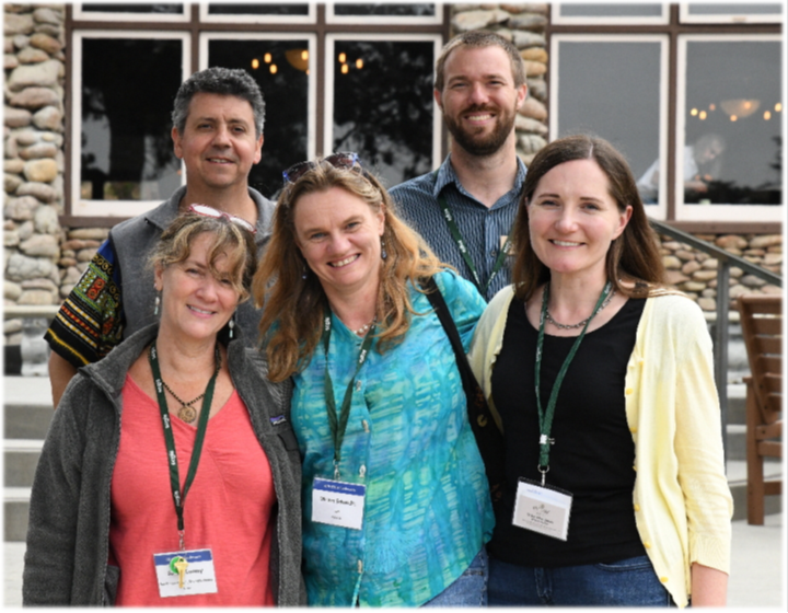
(Photo Below: Miriam Schmidts (center) of the SCGIS Membership Committee)
(Photos Below: In her role on the Membership Committee, Miriam coordinates SCGIS Volunteers for the Scgis Membership Booth at the annual Esri User Conference)

CHRONOLOGY
1990 – 1995 Ruhr University Bochum Diploma (German equivalent to Masters of Science) Biology
Aug 1995 – Feb 1999 Biologist / Environmental consultant Faber KG, Germany
1999 – 2001 M.S. Environmental Science, California State University-Los Angeles
2002 – Becomes an Esri Instructor
2005 First Attends SCGIS Conference
2007- 2010 Headed the SCGIS Domestic Scholarships Committee
2008 Gives first SCGIS Scholars Workshop on Presentation Skills
Scgis 2008 Conference Workshop Moderator: “Remote Sensing Techniques “ Moderator: Miriam Schmidts, ESRI
2010 Begins teaching Tech Workshops at SCGIS Conference. Every year since 2010 Miriam has attended the SCGIS Annual Conference, teaching pre-conference and main conference technical workshops in many topics including: Image Analysis, Storymaps, ArcGIS Pro.
Tips and Tricks for Working with the New ArcGIS 10 Presenter: Miriam Schmidts, ESRI When you first open ArcMap 10, the interface will look much different than what you’ve been used to. The organization of menus and toolbars has been improved, it’s easy to add greatlooking basemaps to your map, and you can now access and manage your data through the new dockable Catalog window built into ArcMap. A new dockable Search window lets you instantly search for maps, data, and tools. Most important for a lot of us, the ArcMap editing environment has an updated look, with streamlined access to functionality. This workshop will help you get started with ArcMap at version 10. I will give you a tour of the new ArcMap interface and show how to use some new key functionality, with a focus on the new editing environment. You will learn how to use the new Editor tools and create and edit features using feature templates.
2011 - Present Scgis Scholar Trainer with Rina Kurnia: Every year since 2011 Miriam and Rina teach the SCGIS scholars a 5-10 -day class on Cloud GIS, Storymaps, Webmaps and ArcGIS Pro. Storymaps that the scholars create out of this class are on the SCGIS ArcGIS Online site, and examples can also be seen on scgis.org
2015 - Present: SCGIS Pre-Conference Technical Workshop Teacher:
2014 ConservationTraining Podcast Series
https://www.conservationtraining.org/mod/page/view.php?id=4971
Overview of ArcGIS Pro. This podcast will provide you with an overview ArcGIS Pro, a new application that is being introduced as part of the 10.3 ArcGIS for Desktop® release.
Podcast Transcript: Download PDF
2014 SCGIS Technical Workshop Introduction to ArcGIS Pro Presenter(s): Miriam Schmidts, Esri ArcGIS Pro is a new application in ArcGIS 10.3 for Desktop. Besides ArcMap, ArcCatalog, ArcScene, and ArcGlobe, the new ArcGIS Pro application has been designed as a premier application for visualizing, editing, and performing analysis using local content or content from your ArcGIS Online or Portal for ArcGIS organization repository. Content can be authored in both 2D and 3D and published as feature, map and analysis services, 3D web scenes, and web maps. ArcGIS Pro supports project-centric workflows, multiple views, and multiple layouts of the same map. It is a 64-bit, multithreaded application with a modern user experience that runs on the Windows platform. This workshop will teach the fundamental concepts of ArcGIS Pro and give you a quick start on key workflows such as mapping and visualization, GIS data editing, and geoprocessing.
2016 Introduction to ArcGIS Pro SCGIS Workshop
https://scgis.org/conference/pages/workshops/confid/27
ArcGIS Pro is designed to simplify desktop GIS workflows while providing new and exciting capabilities. This workshop introduces fundamental ArcGIS Pro concepts and prepares you to be productive right away. You will learn about the major components of ArcGIS Pro and new features related to mapping and visualization, editing, and analysis.
2018 Workshops ArcGIS Pro, ArcGIS Online, and Image Processing and Analysis using ArcGIS
PROFESSIONAL PROFILE
https://www.linkedin.com/in/miriam-schmidts-1965202/
Instructor at Esri
15+ years of ArcGIS hand-on experience using Desktop, Server/Portal and ArcGIS Online technology; proficient in the use of ArcGIS Pro
10+ years of GIS teaching experience in the classroom and online, Certified CompTIA CTT+ Classroom Trainer and CompTIA CTT+ Virtual Classroom Trainer
Developed external and internal training materials and presentations on latest Esri software and new technology
Presented various technical workshops at the Esri International User Conference for the last 10+ years
Authored or the Esri ArcGIS Desktop Associate, Certification Study Guide, published 2013, Esri Press
Participated as a Subject Matter Expert in multiple iterations of Esri Certification exam development for the ArcGIS Desktop Entry, Associate and Professional exams as well as the ArcGIS Enterprise Associate exam.
Esri Certified ArcGIS Desktop Professional and Enterprise Administration Associate
Miriam Schmidts is a Technical Lead and Instructor with the Educational Services team at Esri. With more than 15 years of experience in GIS, she teaches variety of Esri courses, presents at conferences, mentors other instructors, and develops GIS course materials. Her recent accomplishment was authoring the Esri ArcGIS Desktop Associate Certification Study Guide book, a comprehensive review of the GIS skills and knowledge to prepare candidates for the Esri Desktop Associate certification exam.
Miriam is a CompTIA Certified technical trainer (CTT+) and Esri Certified ArcGIS Desktop Professional. Her background is in Biology and Environmental Science, holding Master of Science degrees from Ruhr-University Bochum, Germany and California State University, Los Angeles, US.
Feb 2002 – Present Esri Instructor
Recently, I followed my passion for teaching and returned from Tech Leadership into a Full Time Instructor position.
Jun 2013 – Jun 2018 GIS Instructor / Technical Lead
As a technical lead, I mentor Esri instructors, help them increase their knowledge on the latest Esri software and technologies, and contribute to the development and maintenance of the Esri Training Services curriculum. This includes regular communication and research with different Esri development teams, and the development and delivery of technical presentations and hands-on workshops. In addition to my work as a technical lead, I still very much enjoy teaching customer facing Esri classes, nowadays with a focus on ArcGIS Pro and Imagery.
Feb 2002 – Jun 2013 Esri Instructor
I was in an Esri Instructor position form 01/2008 – 06/20013, but I continued teaching Esri classes when I transitioned into a technical lead postion in 20013. I still regularly teach full-day Esri courses on the use of ArcGIS Desktop, ArcGIS Server, ArcGIS Online and database technologies. Examples of the courses are the ArcGIS 1-4 foundation series, Editing Data using ArcGIS for Desktop, Image Analysis with ArcGIS, Introduction to ArcGIS Pro for GIS Professionals, and ArcGIS Pro: Essential Workflows
In addition I contribute as a course advocate to the development of Esri course materials and presents at various GIS conferences. My focus areas are GIS data editing, data analysis, and data management in geodatabases. One of the highlights of my work in the instructor position was the development and writing of the Esri ArcGIS Desktop Associate, Certification Study Guide book, published by Esri Press in 2013. I am a dedicated teacher, CompTIA Certified technical trainer (CTT+), and Esri Certified ArcGIS Desktop Professional and Enterprise Administration Associate.
As an Educational Specialist, I authored many Esri instructor-led and web-course materials, including hands-on exercises, using real-world data and scenarios. Key projects include authoring the Data Production and Editing Techniques (DPET) and a 3-day instructor-led class as a lead author, and various web courses about ArcGIS Map Production, Geocoding, and Analysis. Starting in 2005, gradually moved more and more towards classroom teaching by working as a part-time instructor between authoring projects.
Licenses & Certifications
ESRI ArcGIS Desktop Associate 19-001
ESRI ArcGIS Desktop Professional 19-001
CompTIA CTT+ Virtual Classroom Trainer
Publications
2013 "Esri ArcGIS Desktop Associate Certification Study Guide" Esri Press, 2013
https://esripress.esri.com/display/index.cfm?fuseaction=display&websiteID=236&moduleID=0
https://www.esri.com/about/newsroom/arcuser/prepare-for-success/
The Esri ArcGIS Desktop Associate Certification Study Guide is a comprehensive review of the GIS skills and knowledge measured in the ArcGIS Desktop Associate certification exam. This easy-to-use study guide provides the following:
—Overviews of essential ArcGIS® for Desktop tools and workflows to strengthen your skills
—Step-by-step exercises to reinforce what you've learned
—Challenge questions to test your knowledge
The Esri ArcGIS Desktop Associate Certification Study Guide includes access to a 180-day version of ArcGIS 10.1 for Desktop Advanced software or ArcGIS Desktop 10 (ArcEditor license) software and a DVD containing data for working through the exercises.
Miriam Schmidts teaches GIS classes and develops course materials for the Esri Educational Services team. She is an experienced instructor, CompTIA Certified Technical Trainer (CTT+), and Esri Certified ArcGIS Desktop Professional.
-
 Anonymous User