- Home
- :
- All Communities
- :
- User Groups
- :
- Conservation GIS
- :
- Documents
- :
- Bijayata Rai, Bhutan
- Subscribe to RSS Feed
- Mark as New
- Mark as Read
- Bookmark
- Subscribe
- Printer Friendly Page
Bijayata Rai, Bhutan
Bijayata Rai, Bhutan
Bijayata Rai, Royal Society of Protection of Nature, Bhutan
Lhado Lam, Kawajangsa, Thimphu, Bhutan
x2020 x2020Scholar x2020Talk xAsia xBhutan xEducation xSustainable xEnvironment xCommunity xYouth xStorymap xArcGISPro xCultural xSocial xIndigenous xStorytelling xAdvocacy xCulturalDiversity xEquity xCitizen xBird xMammal xWildlife xSpecies xEndangered xBiodiversity xClimate
prior/volunteer experience:
2016 – 2019 Performer and Props-master Royal Thimphu College
Performed in three plays: Sophia, The Admirable Chrichton and Harvey, Props-master for: Uncle Vanya and A Doll's House
2018 Volunteer Royal Thimphu College
Studied photography techniques in the Happiness Defined Photography workshop, Challenge Accepted: Season 2
2017 – Present Volunteer at Nazhoen Lamtoen
Helping start small business to help recovering drug addicts, Participing in weekly dialogues with youths, cleaning campaigns
2020 Status: What is the most unique thing about the conservation/GIS work that you do?: Bhutan is very rich in biodiversity and it takes pride in its conservation practices and its commitments. The Constitution of The Kingdom of Bhutan mandates the country to have at least 60% of forest cover. Bhutan is the home to a lot of vulnerable animals such as Tigers, White Bellied Heron, Snow Leopard, Black-necked Cranes and many more. Despite having strict conservation regulations in the country so many animals are losing their habitat. In the case of Black-necked Cranes, the drying up of wetlands (the main habitat for Black-necked Cranes) and the changes in land-use with the development of an area are threatening their existence.
Although Bhutan is trying its best to protect the habitat of such animals the lack of expertise, modern technologies (which can help better the conservation) and capability of carrying out extensive researches are making the country’s efforts ineffective in many areas. There is extreme lack of data and in-depth information of the country especially for the field of GIS. Some of the example for the lack of data can be the lack of updated data on climate and habitat data. The country also has a problem of limited information sharing which creates knowledge gaps and deficit results of various research. So, though managing the Black-necked Crane may seem the same as managing other birds or animals, it is faced with huge hurdles due to the lack of geospatial data available in Bhutan. I am lucky enough to work in an organization that has a great deal of funding for research and data collection, but it is still working with paper data which has predominantly not been digitized. I am hoping that my GIS skills will help in finalizing some needed analysis for no only the Black-necked Crane, but also for the White-bellied Heron.
I am currently working as an entry level staff for the conservation of Black-necked Crane with RSPN. I am very interested in advancing my knowledge in GIS as well as conserving habitats for theses vulnerable animals. I have learnt that GIS is a very powerful tool and has benefits in all aspects of subject matter. Although RSPN works on conservation of nature and wildlife, especially the White-bellied Heron and Black-necked Crane, the organization has no GIS personnel, therefore has not done any proper analysis of the Crane movements or habitat. This hinders their management of such a critically endangered animal. They rely on paper maps and outside consultants to create these maps for them, I believe if I can get a higher level of experience in analysis I could help pave the road for them to conserve both the Black-necked Crane and the White-bellied Heron . I know that in conservation projects, a tool such as GIS would be of great help to the organizations which can help improve the implementation as well as the results of the projects. Hence, I have a strong desire to help the current organization with their research in conserving the vulnerable birds and also improve myself in what I am passionate about.
The crane and heron conservation in my country is less than adequate. Though many resources are being funneled into their management, the lack of technology (GIS, GPS) and the lack of understanding of research and analysis has left these animals on the verge of extinction. I am hoping that with the new tools/skills I would learn in this training, I could help the senior researchers create a more organized system for data collection and analysis. I think it is important for them to understand the questions that are important to the management of these animals and figure out an avenue for appropriate data collection, protocols and data analysis including statistics and analytics. Through ArcGIS Online and Arcpro, I can create a workable system. Training of not only the field staff, but also the researchers it paramount in gaining traction to pull this projects forward in order to develop better management decisions.
I first learned about GIS and statistical analysis in an introductory workshop on use of remote sensing and GIS techniques for geoscience application while I was pursuing my Bachelor’s degree in environmental management. I became comfortable using ArcGIS version 10.6.
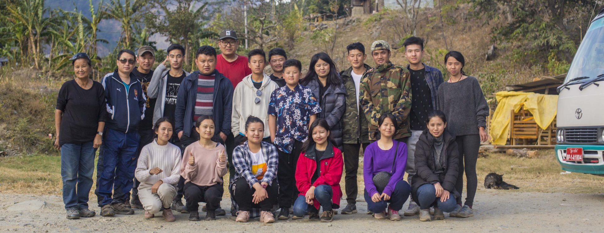
Later on in my Bachelor’s degree program, I studied under Leslie Backus (TTT Trainer). who taught an intensive (6 hours per week) GIS course for one year. I scored top of my class and engaged in many projects with Ms. Backus. Our coursework included ArcGIS Desktop and ArcGIS Online. (see also this story about GIS Trainers ("Building GIS Education in Bhutan"
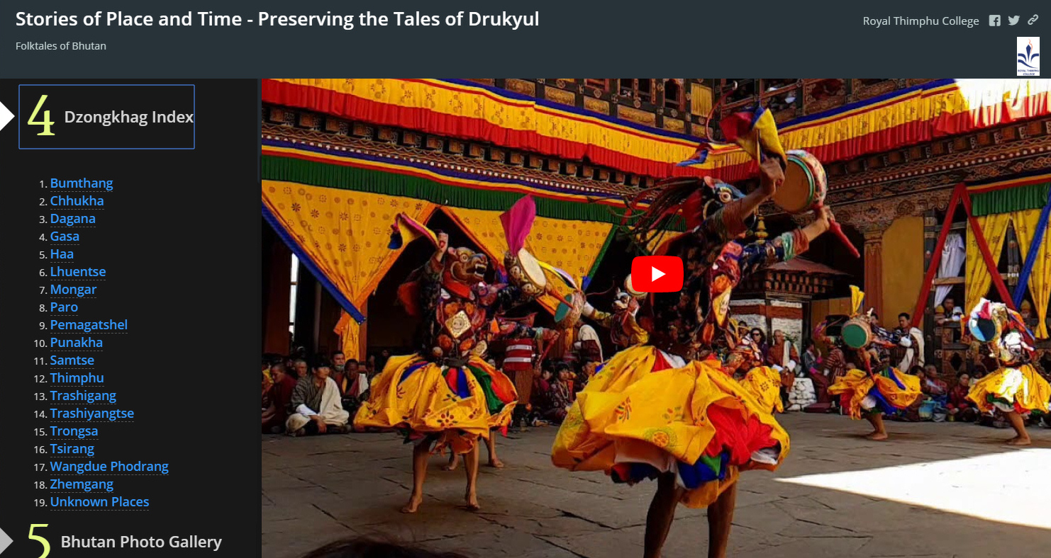
I was also a part of research team for a project which records, captures and shares the unheard stories of Bhutan: Stories of Place and Time – Preserving the Tales of Drukyul. It documented tales of Bhutan, and displayed them as creative storymaps (ArcGIS online) in a digital format. I was mentored by my GIS professor, Leslie Backus, in this re-telling of traditional stories in a modern and an unusual way. It was a delightful learning process where I could learn many things and improve my skills in a field that I am passionate about. I discovered so many beautiful stories originating in Bhutan and learned how to use maps, charts and data to tell a compelling story.
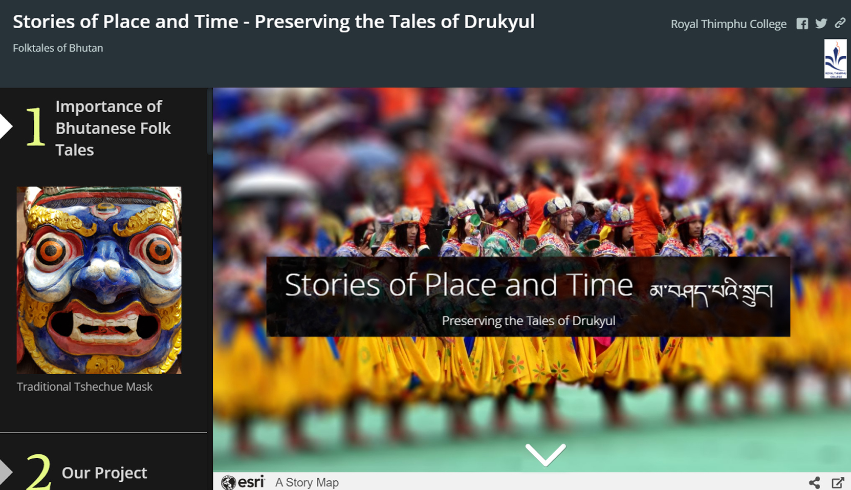
(FROM THE STORYMAP: "Folk stories in Bhutan started a “long time ago,” or “dangphu dingphu.” The origin is unknown, but stories still continue to fascinate listeners in some parts of the country. Although this tradition has now become an almost obsolete practice, grandparents and our octogenarians remember these stories from their parents and grandparents. Folk tales have been a hereditary heirloom of sorts, passed down from one generation to the other.")
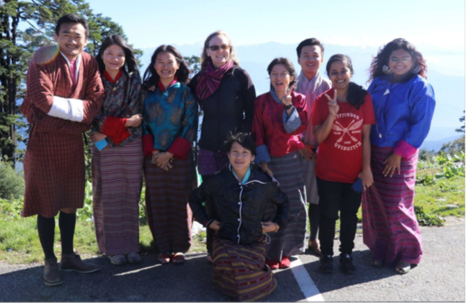
(PHOTO BELOW: The Royal Thimphu College GIS Workshop Group who created the "Stories of Place and Time" Storymap. (TTT Trainer Leslie Backus, center) (From the Online Prezi Workshop Notes by Bijayata Rai )
(From the Storymap)…."My name is Bijayata Rai. I am a third year student pursuing B.Sc. Environmental Management in Royal Thimphu College. I am from Samtse. I had trouble sleeping when I was young, that is why my father used to narrate stories to me so I could fall asleep. I loved listening to his stories. I used to get very excited and always asked him to narrate more stories. My night would always end with scary stories because after my father narrated those stories I was too scared to ask for another one. I would then fall asleep covering myself with the blanket. I grew up in my village, Deorali. It was a remote place with not even a proper road. Every winter, my uncles and aunties would drop my cousins in the village. We would have bonfires, and our grandparents would tell stories to us and we would make-up riddles.

Soon after graduation, I joined as a Research Assistant for a project titled ‘Cities by Women – Urban Space, Livelihood and Embedding Climate Change Resilience of Women Street Vendors in Thimphu’, which was part of a larger research project financed by ICIMOD-HUC. During that time, I made maps locating the women street vendors in Thimphu urban area and studied their vulnerability against climate change. I have some experience working with DEMs and I am familiar with georeferencing images. I am comfortable using the geoprocessing tools. I am more comfortable working with Vector data than with Raster.
(Photo Above, Environmental Society of Royal Thimphu College, courtesy Bijayata Rai, Newsletter editor)
I worked with GIS for my undergraduate research work Determining the Viability of Plastic Roads in Bhutan. I did a comparative analysis on the Pavement Condition Index, cost and environmental suitability. This research was something different and challenging because it was to study roads which gave me the experience of seeing how anthropomorphic activities impact conservation. My recently completed research project was titled ‘Cities by Women – Urban Space, Livelihood and Embedding Climate Change Resilience of Women Street Vendors in Thimphu’. For this research, we used GIS to locate the women street vendors in Thimphu city after which we were able to study some of the risks they were exposed to such as climate variability. During this research I got to learn about nightlife of Thimphu, the struggles of women and their ways to tackle with the hardships from changing climate, authorities, harassment. I also got to hear their stories of how they started the informal business and the societal perceptions as well as family problems.
Currently, I am working for a NGO which researches and manages the White-bellied Heron and the Black-necked Crane, two highly vulnerable species which are an almost extinct with only 60 White-bellied herons left in the world (30 in Bhutan) and less than a hundred Black-necked Cranes. I am currently working with the satellite tracking data of the Black-necked Crane. I have been using some of the time aware applications both in ArcDesktop and in ArcGIS Online.
The Royal Society for Protection of Nature is a Non-Profit, Non-Governmental Organization which was founded by Dasho Paljor J. Dorji in late 1979 with the vision of enabling future generations of Bhutan to live in an environmentally sustainable society and the mission to inspire personal responsibility and active involvement of the people of Bhutan in the conservation of the Kingdom’s environment through education, research and sustainable livelihood opportunities. The organization had a humble beginning and has gained significant recognition from international organization. RSPN has constantly pursued adaptive management and sought to fit its programmes and projects to changing social, economic and political situation and associated emerging environmental issues. RSPN also encourages and carries out environmental education and advocacy programmes. It was the first partner to the Royal Government to introduce the concept of environmental education in Bhutan using both formal and informal education medium. RSPN engages itself in conservation and sustainable livelihood programmes because it understands the role and impacts of the communities in management practices and conservation. Hence, it pays special attention to the livelihood needs of people and their ability to have meaningful involvement in conservation planning and practices. RSPN played a major role in establishing the environment-friendly electric grid of Phobjikha Valley (the major home to the Black-necked Crane in Bhutan) for the conservation of the Black Neck Crane with an awareness programme for sensitizing the community on the impact of above ground transmission lines as well as conservation and seeking support from them for the implementation of the plans. RSPN has increased its regional and international networking with various organization such as IUCN, CANSA, WWF, International Crane Organization, White-bellied Heron Working Group and many more.
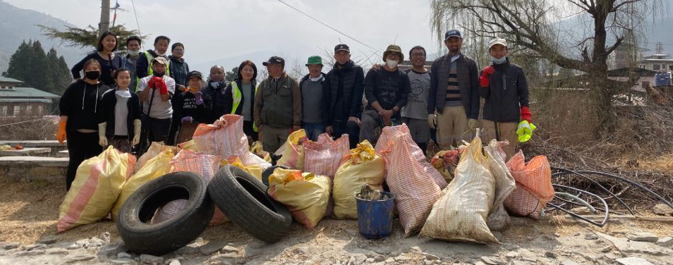
I work for RSPN under the Black-necked Crane Conservation Project under the Environmental Education and Advocacy Division. I am currently working for a project which is to study the Chubachu stream with other researchers.
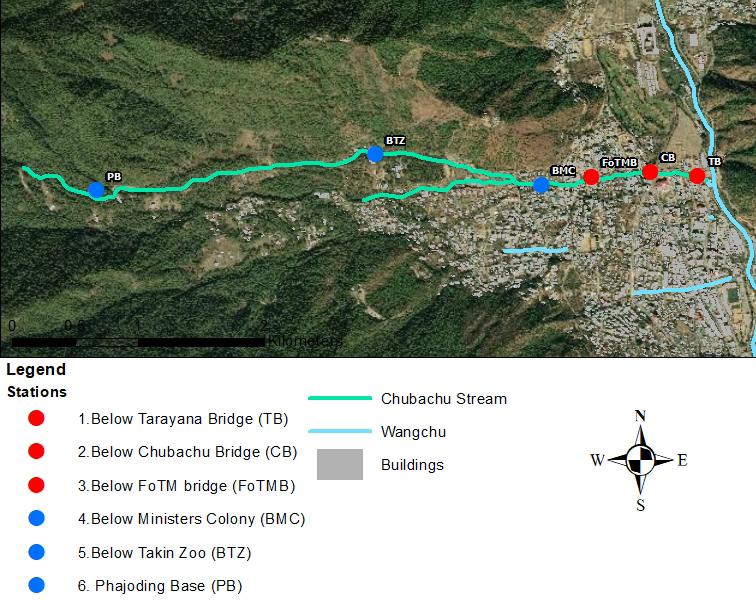
We are studying the micro-invertebrates in the stream and how the level of contamination is affecting those micro-invertebrates. My major contribution to the project would be to make maps locating the sewage outlets into the stream as well as planning and finding suitable toilet locations for the communities near the stream. Since, I joined the organization with the passion to work with one of the two majestic birds, Black-necked Crane or White-bellied Heron, which are conserved intensively by RSPN I have additionally been assigned to the Black-necked Crane Conservation Project. The Blacked-necked Crane program has been underway since the start of the organization in 1979. Loss of habitat is threatening the Black-neck Crane population and I have been given the liberty to make maps relating to Black-neck Crane conservation in Bhutan after studying the project sites as well as studying the recent findings of the crane survey in Bhutan. I will be developing survey forms that will be used across all projects for endangered species. The data in the organization is currently being collected on paper still. By creating forms in Survey123/Collector the organization can take the next step in delving deeper into analysis of their tracking data.
Do you have a local SCGIS chapter?: I am in contact with my GIS professor Ms. Leslie Backus who helps me whenever I find myself in a difficult situation and always teaches me new techniques to perform for specific activities related to not just GIS but in almost everything conservation related. I am also in contact with a local GIS organization called Bhutan GIS Society which has opened a door for us sharing data. I have connections with the National Land Commission which is the Ministry who manages the GIS protocols in Bhutan. Many individuals from these groups meet regularly for data sharing and information support.
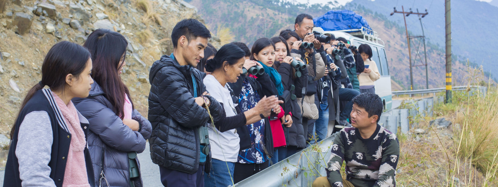
Teaching: Though I have not been a leader of any conservation or any GIS projects directly, I have always participated as a team or a group member, and I have always contributed and have not hesitated to take the lead when needed. I have organized various trekking and hikes for RSPN as well as WWF such as bird watching, orienteering and many more. I was also the activity planner for the Nature club in college. Since I started working with GIS, I have never hesitated to help my juniors or my classmates during the college when they needed help with their GIS projects. During my recent research project, I have introduced GIS to my senior colleagues and have taught few workshops for the research team. I started the creativity club in my college. That club was for reusing and recycling the wastes such as paper, plastic, tire, etc to create decorative items which was sold to the students and teachers. The money collected was then donated to various organization one of which is an old age home in Bhutan. It allowed me to teach not only good citizenship, but also about recycling and sustainability.
CURRENT GIS INTERESTS I currently learn from ArcGIS Online training courses on how to perform a specific activity or use different tools. I refer to books from the college library as guide. I am also constantly being guided by my GIS professor Ms. Leslie Backus and consulting with others in Bhutan who, like me are learning through practical application. I am interested in pursuing the SCGIS training so I can learn ArcPro and AGOL applications like Survey123, Collector, Operational Dashboard, WorkForce.
I am also strongly interested in learning how to process data from the field collection through to analysis. It would also be helpful to have some training on project planning (how to develop forms properly, how to run statistical analysis,…). Since much of my data is satellite tracking data, learning how to use time-based analysis and applications would help in learning how to manage the Black-necked Crane/White-bellied Heron and their habitats.
2020 Paper Title: "Black-necked Crane Conservation in Bhutan"
2020 Abstract: Bhutan is a small country in South Asia, located in Eastern Himalayas and landlocked by China and India. Bhutan has been identified as one of the global biodiversity hotspots and is known for proactive conservation initiatives. Bhutan also provides roosting grounds for the vulnerable Black-necked Crane (Grus nigricollis). Black-necked Cranes are the last discovered crane species out of 15 species globally. It has been found that increasing development and changes in land use threatens the survival of the Black-necked Cranes. With the help of awareness programs of different organizations as well as government officials the local people understand the importance of conserving Black-necked Cranes habitat and supports the conservation programs. On the other hand, increasing population and lack of legal capacity to regulate the situations is leading to an increase in exploitation of the habitat of the Black-necked Cranes. In the early 1990s, the count of the Black-necked Crane was about 200 and in recent years the count has decreased to around 100. Phobjikha and Bumdeling contain the main habitats for the Black-necked Crane in Bhutan. In Bumdeling, visitation of the Black-necked Cranes has decreased after the flooding of the paddy fields. There are small pilot projects to restore the paddy field for the farmers as well as for the birds. The installation of power electric lines in the valleys containing habitat of the Black-necked Cranes created a dangerous situation for the bird because they were getting strangled in the electric wires. Because of this Phobjikha valley has required environmental friendly, underground power lines. The local people also help in making artificial nests for the Black-necked Cranes. Black-necked Cranes have a spiritual, as well cultural, relation to the country and Phobjikha also celebrates an Annual Black-necked Crane Festival. In the recent years, a slight increase has been recorded in the number of Black-necked Cranes in Bhutan.
-
 Anonymous User