- Home
- :
- All Communities
- :
- User Groups
- :
- Conservation GIS
- :
- Documents
- :
- Angela Tarimy, Madagascar
- Subscribe to RSS Feed
- Mark as New
- Mark as Read
- Bookmark
- Subscribe
- Printer Friendly Page
- Report Inappropriate Content
Angela Tarimy, Madagascar
Angela Tarimy, Madagascar
Navigation: ReferenceProject CommunitiesPage ConservationGIS Scgis.org
Angela Tarimy , Madagascar
xTTT2019 x2019TTT x2019Interview x2017TTT xScholar2015 x2015Talk x2012Scholar xIndigenous Knowledge xSuccession xForest xChapter xTTT xReforestation xRestoration xCorridor xDeforestation xStorymap xSurvey123
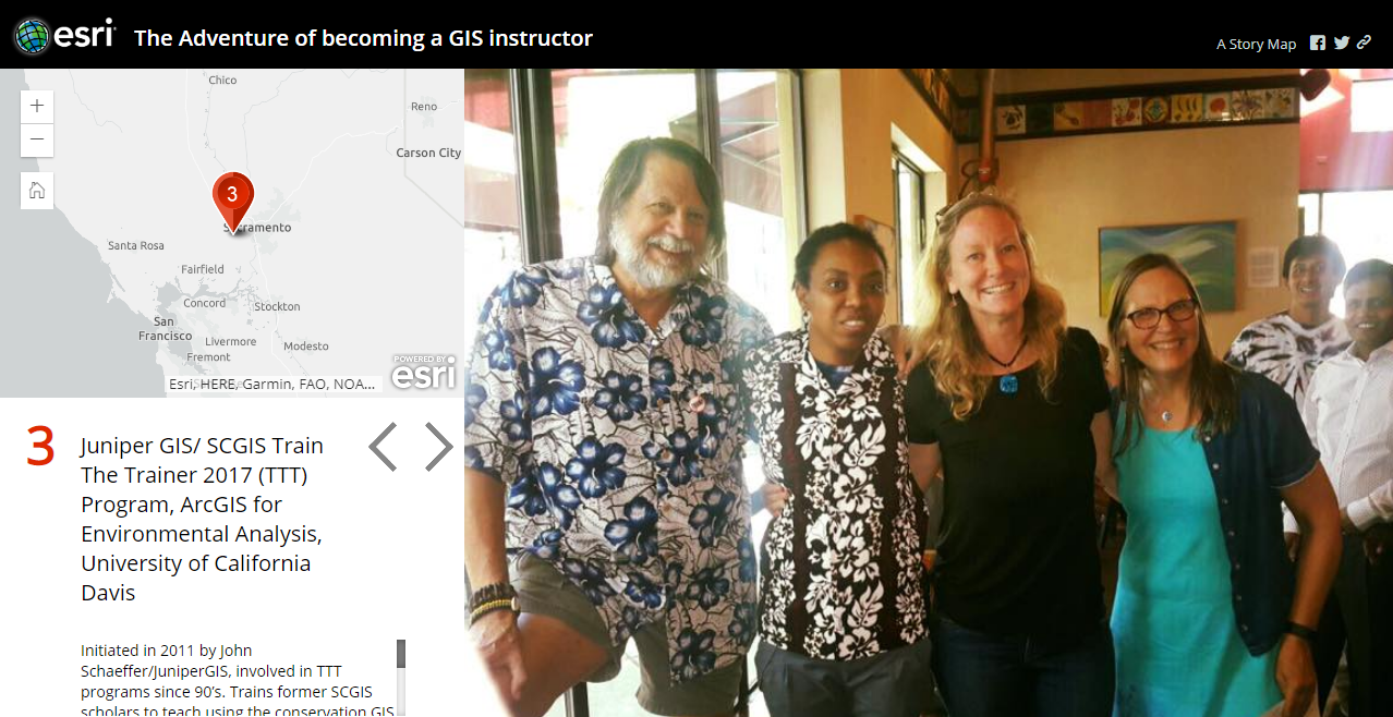
Angela Tarimy first began with SCGIS in 2015, when she wa s selected as an international scholar representing Madagascar. In 2017 she was honored by being selected as a candidate for the SCGIS Train the Trainer program, and she was certified as a full SCGIS TTT Trainer in the summer of 2017. In 2019 Angela joined the first-ever TTT Summit meeting of all TTT trainers worldwide in California. (Left: Angela Interviewed by the Esri Global Media group in 2019 )
SCGIS 2019 Conference Presentation: SESSION: Indigenous Knowledge "How to Interpret Local Languages and Dialects Comparable with Scientific Forest Succession Terminology"
2019 Scgis Video / Map Gallery Presentation: 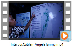
Map/Talk Title "Forest Degredation in Eastern Madagascar"
SCGIS 2019 Trainer Summit Update
For 2019, Angela Tarimy is looking forward to get updates on ArcGIS Pro to be an authorized ArcGIS Pro instructor; and; to exchange with other TTT on how to create, operate and expand an in country conservation GIS training service, how to manage outreach, communications, marketing and funding for GIS trainign operation. In her own words:
"Skills obtained from this new program will help me to develop training on ArcGIS Pro, to exchange experiences and to build strong and long-term capacity for Malagasy network of conservationists."
After this new program, she will be able to share updates to Malagasy conservationists on Image Analysis in Pro, Advanced Stats Analysis Pro, RBridge, Web App Builder, Geoplanner Application, Green Infrastructure/Sustainable Development Goals Application, Survey 123, Citizen Science Field App, and Advanced Storymap Techniques.
Angela Tarimy first discovered GIS in 2002 with Map Info. Ten years later, she focus back to GIS with the project Manondroala that aims to contribute to raise the capacity of Malagasy conservationists network on forest mapping and monitoring using modern technology like GIS. From Angela's 2015 scholar report :
2015: "As a learning by doing GIS user, being an SCGIS scholar in 2015 has strengthen my passion about technology and has provided me the best GIS experience for my nature conservation career. "
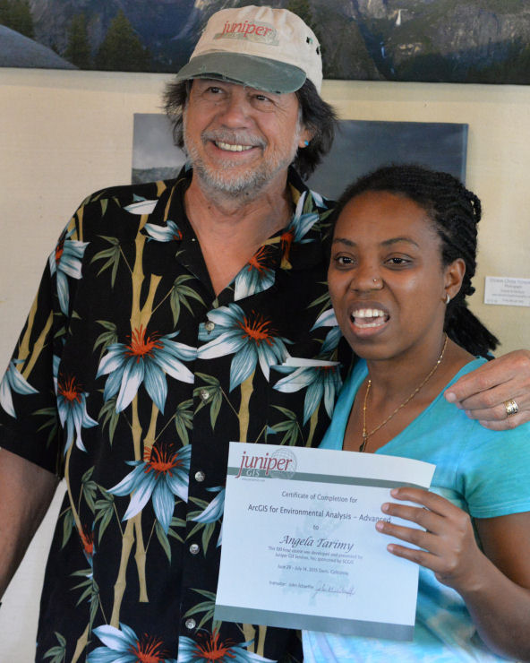
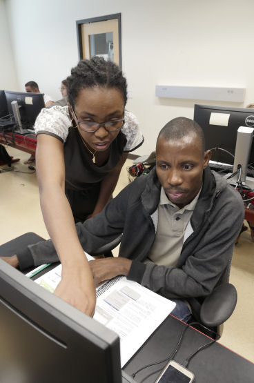
In 2017, the SCGIS community gave her great opportunity to improve her capacity to develop GIS training for local conservationists. She became the principal GIS instructor of her organization.
Angela's 2017 Scholarship Program Storymap --> "Describing the 2017 TTT program, and the adventure of becoming a GIS instructor"
The Train-The-Trainer 2017 graduates:
2015: "The SCGIS is a fantastic GIS community that I feel lucky to be member with."
2015: "Being an SCGIS trainer has inspired me to focus on putting my passions and skills on GIS to good use by supporting local organizations and projects that really care about nature conservation of Madagascar."
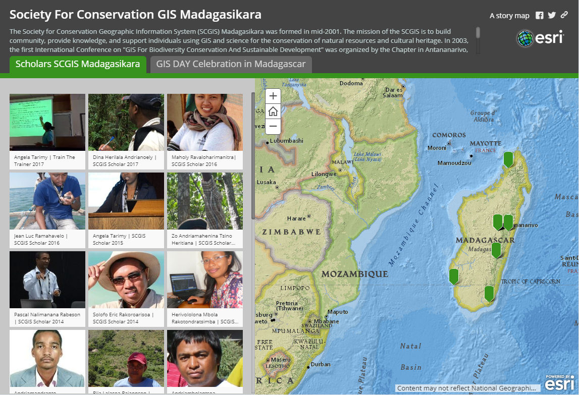
Also, she is proud to be an active member of the local chapter: The SCGIS Madagasikara
The Society for Conservation GIS Madagasikara Storymap --> "Describing the Madagascar Chapter, the members and the GIS day celebration in Madagascar"
SCGIS 2017 Profile (TTT Program Candidate)
Angela Tarimy, Finnish Association for Nature Conservation (FANC) - Manondroala project , Madagascar

Name: Angela Tarimy
Organization name: Finnish Association for Nature Conservation (FANC) – Manondroala project, Madagascar
Country: Madagascar
Organization Web site URL if any: http://www.sll.fi/madagascar
Job title: Project Coordinator
Email address: angelatarimy@gmail.com
Phone: (+261)340197297
Teaching experience:: For more than 6 years, I was working on forest mapping and forest restoration of Madagascar within the project Manondroala. The project aim is to create a new, locally applicable forest monitoring method that can be used in community forest management as well as in research.
I have contributed to develop content and overall training structure on humid forest mapping method of project Manondroala. Trainings are for Malagasy network of conservationists and are specially developed with adopted manual in Malagasy language and in English. The humid forest mapping method was developed together with national and international GIS network.

Also, I was developing training materials and taught at local community level the “Basic manipulation of GPS, GIS software and Google Earth” The local perception of intactness and degradation forests classes of humid forests of Madagascar. The objective is to empower decision makers at local and national level with accurate and up to date information on deforestation and forest degradation in Madagascar.
See more details about Manondroala mapping method here: https://manondroala.wordpress.com/2016/02/10/three-steps-to-success-in-satellite-image-classificatio...
Perspectives The Train The Trainer Program is very important to support the efforts of popularizing the utilization of ArcGIS tools to the Society for Conservation GIS Madagascar members, to the network of GIS and conservationists and even to the local community managing protected area.
In fact, the Train the Trainer Program helps to develop training materials adopted to introduce new technologies for a better nature conservation in Madagascar

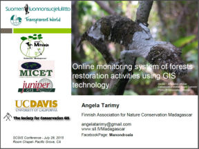
SCGIS 2015 International Conference presentation:
TITLE: "Online Monitoring System of Reforestation Activities Using GIS New Technology" SESSION: "Forest Conservation & Corridor Design"
* Presenter: Angela Tarimy, Madagascar Finnish Association for Nature Conservation
ABSTRACT: The monitoring system of forests restoration will show in real time annual forests restoration sites and future potential sites to link forests fragments as corridors in Andasibe Madagascar. Feasible Wildlife Corridor Identification in KAZA TFCA Using Landscape Analyses * Presenter: Tatenda Noreen Muchopa, Zimbabwe Painted Dog Research Trust The main objective of the project is to extract useful layers from SPOT imagery (2.5m per pixel SPOT images 2010: May, June, July) such as vegetation, terrain, elevation, and watersheds to map the location of existing and possible wildlife corridors. This will be done using map calculations in ILWIS 3.3 and ArcGIS landscape analysis software applications. Using satellite imagery analyses will give a more accurate and most up to date representation of the actual location of these suspected corridors as compared to relying only on historical accounts of where they are located. The results will be used to inform local wildlife management authority, Rural District Councils and land use planners to help minimize adverse effects of land use change and infrastructure development and promote the implementation of best land use practices for wild dog conservation in accordance to the KAZA TFCA objectives

SCGIS 2015 Introductory films:

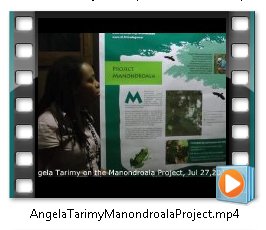 <--MP4 Angela Introductory videos MP4-->
At left Angela introduces her work helping National Parks in Madagascar.
At right Angela gives a 2015 SCGIS map gallery presentation about the Manondroala project.
SCGIS 2015 Profile: Angela Tarimy, Madagascar 
*-Organization name: Finnish Association for Nature Conservation (FANC) – Manondroala project, Madagascar
*-Organization full street address: MICET - Lot VU 283D Villa Rotciv, Manakambahiny - 101 Antananarivo - Madagascar
*-Country: Madagascar
*-Work phone with country and area code: +261 3321 97703
*-Main email: angelatarimy@gmail.com
*-Organization Web site URL if any: http://www.sll.fi/madagascar
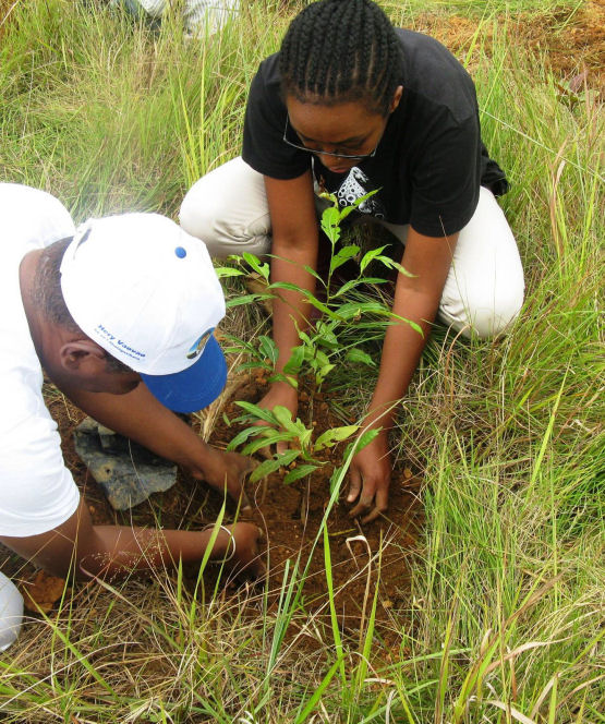
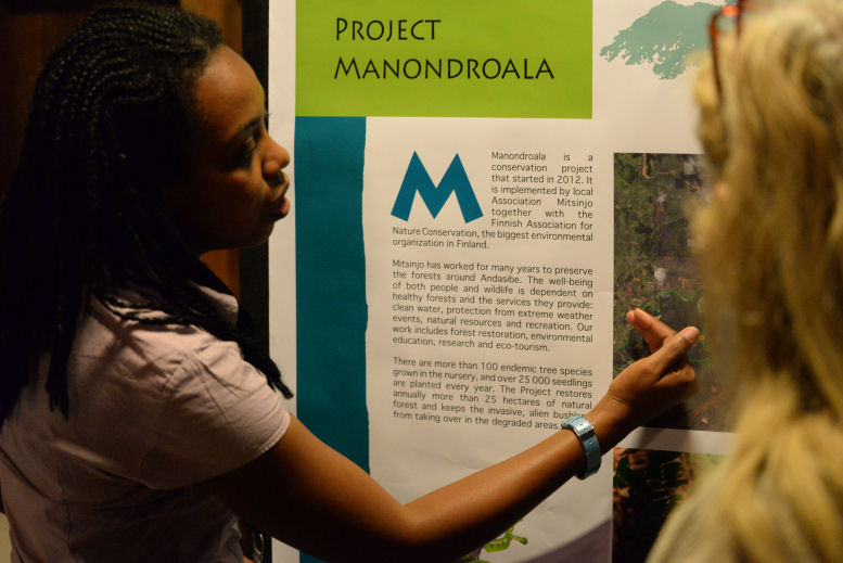
 My organization - The Finnish Association for Nature Conservation (FANC) in collaboration with Malagasy and Russian (NGO Transparent World) Partners is developing in Madagascar a new mapping tool for tropical forests, as local conservation tools, through the project called Manondroala. The word manondroala is Malagasy language, and it means showing the forest. It is also the name of an endangered local tree species that grows in the East coast of Madagascar – and is highly dependent on the remaining forest areas. The aim of the project is to develop a forest monitoring network throughout Madagascar, for local to national level, from community associations to universities and to forest administration. So far, during the first three years (2012-2014), the project has trained and collaborated with locals in ten important forest areas of Madagascar in collection of field data, classification of different kinds of forest stands and the use of GIS (Geographical Information System) mapping tools. The project continues for the next 3 years (2015-2017) and will achieve the forests mapping of the entire country. Also, since 2012 until 2017, the project is supporting the reforestation activities of the local association called Mitsinjo, in Andasibe- Madagascar. The goal is to link fragmented forests in the forest corridor.
We use ArcGIS to identify new sites for reforestation and to optimize activities and to monitor the reforestation achievement.
your personal role in the organization: I am the National Representative of FANC in Madagascar and the National Coordinator of FANC project.
In addition with the project management, communication, Monitoring&Evaluation sides of my work, I am also in charge of :
- the identification of new reforestation site, the monitoring and optimization of reforestation work using ArcGIS 9.3.1
-the trainings for community-based organization and local actors.
Capacity building of local actors on forest mapping, on basic manipulation of GIS is important to make participative accurate maps which will be local tools for conservation.
 history of your personal work in conservation and GIS: Since 2003: I started to work in GIS when I was Responsible of Monitoring&Evaluation and the GIS system of the National Program fighting against the “Acquired Immunodeficiency Syndrome” (AIDS). At this time, we worked with MapInfo software.
2005-2009: Then I continued with Arcview when I was Responsible of Monitoring&Evaluation and the GIS system of the Regional good governance Program called ACORDS which Support Public and Rural Organizations in South of Madagascar (Program ACORDS)
2009-2010: I also worked with Arcview when I was the experts of Monitoring&Evaluation and the GIS system of the Nutritional Project in the South of Madagascar
2011-until now: I work with ArcGIS 9.3.1 to monitor the forests reforestation project of the Finnish Association for Nature Conservation (FANC)
what is the most unique and the most challenging about the conservation/GIS work that you do: The most challenging about my GIS work is to monitor reforested areas. Seedlings newly planted are not visible immediately on imagery, so it took time to visibly see forest structure changes on desktop. The most challenging about conservation work is the monitoring of the community based-organization’s field work and conservation work. Forest intactness and degradation is a complex processes, actors need right tools for real-time monitoring.
Above is the map gallery presentation about Forest restoration of Andasibe Madagascar within the project Manondroala, a Cooperation between the Association Mitsinjo and the Finnish Association for Nature Conservation. The goal is to support community-based forest restoration in Madagascar.