- Home
- :
- All Communities
- :
- Global
- :
- Americas
- :
- Comunidad Esri Colombia - Ecuador - Panamá
- :
- Soporte
- :
- Re: Connect PolyLine between two circular figures ...
- Subscribe to RSS Feed
- Mark Topic as New
- Mark Topic as Read
- Float this Topic for Current User
- Bookmark
- Subscribe
- Mute
- Printer Friendly Page
Connect PolyLine between two circular figures - ArcGIS 4
- Mark as New
- Bookmark
- Subscribe
- Mute
- Subscribe to RSS Feed
- Permalink
- Report Inappropriate Content
- Mark as New
- Bookmark
- Subscribe
- Mute
- Subscribe to RSS Feed
- Permalink
- Report Inappropriate Content
Hi / Hola Abiel Jesrrel Delgado Lee ,
You published your questions in the Esri Colombia - Ecuador - Panamá space and this space is intended for Spanish content. I assume that you question is about the ArcGIS JavaScript API version 4. If you want to receive more suggestions or answers to your question and doing this in English is not a problem for you, I recommend moving this question to the https://community.esri.com/community/developers/web-developers/arcgis-api-for-javascript space. I also recommend you to explain a little more on the conditions as to when to connect points (do all points need to be connected or only those that match a certain condition?).
- Mark as New
- Bookmark
- Subscribe
- Mute
- Subscribe to RSS Feed
- Permalink
- Report Inappropriate Content
Hola Xander Bakker!
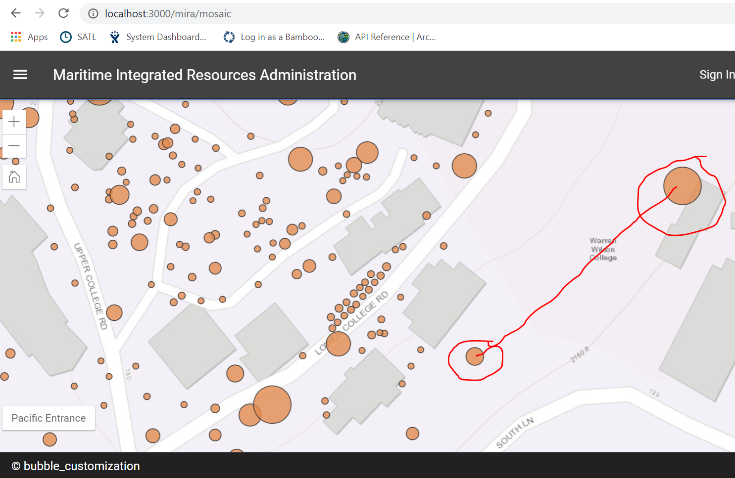
Muy buenos días, gracias por su respuesta, explico mi problemática o más bien en donde estoy algo confundido, necesito dibujar una línea entre esos dos círculos, estoy utilizando ArcGIS JavaScripr 4 en VEU, tengo parte de mi código, más aun no comprendo a su totalidad como poder realizar eso.
El código que llevo es
function polyLineDrawfigures(viewmap) {
var patshfigure1, patshfigure2
var graphic1, graphic2
\\Código que me falta para realizar el match entre cículos y asignar a las variables el arreglo de ubicación
\\Asgino a las variables patshfigures la ubicaciones con respecto a las variables graphics
patshfigure1 = [graphic1.layer.longitude, graphic1.layer.latitude]
patshfigure2 = [graphic2.layer.longitude, graphic2.layer.latitude]
var polylinedraw = {
type: 'polyline',
patsh: [[patshfigure1 ],[patshfigure2 ]]
}
var polylinefigure = {
type: 'simple-line',
color: [0,137,168],
width: 3
}
var polylinefiguregraphic = new graphic {
geometry: polylinedraw,
symbol: polylinefigure
}
viewmap.graphic.add(polylinefiguregraphic)
}
Disculpen si no manejo bien los términos ya que soy muy nuevo en este tema y de antemano gracias por si gran colaboración.
Saludos,
Abiel Jesrrel
 Thanks team