- Home
- :
- All Communities
- :
- User Groups
- :
- Cartography and Maps
- :
- Questions
- :
- Problem with gradient stroke when printing/exporti...
- Subscribe to RSS Feed
- Mark Topic as New
- Mark Topic as Read
- Float this Topic for Current User
- Bookmark
- Subscribe
- Mute
- Printer Friendly Page
Problem with gradient stroke when printing/exporting
- Mark as New
- Bookmark
- Subscribe
- Mute
- Subscribe to RSS Feed
- Permalink
I'm experimenting with gradient strokes for area boundaries following John Nelson's guide (Boundary Dropshadow Mega-Hack ) and while everything looks great in ArcGIS Pro, the output (this is for a print publication) is unusable.
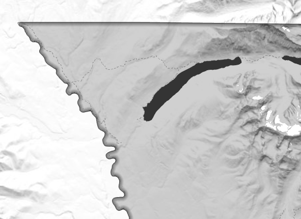
Here's what the boundary looks like in ArcGIS Pro:
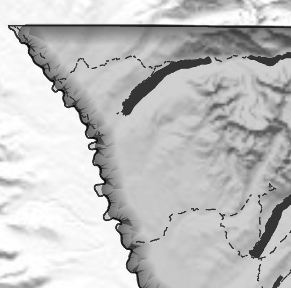
Here's what the boundary looks like in a PDF file (viewed at 400%):
I get the same PDF output using default (mix vector/raster) and "Output As Image" (raster only) options for the PDF export. Same for PNG exports. Anyone have suggestions for fixing this for a professional output format?
Thanks,
Eric
- Mark as New
- Bookmark
- Subscribe
- Mute
- Subscribe to RSS Feed
- Permalink
Hi Eric Compas,
Did you ever figure out what was happening with this? I've been playing around with it and haven't experienced any export issues as of yet.
Potentially look at the Output Image quality ratio in Configuring map export as well as the troubleshooting for some assistance.
Shane
- Mark as New
- Bookmark
- Subscribe
- Mute
- Subscribe to RSS Feed
- Permalink
Shane,
Thanks for responding. No, I haven't found a workaround yet. I'm using the "Best" setting in the Image Quality export layout options (note that the link you provide is to ArcMap and not ArcGIS Pro; here's the correct link).
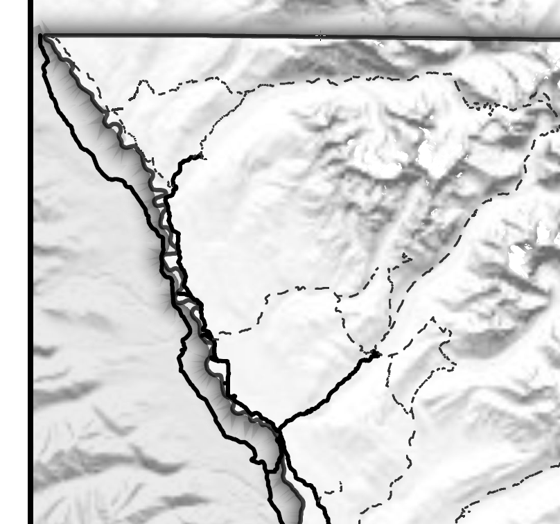
I notice that your gradient is outside your boundary, so I gave that a try. Same result (gradient overlap on west boundary of park):
I'm using Pro 2.4.3. Do you have a newer, internal version where this issue's been fixed?
Thanks,
Eric