- Home
- :
- All Communities
- :
- User Groups
- :
- Cartography and Maps
- :
- Questions
- :
- Labeling in ArcGIS Desktop
- Subscribe to RSS Feed
- Mark Topic as New
- Mark Topic as Read
- Float this Topic for Current User
- Bookmark
- Subscribe
- Mute
- Printer Friendly Page
Labeling in ArcGIS Desktop
- Mark as New
- Bookmark
- Subscribe
- Mute
- Subscribe to RSS Feed
- Permalink
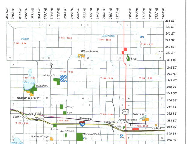
I am creating several county maps using Data Driven Pages. I have my data frame clipped to the Data Driven page which is indexed to my county layer. I have a local roads layer and I want the labels to appear on the outside of the data driven page/data frame like in the below image. The roads go beyond what is in the data frame as it is clipped. I am afraid that might cause issues as the end or the beginning of the road line may not fall within the county. Any ideas on how I can accomplish this without manually creating every road label for every county?

- Mark as New
- Bookmark
- Subscribe
- Mute
- Subscribe to RSS Feed
- Permalink
One way that you may wish to consider is to create your own custom overlay grid from a roads feature class that contains the gridded road network. Use the ROADNAME field for the Labelfield when you create it. Once created, go to Data Frame Properties, click the Grids tab, and Style... from the button list on the right. Select your newly created Custom Overlay grid - voila!
- Mark as New
- Bookmark
- Subscribe
- Mute
- Subscribe to RSS Feed
- Permalink
I'm almost there! I created the custom overlay except it draws all the roads outside of the county even though my data frame is clipped to my data driven page. Is there a way to clip the overlay to the county?
- Mark as New
- Bookmark
- Subscribe
- Mute
- Subscribe to RSS Feed
- Permalink
I checked the box that says clips Grids and Graticules but that didn't seem to do anything under the data frame options.
- Mark as New
- Bookmark
- Subscribe
- Mute
- Subscribe to RSS Feed
- Permalink
You could create a 2nd feature class clipped to the county boundary and use that for your data driven pages. Might resolve the issue.