- Home
- :
- All Communities
- :
- User Groups
- :
- Cartography and Maps
- :
- Questions
- :
- extent indicator rotated
- Subscribe to RSS Feed
- Mark Topic as New
- Mark Topic as Read
- Float this Topic for Current User
- Bookmark
- Subscribe
- Mute
- Printer Friendly Page
- Mark as New
- Bookmark
- Subscribe
- Mute
- Subscribe to RSS Feed
- Permalink
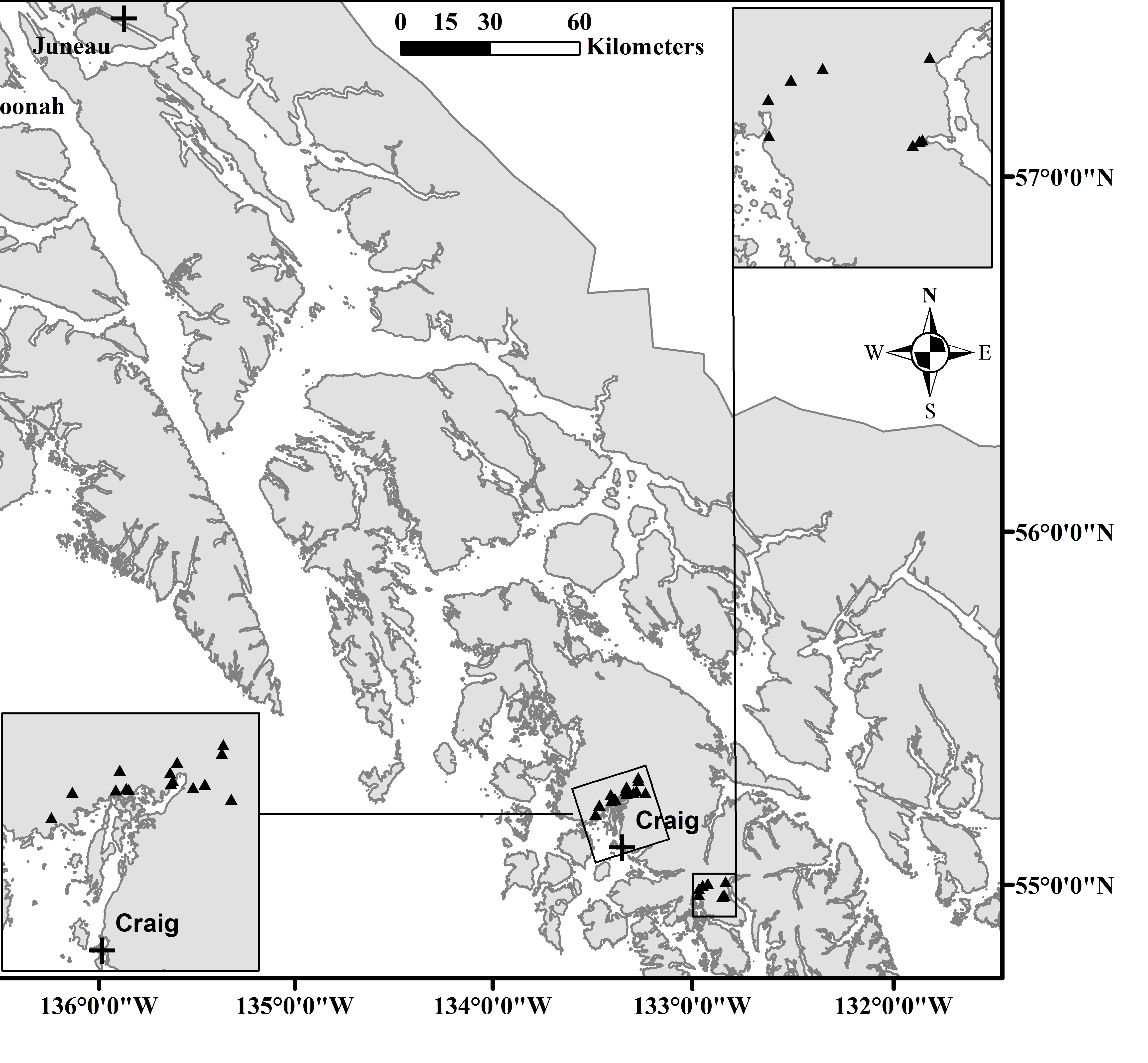
I have created a map with ArcMap 10 with multiple extent indicators within it. One of the extent indicators (closest to craig in attached image) is rotated while the data frame it is indicating is not rotated. Any advice as to un-rotate the indicator box to be oriented normally?
Thanks
Solved! Go to Solution.
Accepted Solutions
- Mark as New
- Bookmark
- Subscribe
- Mute
- Subscribe to RSS Feed
- Permalink
Hi Jared, I am guessing this is a projection issue--your data or map document is in a projection that causes it to skew as it moves north toward the pole. What projection are you using? Can you change it to something that pr4eserves area better over your map extent?
- Mark as New
- Bookmark
- Subscribe
- Mute
- Subscribe to RSS Feed
- Permalink
Probably not the best answer but you can 'trick' it. It's super accurate right now, but not a polished look.
I would:
-Make the existing boundary invisible or none.
-Create a new graphic box in the layout with the same black graphic properties and eyeball it into the right place in the desired rotation.
Not a great fix, but it'll get it done.
- Mark as New
- Bookmark
- Subscribe
- Mute
- Subscribe to RSS Feed
- Permalink
Hi Jared, I am guessing this is a projection issue--your data or map document is in a projection that causes it to skew as it moves north toward the pole. What projection are you using? Can you change it to something that pr4eserves area better over your map extent?
- Mark as New
- Bookmark
- Subscribe
- Mute
- Subscribe to RSS Feed
- Permalink
Are all of the data frames using the same projection and parameters?