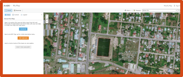
On August 10, 2017 +Metro imagery for Belize City and Belmopan was released to World Imagery in arcgis.com. The imagery for Belize City was captured in May 2017. The imagery for Belmopan was captured in the early part of 2017.

In the image above, the Belize Civic Center Sports Complex as well as the Swift Hall, St. Martin De Porres Church, can be seen. In the image below, we see a beautiful imagery of Belmopan showing the Isodoro Beaton Stadium.
These updates to Belize City and Belmopan in ArcGIS can be used in unmeasurable ways. Green Infrastructure, city planning, local government, census and emergency response are just some ways how updated imagery can be most useful.
Updates were made to all of Central and South America, parts of North America and Africa to name a few. See story map here to get all the updates.
Follow us on our Facebook page to get daily news, updates and blogs on ArcGIS.