- Home
- :
- All Communities
- :
- Products
- :
- ArcPad (Retired)
- :
- ArcPad Questions
- :
- Using ArcPad 10.0 to navigate to points
- Subscribe to RSS Feed
- Mark Topic as New
- Mark Topic as Read
- Float this Topic for Current User
- Bookmark
- Subscribe
- Mute
- Printer Friendly Page
Using ArcPad 10.0 to navigate to points
- Mark as New
- Bookmark
- Subscribe
- Mute
- Subscribe to RSS Feed
- Permalink
Hello All-
Really hoping someone can give me input here. We have a project requested by our Public Works Department. They want to use our gps unit (Trimble GeoXH running ArcPad 10.0) or another mobile device (we have iPhones, iPad or android phones), to give a bulldozer operator the ability to navigate to each of the points in a shapefile to create a walking path through a thickly wooded area. We created the shapefile from coordinates provided by the PW Dept (there's 234 points).
When we tested both of ArcPad's navigation methods ( the Query and Go To - using the binoculars, and the Go To Selected method where you select a point on the screen and choose go to selected feature) neither one really works. The compass arrow is too erratic and doesn't provide consistent directions. Someone using it from the driver's seat would never be able to make it work.
I've checked other methods online - even geocaching type functionality - but everything looks geared to navigating to one point. We'd like him to get within 5 - 10 feet of each point in order to clear the land for the trail.
Has anyone else tried to do something like this? Any ideas? Our ESRI rep suggested Collector - but the user doesn't need to capture any data in the field - they just need to be able to guide their tractor to each point to create a gently undulating line. I'm stumped! Thanks in advance for any guidance.
- Mark as New
- Bookmark
- Subscribe
- Mute
- Subscribe to RSS Feed
- Permalink
I think what you're needing is navigation software and not gps collection software. Most gps collection software won't be designed to be used while driving. You'll notice the point on the map bouncing around because the GPS Unit will constantly be updating where it thinks you're located based on dozens of factors (DOPs, number of satellites, coverage of satellites, and strength of satellite signal (i.e. do you have a unobstructed view to the sky), etc.).
Typically most people would send out a survey crew to take time and accurately survey/mark the area. They would take the collected information and post-process it in the office (unless they have something similar to a RTK setup that is broadcasting corrections during the collection). This data could then be used within a device that supports navigation to help the "driver" stay on track.
If you're wanting to do both at the same time, then your dozer operator may have to walk the trail a bit and mark where he needs to drive to ensure that they're staying on track. Otherwise you could have someone else walk the trail and then use the collected data within an application geared more towards navigation than gps collection.
The only out-of-the-box app that comes to mind is Navigator for ArcGIS
http://doc.arcgis.com/en/navigator/
Outside of this I would think you'd probably want to build your own application using one of the SDKs shown on the following site.
ArcGIS for Developers
- Mark as New
- Bookmark
- Subscribe
- Mute
- Subscribe to RSS Feed
- Permalink
I looked at some navigation software (not the one you mentioned, thanks), but this is not along a roadway. This is a heavily wooded area that is supposedly not walkable due to overgrowth - they want to blaze a trail through it using gps guidance. Total area for the project is about 16 acres.
When you say "This data could then be used within a device that supports navigation to help the "driver" stay on track." can you give me some more suggestions on devices? I haven't seen anything financially feasible that allows input of multiple points - geocaching programs seem to want you to add one set of coordinates at a time. Navigation software wants to give directions.
I guess I need something like what they use in farming automation?
- Mark as New
- Bookmark
- Subscribe
- Mute
- Subscribe to RSS Feed
- Permalink
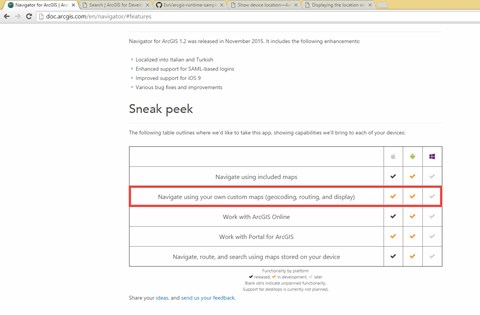
I couldn't really provide an suggestions on devices. In that line I was referring to software that would allow you to specify the reference data and navigate against it. I'm not really familiar with the navigator product, but on the features page it does mention that "Future releases of ArcGIS Pro will support creating custom navigation maps.". You could probably log a case with support to determine about what this functionality would provide and maybe when it would be available.
I spend more of my time in the "build your own application" space. In this space you could build applications for various devices (i.e. desktops with gps units (windows, mac, linux, ubuntu) or mobile applications (iOS, Android, Windows Phone)) that would allow you to better present this task to the user. For example, if I had to accomplish this I'd probably build an overhead display that leverages one of the following examples.
Show device location (Consumed on Windows devices using .NET Runtime)
https://developers.arcgis.com/net/desktop/guide/show-device-location.htm
Displaying the location on a map (Consumed on iOS devices using iOS Runtime)
https://developers.arcgis.com/ios/swift/guide/map-gps.htm
In both of the above examples I'd probably have someone in the office or in the field drop some digital flags on the map that I could use to create lines or have them just draw the line on the map and then keep an eye on their position as they move around. This will never be as precise as mapping everything out on the ground, but it would keep you in the right area.
- Mark as New
- Bookmark
- Subscribe
- Mute
- Subscribe to RSS Feed
- Permalink
This looks promising. Thanks for the help!