In ArcMap, I convert the point layers Label to annotation layer, then remove the point layer and just retain the annotation layer in mxd. I have two questions to ask:
1. how can I determine if an annotation layer is converted from a point layer , a line layer or a polygon layer?
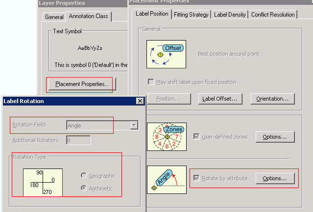
2. In ArcMap I can see the rotation type and rotation field setting, but how can I read these settings in ArcObjects?
thanks for your help!
[ATTACH=CONFIG]30384[/ATTACH]