Turn on suggestions
Auto-suggest helps you quickly narrow down your search results by suggesting possible matches as you type.
Cancel
- Home
- :
- All Communities
- :
- Products
- :
- ArcMap (Retired)
- :
- ArcMap Questions
- :
- Extract polygons in reference of a raster
Options
- Subscribe to RSS Feed
- Mark Topic as New
- Mark Topic as Read
- Float this Topic for Current User
- Bookmark
- Subscribe
- Mute
- Printer Friendly Page
Extract polygons in reference of a raster
Subscribe
998
1
11-05-2020 09:19 PM
11-05-2020
09:19 PM
- Mark as New
- Bookmark
- Subscribe
- Mute
- Subscribe to RSS Feed
- Permalink
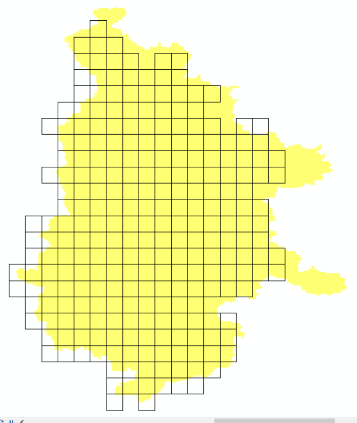
I am looking to extract/clip the grid polygon that are completely filled by the raster in the background (yellow). How can I do this in ArcGIS? Basically, the clipping result will give me a grid polygon with grids that were completely filled by the raster.
1 Reply
11-06-2020
01:07 AM
- Mark as New
- Bookmark
- Subscribe
- Mute
- Subscribe to RSS Feed
- Permalink
Convert the raster to a polygon, then clip your grid by that new polygon. Compare the areas of the resulting grid cells and delete any that aren't the same as before.
may even be faster to select and delete them individually if i'm honest.