Turn on suggestions
Auto-suggest helps you quickly narrow down your search results by suggesting possible matches as you type.
Cancel
- Home
- :
- All Communities
- :
- Products
- :
- ArcMap (Retired)
- :
- ArcMap Questions
- :
- arc gis 10.4.1 problem with exporting and printin...
Options
- Subscribe to RSS Feed
- Mark Topic as New
- Mark Topic as Read
- Float this Topic for Current User
- Bookmark
- Subscribe
- Mute
- Printer Friendly Page
arc gis 10.4.1 problem with exporting and printing
Subscribe
1120
0
05-21-2021 09:46 AM
05-21-2021
09:46 AM
- Mark as New
- Bookmark
- Subscribe
- Mute
- Subscribe to RSS Feed
- Permalink
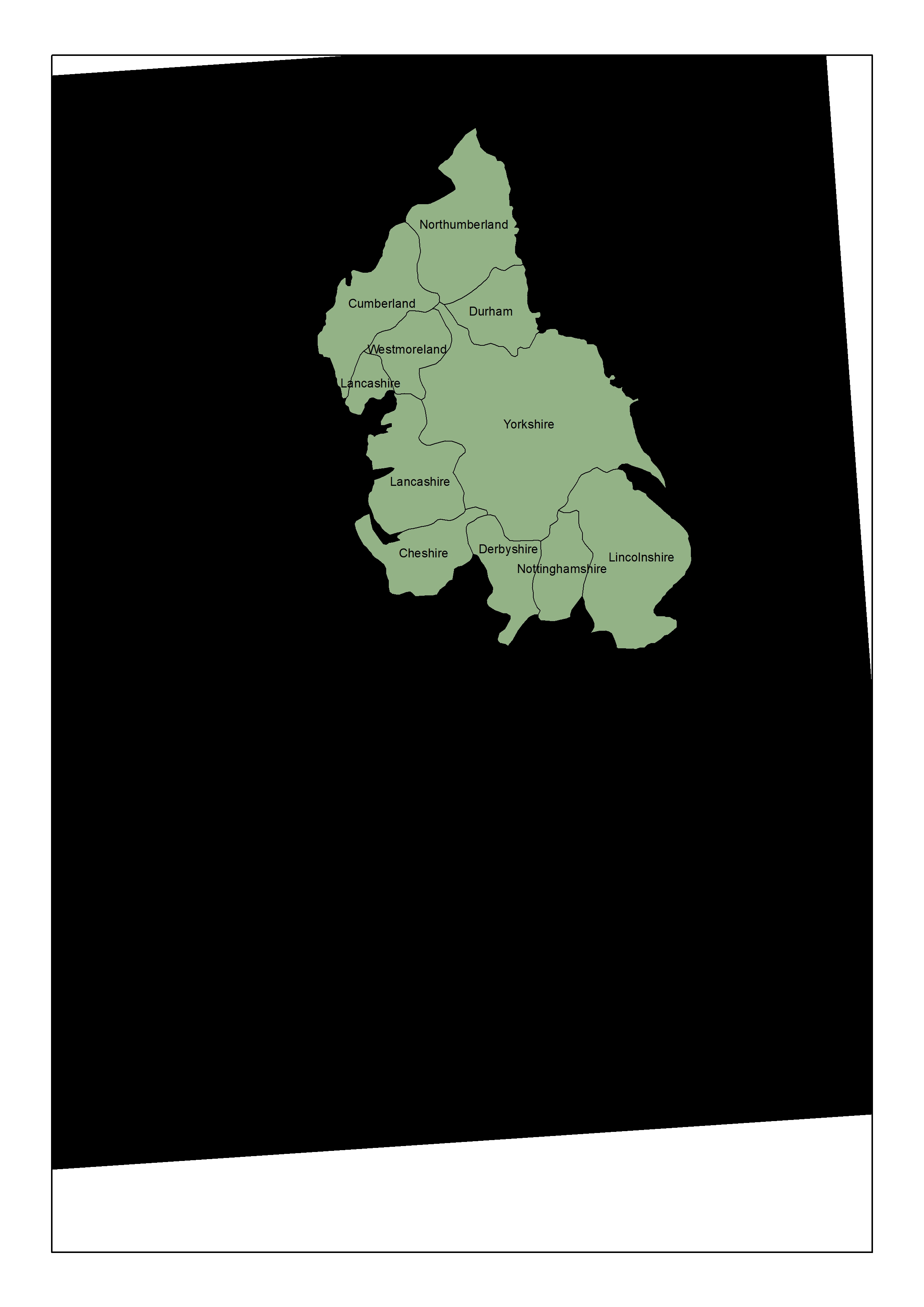
I have geo-referenced a 17 century map of England and am making a polygon layer of the counties. It looks good in GIS but when I try to export it or print it I get the polygon layer with a totally black background - no map. See attached screenshot and exported map.
0 Replies