- Home
- :
- All Communities
- :
- Products
- :
- ArcGIS Web AppBuilder
- :
- ArcGIS Web AppBuilder Questions
- :
- Generalizing regular mesh of points
- Subscribe to RSS Feed
- Mark Topic as New
- Mark Topic as Read
- Float this Topic for Current User
- Bookmark
- Subscribe
- Mute
- Printer Friendly Page
Generalizing regular mesh of points
- Mark as New
- Bookmark
- Subscribe
- Mute
- Subscribe to RSS Feed
- Permalink
I am working with a regular mesh of points in an app developed with Web AppBuilder. This dataset has tens of millions of points and the geographical scope of work is very extensive so I have to see the data set at E 1: 1,000,000 for a complete overview.
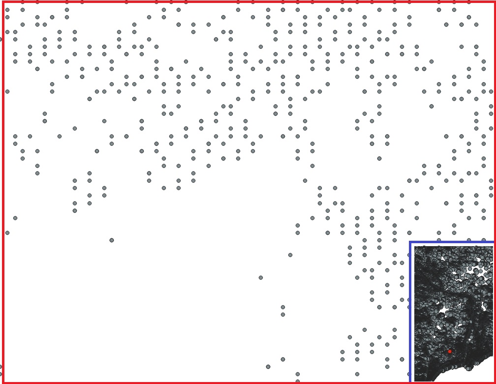
Attached image shows a sample of the data at a scale of 1: 5,000 (red box), and 1: 1,000,000 (blue box).

So, I would like to reduce the quantity of points (generalization [2]) from E1,000,000 to E1: 10,000 because they were used only for visualization.
A simple technique of generalizing points in regular mesh is to construct a mesh subset of a mesh, and so on for the different scales.
Here I have two doubts,
1. For a given map scale, which mesh pitch is appropriate? Is there any theory about it?
2. How can you generate a mesh from a subset of data taking into account the values of the points of the original mesh? I have to preserve the symbology of the points on all scales.
Any suggestion or examples will be greatly appreciated.
Thank you in advance!
References:
[1] Vary Point SIZES by SCALE, https://developers.arcgis.com/javascript/latest/sample-code/visualization-sm-location-scale/index.ht...
[2] https://pro.arcgis.com/es/pro-app/help/mapping/map-authoring/author-a-multiscaled-map.htm