- Home
- :
- All Communities
- :
- Products
- :
- ArcGIS Vector Tile Style Editor
- :
- ArcGIS Vector Tile Style Editor Questions
- :
- Re: visible zoom level not working right?
- Subscribe to RSS Feed
- Mark Topic as New
- Mark Topic as Read
- Float this Topic for Current User
- Bookmark
- Subscribe
- Mute
- Printer Friendly Page
- Mark as New
- Bookmark
- Subscribe
- Mute
- Subscribe to RSS Feed
- Permalink
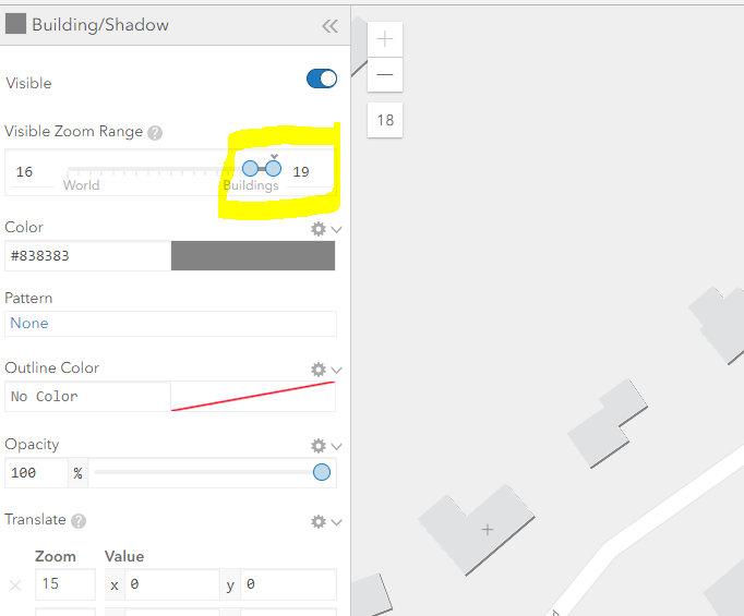
Love the new editor. One thing that may not be working right:
-playing with light gray basemap, editing building shadows
-it is set for scale levels 16-18, but when zoomed into level 18, it turns off
pics below:
level 17, all looks good, you can see that dark shadow accenting the buildings

level 18, shadow turns off but shouldn't

Actually this is true at any level, meaning if I set the upper limit of the visible range to level 17, when the map is drawn at level 17 the layer does not show.
In this way (that it does not include the level that is set as the upper scale range), there is no way to have it draw at the largest scale (level 18).
Perhaps I am missing something.
Tom S.
Solved! Go to Solution.
Accepted Solutions
- Mark as New
- Bookmark
- Subscribe
- Mute
- Subscribe to RSS Feed
- Permalink
Thanks Allan - I found a workaround, and that is to manually type "19" into the zoom range upper limit box. Obviously should not have to do that, but at least it works.
- Mark as New
- Bookmark
- Subscribe
- Mute
- Subscribe to RSS Feed
- Permalink
Hi Tom. This looks to be an issue and we looking into it.
Thanks you!
AL
- Mark as New
- Bookmark
- Subscribe
- Mute
- Subscribe to RSS Feed
- Permalink
Thanks Allan - I found a workaround, and that is to manually type "19" into the zoom range upper limit box. Obviously should not have to do that, but at least it works.
- Mark as New
- Bookmark
- Subscribe
- Mute
- Subscribe to RSS Feed
- Permalink
Ah sweet! We'll make a note of that and get it fixed. Cheers!
- Mark as New
- Bookmark
- Subscribe
- Mute
- Subscribe to RSS Feed
- Permalink
I am also experiencing this issue
- Mark as New
- Bookmark
- Subscribe
- Mute
- Subscribe to RSS Feed
- Permalink
I have encountered this same problem as well when working with the World Street Map vector tile layer. I can change the Visible Zoom Range for road lines but the roads still disappear when I zoom out and the visible zoom range is still valid.
For example at a zoom level of 12 the Road/Local/Line features are visible. However even with the visible range set from 9 to 22, the roads disappear when I zoom out to various zoom levels within the valid range.
Zoom Level 12, Roads are visible

Zoom Level 11 roads disappear 😞

I'm not sure what I'm doing wrong here. I've tried saving and reopening. While the zoom range is saved, the roads do not honor it. I've tried with various other road layers and the zoom levels seem be working properly.
- Mark as New
- Bookmark
- Subscribe
- Mute
- Subscribe to RSS Feed
- Permalink
Forgot to mention that I tried the solution above with no luck.
- Mark as New
- Bookmark
- Subscribe
- Mute
- Subscribe to RSS Feed
- Permalink
I have the same issue, have you resolved that?
- Mark as New
- Bookmark
- Subscribe
- Mute
- Subscribe to RSS Feed
- Permalink
This could be related to BUG-000140715 "The Create Vector Tile Package tool creates a vector tile package with the symbology or labeling colors changed or missing inconsistently if the layers are applied with Visibility Range in ArcGIS Pro."
https://www.esri.com/content/dam/esrisites/en-us/media/products/arcgis-pro-issues-addressed/arcgis-p...
- Mark as New
- Bookmark
- Subscribe
- Mute
- Subscribe to RSS Feed
- Permalink
I'm also trying to modify the Community basemap to allow local roads to be visible at level 11, but based on this note (which appears to have been added since these 2021 posts), I'm thinking that those segments just aren't available. Can someone from the VTSE/basemaps teams confirm? Thanks!