- Home
- :
- All Communities
- :
- Products
- :
- ArcGIS Tracker (Deprecated)
- :
- ArcGIS Tracker Questions
- :
- External GPS connected in Tracker for ArcGIS
- Subscribe to RSS Feed
- Mark Topic as New
- Mark Topic as Read
- Float this Topic for Current User
- Bookmark
- Subscribe
- Mute
- Printer Friendly Page
External GPS connected in Tracker for ArcGIS
- Mark as New
- Bookmark
- Subscribe
- Mute
- Subscribe to RSS Feed
- Permalink
Hi,
We are just getting familiar with Tracker for ArcGIS to use along with Collector. In the Collector app we see the external GPS is shown in the provider setting. How do we know which GPS the Tracker app is using? We want to make sure it’s using the external and not the integrated.
Thank-you!,
Kathy
- Mark as New
- Bookmark
- Subscribe
- Mute
- Subscribe to RSS Feed
- Permalink
I apologize I meant to add post a question, not a discussion!
- Mark as New
- Bookmark
- Subscribe
- Mute
- Subscribe to RSS Feed
- Permalink
If you have an external receiver connected to your device, locations from the receiver should be directly passed into the location manager which is used by apps like Tracker. Collector has implemented additional logic to support reading the extra metadata from the device.
So the high-accuracy locations will be used by Tracker but there is no indication of that in the app since it "just works". Also at least on iOS, the minimum accuracy reported will be 5 meters, even if the receiver actually has better accuracy.
- Mark as New
- Bookmark
- Subscribe
- Mute
- Subscribe to RSS Feed
- Permalink
That's great it "just works" but still have a setting within the app that actually shows which GPS provider the app is using would still be my preference. I don't like to just make assumptions. So far in our group the lack of settings in the tracker user interface doesn't have folks feeling that comfortable with the Tracker app compared to the Collector settings.
- Mark as New
- Bookmark
- Subscribe
- Mute
- Subscribe to RSS Feed
- Permalink
What information do you need to see? Just the location provider? Any other information like what Collector shows here:
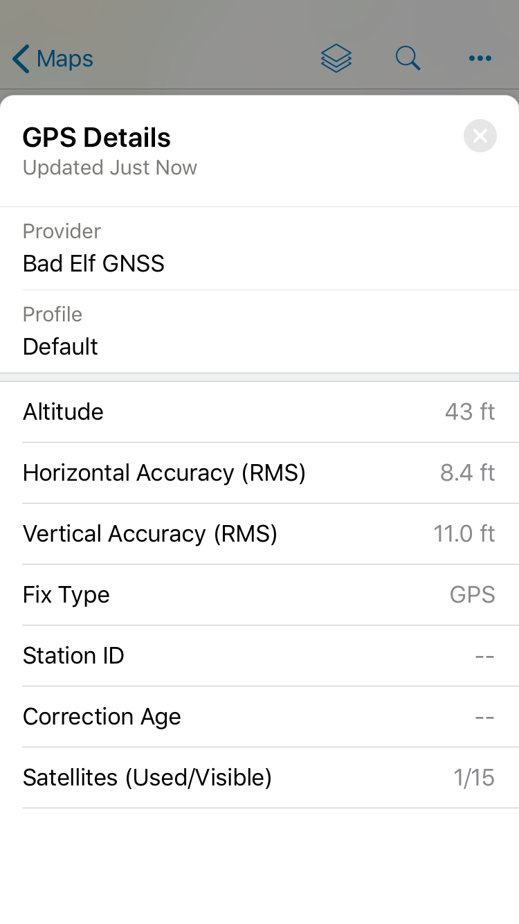
Would you need that metadata stored with each track point as well?