- Home
- :
- All Communities
- :
- Products
- :
- ArcGIS Survey123
- :
- ArcGIS Survey123 Questions
- :
- Re: How to specify default geopoint base map in Su...
- Subscribe to RSS Feed
- Mark Topic as New
- Mark Topic as Read
- Float this Topic for Current User
- Bookmark
- Subscribe
- Mute
- Printer Friendly Page
How to specify default geopoint base map in Survey123 Connect?
- Mark as New
- Bookmark
- Subscribe
- Mute
- Subscribe to RSS Feed
- Permalink
- Report Inappropriate Content
Using Survey123 Connect.
Added a geopoint question.
In main Survey123 Connect interface selected map options and then specified default coordinates and map background (Streets Map).
When survey gets published and opened in a browser, the base map is the TOPO map.
Trying to figure how to default to the Streets Map.
Any insights would be appreciated.
- Mark as New
- Bookmark
- Subscribe
- Mute
- Subscribe to RSS Feed
- Permalink
- Report Inappropriate Content
Hi Amanda,
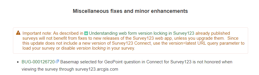
As the fix is on the website, you will definitely want to use the latest version of the web app with any existing surveys you have. On our existing documentation, we do mentioned that use web app version setting to control the behavior.
Every version of Survey123 for ArcGIS includes incremental fixes and enhancements to the web app that change its behavior.
Web app version—Survey123 for ArcGIS | Documentation
To sync the surveys betwwen Connect and web app, always pay attention to the versions of the application to make sure you keep consistency among the platofrms.
We do add a note to the post as well to remind users:
Hope that helps to clarify some of your questions.
- Mark as New
- Bookmark
- Subscribe
- Mute
- Subscribe to RSS Feed
- Permalink
- Report Inappropriate Content
I thought the Survey123 Connect upgrade would fix the issue of changing basemap in the published Web Form. It actually made it worse, as the default is the TOPO which is the oldest and slowest of all the basemaps. Yes it allows for the user to change the basemap, but a simple form that public user (ie NOT people familiar with mapping) should not have to require this. I will be converting back to the older version of Survey123 Connect until this is fixed.
And yes, i have to use Survey123 Connect instead of Web Forms because of additional functionality that isn't available in Web Forms that is in Connect.
- Mark as New
- Bookmark
- Subscribe
- Mute
- Subscribe to RSS Feed
- Permalink
- Report Inappropriate Content
Hi Nolita Lavoie,
We completely agree. We're facing this ridiculous pain point as well. As I mentioned in a separate post, this is a fundamental functionality required in any web GIS application. In a time where custom basemaps are supported everywhere in the AGOL environment, this is a huge shortcoming for S123.
What version of Survey 123 connect are you reverting to that this functionality is available? We will be reverting as well.
- Mark as New
- Bookmark
- Subscribe
- Mute
- Subscribe to RSS Feed
- Permalink
- Report Inappropriate Content
Is anything happening with this issue? I've specified the streets basemap in the web app, and Connect, and Topo keeps coming up when I open the survey. Is there a way to hide the map in the GeoPoints widget?
- Mark as New
- Bookmark
- Subscribe
- Mute
- Subscribe to RSS Feed
- Permalink
- Report Inappropriate Content
Hi Levi,
If you created the survey initially from web designer, and the basemap is not honored by Connect and field app, which is due to this salesforce issue:
BUG-000109078
Survey123 Connect for ArcGIS and Survey123 for ArcGIS field apps (Android, iOS, and Windows) does not preserve the default basemap set while designing a survey on the survey123.arcgis.com website.
However, if you create the survey from Connect, the basemap should be honored in web form if you set the web app version to 3.8.
Survey123>Settings>Version>Always use the latest version(3.8).
To hide the map in the web form, please check this post:
- Mark as New
- Bookmark
- Subscribe
- Mute
- Subscribe to RSS Feed
- Permalink
- Report Inappropriate Content
I am using the latest version of Connect, which is 3.9, but this is not working for me. I created the survey in Connect, where the settings/map shows the Streets basemap, but the Form Preview shows the topo basemap. I don't see an option to set the basemap in Connect and can't edit in Survey123 web, because the form was created in Connect. From what I can tell of what you are saying, I should somehow be able to change the basemap for a web form, is that correct or not?
Thanks
- Mark as New
- Bookmark
- Subscribe
- Mute
- Subscribe to RSS Feed
- Permalink
- Report Inappropriate Content
Hi Nadine,
Survey123 Connect#3.9.120 worked to set the default basemap and web form is also reflected the basemap set in Connect.
In Connect, go to Settings>Map and clcik the basemap chooser(red circle) and pick your preferred one, then publish the survey.
Now go to the web form, the basemap should still honors the basemap you set in Connect.
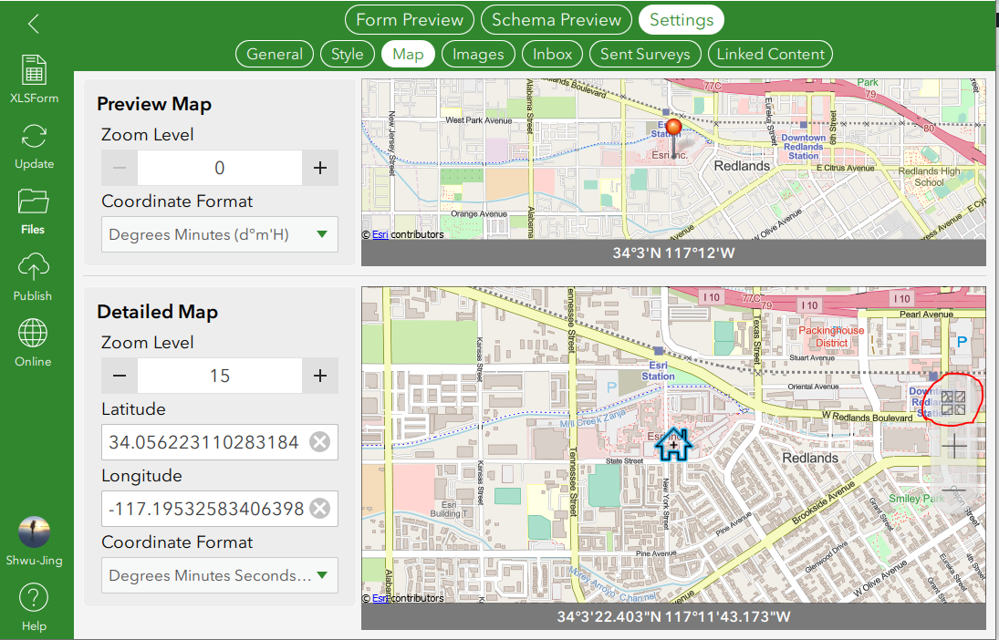
User can click the basemap chooser(red circle) on the web form if they want to choose other basemap than the default one.
The basemap chooser allows users to overwrite the basemap to their preferred one.
- Mark as New
- Bookmark
- Subscribe
- Mute
- Subscribe to RSS Feed
- Permalink
- Report Inappropriate Content
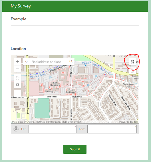
Oh thank you so much, I swear I was looking for that but it just blended in so well with the map! Can I ask you another questions about Survey123? The phrase 'Survey Point' is embedded somewhere in the feature layer information, but I can't find where. Is it somewhere in the xml or settings, so I can change it? It just adds noise to the legend.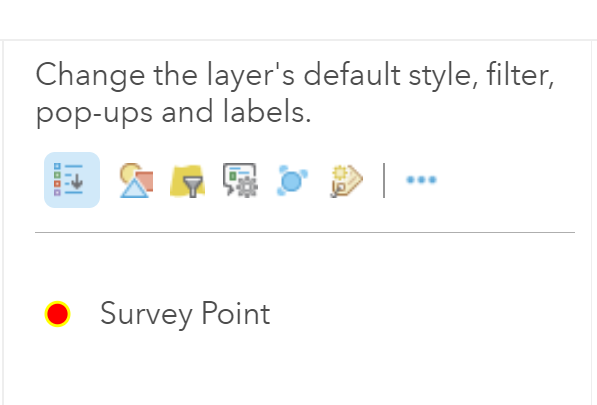
- Mark as New
- Bookmark
- Subscribe
- Mute
- Subscribe to RSS Feed
- Permalink
- Report Inappropriate Content
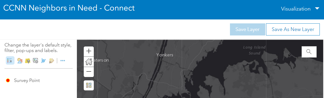
Survey Point is the title of the feature layer.
You can change this in the item details page of your survey's feature layer. As shown below.
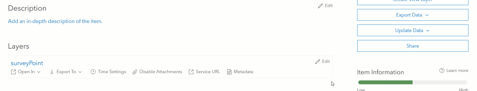
You just want to make sure you change the layer title on the same layer you are adding to your web map.
- Mark as New
- Bookmark
- Subscribe
- Mute
- Subscribe to RSS Feed
- Permalink
- Report Inappropriate Content
That's what I thought, but doesn't seem to be working. Here's my workflow.
To make sure I get the right service, I get the item details from the map...
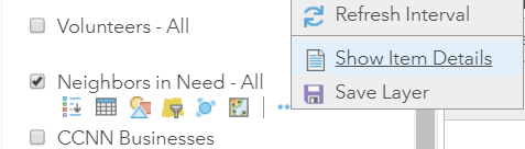
I have already changed the layer name, so this is what it shows in the overview, note the name is 'neighbors'...
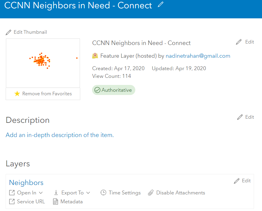
But in the visualization settings (and map legend), it still shows this 'survey point'