- Home
- :
- All Communities
- :
- Products
- :
- ArcGIS Survey123
- :
- ArcGIS Survey123 Questions
- :
- Re: Geopoint as UTMs?
- Subscribe to RSS Feed
- Mark Topic as New
- Mark Topic as Read
- Float this Topic for Current User
- Bookmark
- Subscribe
- Mute
- Printer Friendly Page
- Mark as New
- Bookmark
- Subscribe
- Mute
- Subscribe to RSS Feed
- Permalink
Hi, I am very new to Survey 123. Can I record my Geopoint as UTMs instead of DMS and DD?
Solved! Go to Solution.
Accepted Solutions
- Mark as New
- Bookmark
- Subscribe
- Mute
- Subscribe to RSS Feed
- Permalink
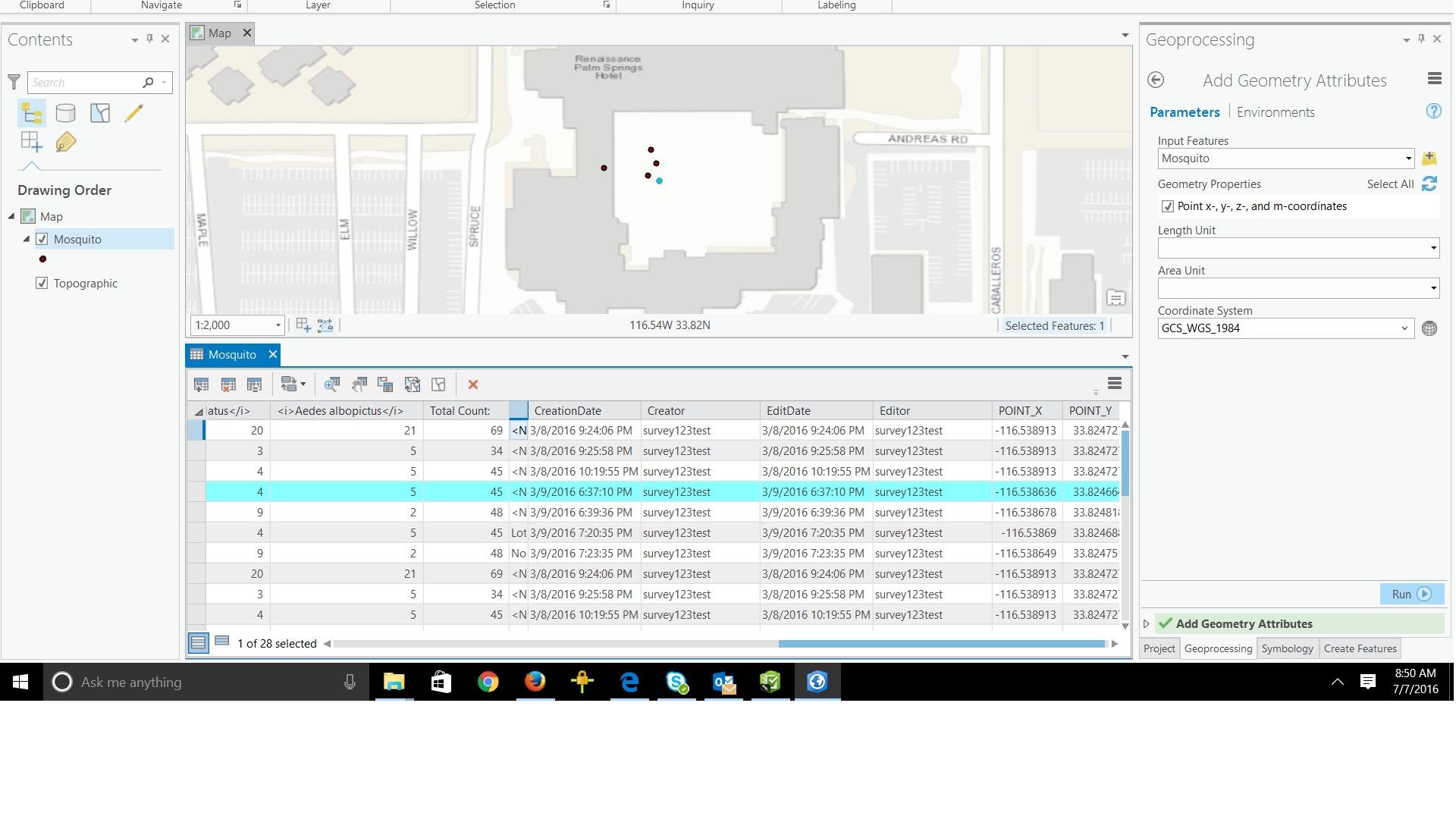
When you export the data to FileGeodatabase or Shapefile, the coordinates of your points are encoded within the SHAPE field. If you want to get the coordinates out, I would recommend you use ArcGIS Pro as follows:
- Add your Survey123 layer/s into a new Map in ArcGIS Pro
- Open the Toolbox and activate the Add Geometry Attributes tool
- Execute the tool passing the Survey123 layer as an input, plus the output coordinate system and checking the option to add the X and Y columns
Attaching screenshot for clarity. After executing, you should see the Point_X and Point_Y columns added and their values populated accordingly.
- Mark as New
- Bookmark
- Subscribe
- Mute
- Subscribe to RSS Feed
- Permalink
Hi. Survey123 for ArcGIS always persists coordinates as Lat/Lon but once you have your data captured you can export it into a File Geodatabase or Shapefile and then project it to UTM using ArcGIS for Desktop (ArcMap or ArcGIS Pro).
- Mark as New
- Bookmark
- Subscribe
- Mute
- Subscribe to RSS Feed
- Permalink
Hi Ismael,
Thanks for your reply.
I exported it into a GDB but I cannot see the Lat/Long columns or fields, however Lat/Long fields are present in CSV files. Is there any way to get Lat/Long fields in FC too?
Thanks-PJ
- Mark as New
- Bookmark
- Subscribe
- Mute
- Subscribe to RSS Feed
- Permalink
When you export the data to FileGeodatabase or Shapefile, the coordinates of your points are encoded within the SHAPE field. If you want to get the coordinates out, I would recommend you use ArcGIS Pro as follows:
- Add your Survey123 layer/s into a new Map in ArcGIS Pro
- Open the Toolbox and activate the Add Geometry Attributes tool
- Execute the tool passing the Survey123 layer as an input, plus the output coordinate system and checking the option to add the X and Y columns
Attaching screenshot for clarity. After executing, you should see the Point_X and Point_Y columns added and their values populated accordingly.
- Mark as New
- Bookmark
- Subscribe
- Mute
- Subscribe to RSS Feed
- Permalink
Thanks a lot for your help. I did it in ArcMap and it worked fine. I was wondering if you use any script to upload the FC into your Master GDB.
- Mark as New
- Bookmark
- Subscribe
- Mute
- Subscribe to RSS Feed
- Permalink
ArcMap will certainly work as well! Well done!
If I were to move the data into another geodatabase, I would go with either the Copy Features or Append geoprocessing tools. You can run these tools manually, or as part of a python script.
- Mark as New
- Bookmark
- Subscribe
- Mute
- Subscribe to RSS Feed
- Permalink
Thanks for your reply.
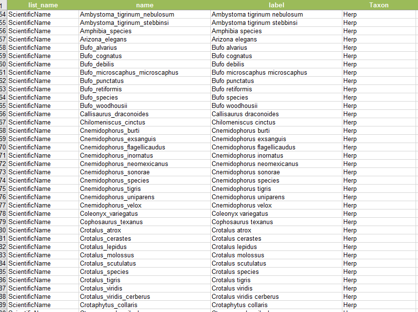
I have another question. I want to record Scientific Name of the species in the geodatabase but in the name column under “choices”, the Values (in our case Scientific Name) do not accept spaces. There should be a gap between first name and the last name. So, is there any way I can separate the first and last name in the geodatabase? I entered the Scientific names in name as well as in label column but still scientific names are not separated in the downloaded FC. Is there any solution for that?