- Home
- :
- All Communities
- :
- Products
- :
- ArcGIS Survey123
- :
- ArcGIS Survey123 Questions
- :
- Re: Displaying a map for a geopoint question
- Subscribe to RSS Feed
- Mark Topic as New
- Mark Topic as Read
- Float this Topic for Current User
- Bookmark
- Subscribe
- Mute
- Printer Friendly Page
- Mark as New
- Bookmark
- Subscribe
- Mute
- Subscribe to RSS Feed
- Permalink
Just new to Survey123. In every example I've seen (youtube), when the user creates a form with a geopoint a map is displayed directly after the question for the user to select a point. However when I try the same all I get a small map icon image. I then have to click on the map icon to get the map to display on a new screen, select a point, before returning back to the previous screen.
How do I get the actual map to appear directly below the question rather than the icon?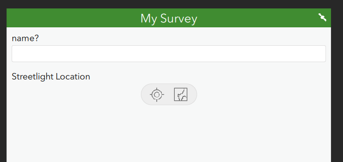
Solved! Go to Solution.
Accepted Solutions
- Mark as New
- Bookmark
- Subscribe
- Mute
- Subscribe to RSS Feed
- Permalink
Hi Glenn,
The map will appear once a valid point location is determined. This normally happens by Survey123 reading the device's location. I note that the satellite icon in the top right of the form looks like it's indicating that it can't access the location; in that situation the map won't immediately appear (you should also be seeing the 'My Location' button pulsing as it tries to determine the location).
- Mark as New
- Bookmark
- Subscribe
- Mute
- Subscribe to RSS Feed
- Permalink
Are you using Survey123 Connect? If so, going to Settings > Map, and configuring your settings.
- Mark as New
- Bookmark
- Subscribe
- Mute
- Subscribe to RSS Feed
- Permalink
Hi Glenn,
The map will appear once a valid point location is determined. This normally happens by Survey123 reading the device's location. I note that the satellite icon in the top right of the form looks like it's indicating that it can't access the location; in that situation the map won't immediately appear (you should also be seeing the 'My Location' button pulsing as it tries to determine the location).
- Mark as New
- Bookmark
- Subscribe
- Mute
- Subscribe to RSS Feed
- Permalink
I assumed the cause was probably due to my device not being able to identify my location.
Thanks James.